In Synopsis Part 5, the Corps of Discovery leaves Fort Clatsop on the Pacific Ocean and travels back to St. Louis.
Up the Columbia
Leaving Fort Clatsop
Produced by Joseph A. Mussulman
Columbia River above the Washougal River (view SW)
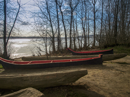
© 29 March 2009 by Kristopher K. Townsend. Permission to use granted under the Creative Commons Attribution-Share Alike 4.0 International license.
On 23 March 1806, once again battling the rising spring runoff, as it had each of the two previous years on the Missouri, the Corps of Discovery started up the Columbia River. They traveled in six boats: three dugout canoes made the previous September, two native canoes they had purchased, and one stolen from the Clatsops. The rapids, beginning east of today’s Portland, were higher and more formidable than before, and correspondingly more dangerous. Portages were arduous, and the Indians were determined to exact their tolls. By the end of April the company was again on horseback, headed for Nez Perce country.
Diplomatic negotiations with the native nations continued. Opposite the mouth of the Walla Walla River, 15 miles south of the confluence of the Snake and the Columbia, Lewis and Clark were entertained at a feast with several hundred Walla Wallas and Yakamas. It was sponsored by the Walla Wallas’ Chief Yelleppit, to celebrate an alliance with these American tourists, which he sealed with an exchange of “meddicine songs.”
Once again Meriwether Lewis and William Clark benefited from Indian advice, taking a well-traveled overland trail that led them more or less straight to the mouth of the Clearwater. They retrieved their Lemhi Shoshone and Salish horses from the Nez Perce, traded themselves into bankruptcy, and prepared to tackle the Rockies again. Exceptional snowpack in the Bitterroot Mountains held them at bay for almost a month. With two Nez Perce guides to keep them on the ancient Indian trail, they set out again on 24 June 1806. Light-footed and determined, though again short of food, they raced along the ridges over the eight-foot drifts. Averaging about twenty-six miles per day, they covered in six days what had taken eleven days westbound.
They warmed their bones in the waters of Lolo Hot Springs, then left “those tremendious mountains” behind. “This,” said Clark, “is like once more returning to the land of the liveing.” On 3 July 1806, at Travelers’ Rest, the captains split up as planned, not to be united again for more than a month.[1]See Return to the Clearwater, Road to the Buffalo, and Dividing Forces at Travelers’ Rest.
Clark on the Yellowstone
Yellowstone River morning
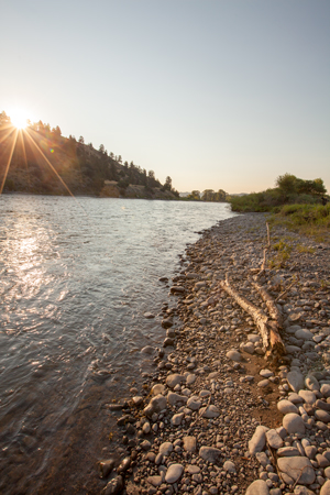
© 20 July 2017 by Kristopher K. Townsend. Permission to use granted under the Creative Commons Attribution-Share Alike 4.0 International license.
With a party of twenty-three, including York, Toussaint Charbonneau, and Sacagawea and her little boy, Captain Clark returned to Ross’ Hole and, bypassing the Shoshone encampments in Idaho, took a shortcut across Gibbons Pass. Then, following Sacagawea’s directions, he headed for Fortunate Camp on the Beaverhead River, where the party had camped in August 1805. Perhaps the tobacco cached there spurred the nicotine-deprived men onward. Recovering the canoes, a party under Sergeant John Ordway made better time on the spring-filled Beaverhead and Jefferson than Clark did on horseback, despite the meandering courses of the riverbeds. In contrast to the laborious, twenty-one day ascent of the previous August, the eastbound party floated ninety miles in one day and completed the entire journey to the Three Forks of the Missouri of the Missouri in three and a half days.
Nor did Clark’s crew waste any time at Three Forks. Ordway immediately departed with nine men down the Missouri, to join forces with Sergeant Gass for the portage around the Great Falls of the Missouri. With forty-nine horses and a colt, Clark took off up the beaver-choked Gallatin River. Sacagawea pointed out “a large road” (then a trail, today’s Interstate 90) through the Bridger Mountains, and on 15 July 1806, the party struck the Yellowstone River at the site of modern Livingston, Montana. Since there were no trees of sufficient size to hollow out for canoes, Clark kept going for five days and a hundred miles. His horses went lame on the stone and gravel, so he had buffalo-skin “mockersons” made for them. On the 18th Private George Gibson fell and drove a snag deep into his thigh. He couldn’t walk, and he couldn’t ride, so canoes became imperative. Clark finally found two cottonwood trees that his men turned into twenty-eight-foot canoes, lashed together for stability. While building the vessels he was chagrined to discover that Indians, perhaps of the Crow tribe, had run off with half his horses. Entrusting the rest to Sergeant Pryor for a quick overland trip to Fort Mandan, Clark took to the river. On Pryor’s second day out, he lost all of his mounts to the thieves, so his party of four hastily built bull boats (animal hides stretched over round, willow frames) and bobbed along some distance behind Clark and the rest.
Clark’s group descended the Yellowstone at prodigious rates of speed. In ten days he covered, by his own generous estimation, nearly six hundred fifty miles, although it’s only five hundred of today’s miles. His exploration of the “Rochejhone” was necessarily brief and superficial. (He was unaware that the lower Yellowstone basin had been explored the previous year by the British trader Françcois-Antoine Larocque.) On 25 July 1806 Clark climbed a massive gray rock twenty-five miles east of modern Billings, Montana, dubbed it “Pompy’s Tower” (little Jean Baptiste Charbonneau‘s nickname and now named Pompeys Pillar), and carved his own name on its side. The etching remains there today, the only surviving physical evidence of the Lewis and Clark Expedition.
The captain saw so much game on the river, including American bison (the American buffalo), elk, pronghorn, and wolves, that he found it “increditable” and resolved “to be silent on the subject further.” But the next day he couldn’t refrain from remarking on the “emence herds” he saw. Once he laid to for an hour to let buffalo cross the river. On 3 August 1806, he reached the Missouri. His return through Montana from Travelers’ Rest, via the Yellowstone, took thirty-two days. The trip upriver between the same two points in 1805, via the Missouri River, had taken 134 days. For more, see Clark on the Yellowstone.
Lewis on the Marias
Moonset at dawn over the Rocky Mountain Front
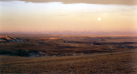
© 1999 VIAs Inc.
View west from Flag Butte, above the Two Medicine River, where Lewis and his companions met eight Piegan youths, 26 June 1806.
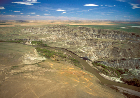
This may have been the site of the camp that Lewis, Joseph and Reubin Field, and George Drouillard shared with the eight Peigans on Saturday night, 26 July 1806. The view is northeast from Flag Butte.
Fight on the Two Medicine River
26 July 1806:
Produced by Joseph A. Mussulman
Meriwether Lewis, meanwhile, experienced a far more eventful journey.
With a party of nine men, and his dog, Seaman, Captain Lewis left Travelers’ Rest on 3 July 1806. In the vicinity of modern Missoula his Nez Perce guides turned back, fearful of following what they knew as the “river of the road to buffalo” (Blackfoot River) since it also led to the fiercely guarded territory of the Blackfoot Indians. Knowing the risk he was running, Lewis warily proceeded on, through Hellgate Canyon, up the Big Blackfoot River, and across the Continental Divide north of today’s Rogers Pass. He and his men celebrated their return “to the fat plains of the Missouri ” by feasting on fat buffalo meat. Reaching the Sun River, he followed it down to the Missouri, arriving at the old upper portage camp at White Bear Islands, above the Falls of the Missouri, on 11 July 1806. By this more direct route, he had covered about 180 miles in nine days, a far cry from the 750 miles in fifty-seven days of 1805. The cache at the upper portage camp had not fared well: Lewis lost the entire collection of plant specimens he had collected between Fort Mandan and the falls.
Lewis’s Disappointment
On 17 July 1805, with only three men (interpreter George Drouillard and the Field brothers, Joseph and Reubin) and six horses, and with a scattered force at his back, Lewis now deliberately ventured deeper into Blackfeet country. His purpose was to explore the Marias River beyond the stretch he had traversed a year earlier, and learn whether any branch of the river lay as far north as the fiftieth parallel. Constantly on the lookout for hostile Blackfeet, he traveled across a shortgrass plains so flat he likened it to “a well-shaved bowling green,” or an ocean, “not a tree nor a shrub to be seen.” Striking the Marias, he followed it and its tributary Cut Bank Creek for a hundred miles, to a point about 20 miles below the foot of the Rocky Mountains. It was the northernmost spot reached by the expedition, about 25 miles south of the present boundary between the United States and Canada, which is at forty-nine degrees north latitude.
His own name, “Camp Disappointment,” reflected Lewis’s attitude on realizing that the Marias did not reach as far north as he had hoped. It also commemorated the four days he spent unsuccessfully attempting under cloudy skies to establish precisely where he was in terms of longitude and latitude. He had wasted precious time. “I now begin to be apprehensive that I shall not reach the United States within this season,” he reflected. He was in no mood to dally when, on the return to the Missouri, he had what he most hoped to avoid, an “interview” with a band of Piegan Blackfeet Indians.
Actually, the “interview” was cordial enough. Yet with the best of intentions, mainly self-preservation, Lewis said all the wrong things to the Blackfeet: that the Nez Perces and Shoshones were now united in a peace-pact he had brokered, and that they would be trading with Americans in the future. Those must have sounded like veiled threats to the Blackfeet, who for twenty years had depended on Canadian agents of the Hudson’s Bay and the North West fur companies to supply guns and ammunition with which to keep people like the Nez Perces and Shoshones out of their territory. That night the eight Blackfeet and four Americans camped together on the Two Medicine River. The next morning Lewis awoke to sounds of a scuffle, and to Drouillard’s cry “damn you let go my gun”! In the melee that followed, Reubin Field stabbed one of the Blackfeet to death. Trying to stop another from stealing his horse, Lewis shot him in the belly. The wounded man returned fire, and Lewis, “being bearheaded . . . felt the wind of his bullet very distinctly.” Certain they would be pursued, Lewis, Drouillard, and the Field brothers raced southeast toward the Missouri River, covering at least a hundred miles before camping again. For more, see Fight on the Two Medicine.
Down the Missouri
Early on the 28th the four arrived at the Missouri River, where, to their great good fortune, they encountered Ordway’s canoe detail, coming down from the portage camp below the Falls of the Missouri. With Lewis and his three companions aboard, they pushed on for the mouth of Maria’s River, where they met up with Sergeant Patrick Gass and Private Alexander Willard, who had ridden horses overland. After emptying the caches they had dug in June of the previous year, all the men clambered aboard the canoes and put fifteen more miles between the enlarged party and its putative pursuers, before making camp.
Near-constant rain marked their headlong flight from Montana, but for the next ten days the men “plyed their oars faithfully,” and they went at “a good rate.” When they paused “for a few minutes” at the mouth of the Milk River, someone killed a five-foot-long rattlesnake, and Lewis, habituated to minute observation, patiently counted 176 scuta on its abdomen, and 25 on the tail.
The Final Leg
Lewis and his party arrived at the Yellowstone on 7 August 1806, having covered a record 83 miles on that day. Clark’s group, tormented by mosquitoes, had already gone downstream. Four days later Pierre Cruzatte, blind in one eye and nearsighted in the other, mistook Captain Lewis for an elk and shot him in the buttocks. On 12 August 1806 the expedition, separated throughout Montana and divided at different times into five smaller parties, was at last reunited for its triumphant six-week voyage to St. Louis and civilization.
With seven canoes and the recovered white pirogue, they pushed on hard. By 14 August 1806, they were back at the Knife River Villages. There they learned that the peace they had so carefully arranged among the Mandans, Hidatsas and Arikaras was in shambles, and that the Hidatsas had attacked a Shoshone village, perhaps Cameahwait’s. Furthermore, during their winter residence at the Knife River Villages, the captains had urged the Mandan and Hidatsa chiefs to return to Washington with them, to get acquainted with President Jefferson, but Sioux and Arikara soldiers had raided the Mandans in the meantime, and now the chiefs were reluctant to trespass in Sioux territory. The captains hired trader René Jusseaume, a resident of the area, to intercede; Jusseaume succeeded in persuading the Mandan chief, Big White, also called Sheheke, to make the trip with him.[2]See Sheheke’s Delegation.
The captains mustered out Private John Colter, who headed back up to the Yellowstone River with two passing trappers. They also paid off interpreter Toussaint Charbonneau in the amount of five hundred dollars and thirty-three and one-third cents. Sacagawea received nothing, though Clark was later to acknowledge his indebtedness to her in a letter to her husband: “Your woman who accompanied you that long dangerous and fatigueing rout to the Pacific Ocian and back diserved a greater reward for her attention and services on that rout than we had in our power to give her.”
Racing downstream at up to 60 miles a day, the captains paused only long enough to confer with some Cheyennes, Arikaras, and Yankton Sioux, and to exchange threats with the same band of Lakota Sioux that had tried to turn them back in the fall of 1804. Below the Platte River the clouds of mosquitos tormented them only a little less than before, but the weather grew “disagreeably worm.”
The traffic of traders, trappers, and others outbound from St. Louis increased daily. The news was mixed: Alexander Hamilton’s death in a duel with Aaron Burr; Zebulon Pike‘s departure for the Red and Arkansas rivers; amusing rumors that they themselves were all dead, or had been enslaved by the Spaniards. The men “plyed thear ores with great dexterity ” and at four in the afternoon of 21 September 1806 landed back in St. Charles, whose inhabitants “seem to vie with each other in their politeness” toward the trail-weary men. Two days later they were similarly greeted by St. Louisans. The long and arduous “voyage of discovery” was over.
Legacies
Jefferson’s Prediction
Here is the context in which President Jefferson made the extravagant prediction quoted by Dr. Fritz:
Let us, then, with courage and confidence pursue our own Federal and Republican principles, our attachment to union and representative government. Kindly separated by nature and a wide ocean from the exterminating havoc of one quarter of the globe [the then-warring powers of Europe]; too high-minded to endure the degradations of the others; possessing a chosen country, with room enough for our descendants, to the thousandth and thousandth generation.”[3]First Inaugural Address, 4 March 1801, in Merrill D. Peterson, ed., Thomas Jefferson: Writings (New York: Literary Classics of theUnited States, Inc., 1984), 493–94.
For the purpose of time measurement today, the term “generation,” which denotes the interval of time between the birth of parents and the birth of their children, is considered to be thirty years, but Jefferson himself defined a generation as nineteen years. If we interpret Jefferson’s phrase, “thousandth and thousandth” to mean two thousand years, then he was saying that “our chosen country” would not be filled for 38,000 years! We cannot be sure whether he was referring to the land encompassed by the United States at that moment, or anticipating his country’s eventual occupancy of the continent all the way to the Pacific. In either case, this rhetorical flourish must have sounded, even then, like a boastful exaggeration–a gasconade.[4]ot to be confused with the Gasconade River in Missouri, which was named by French explorers, reportedly because it reminded some of them of the pre-Revolutionary province of Gascogne on the Atlantic … Continue reading At the time of the expedition’s bicentennial observance, the U.S. was about halfway through Jefferson’s tenth generation.
—Joseph Mussuluman
Except for a flurry of congratulatory banquets, speeches, eighteen toasts, and a few songs, the people of the United States scarcely paused to appreciate the explorers’ efforts or admire their achievements.[5]See Betty Houchin Winfield, “The Press Response to the Corps of Discovery: The Making of Heroes in an Egalitarian Age,” Journalism & Mass Communication Quarterly, Vol. 80, No. 4 … Continue reading Sergeant Gass rushed his diary into print in 1807. Clark saw to the publication, in 1814, of the “official” two-volume account after Lewis’s tragic death in 1809, but only 2,000 sets were printed.
Lewis and Clark’s descriptions of plants and animals, and their records of the native nations that inhabited the Missouri and Columbia river valleys, were obscured from general knowledge for nearly a hundred years, or were assimilated with scant notice into the work of other inquirers. The expedition’s immediate legacy was fundamentally geographical: Lewis and Clark broke the space barrier, took a “moon walk” that confirmed what thinking people figured they already knew. There was something out there: land! Americans were emotionally packed up and ready to head west; they were going that way anyhow, driven by their own dreams. Even the place names the expedition members left behind were unwittingly, and often repeatedly, replaced by settlers who perhaps had scarcely heard of Lewis and Clark.
Western Expansion
A-westering they went: the fur trade; more “scientific” expeditions; military excursions; missionary pilgrimages; railroad surveys; farmers and ranchers; the mining, fishing, and logging industries; river commerce; dams for “reclamation,” navigation, and electrical generation; nuclear energy plants; markets on the Pacific Rim; Microsoft and Apple.
Nobody really, entirely followed in the footsteps of Lewis and Clark. Succeeding explorers, traders, and emigrants found easier overland routes to the Northwest, such as the Oregon Trail, and in due time switched to conveyances other than horses, keelboats, or dugout canoes—to covered wagons, steamboats, trains, automobiles, jet liners—usually faster, sometimes safer, and always noisier. By 1990 the environmental window of silence through which one could hear the sounds of nature as Lewis and Clark heard them, unpolluted by the noises of civilization and its machines, had narrowed, even in some remote localities, to as little as ninety seconds at a time.
In his first inaugural address, in 1801, Thomas Jefferson told his listeners that the nation had room enough for their descendents “to the thousandth and thousandth generation.” In 1890, before the fifth generation after Jefferson’s was out upon the land, the United States Census Bureau declared that the West had been settled, and the frontier was gone. At the end of the twentieth century, another five or six generations later, the total population of the eleven Lewis and Clark Trail states alone exceeds 39 million, seven times the population of the sixteen United States in 1800.
None of this was wrought by Lewis and Clark; they deserve neither blame nor credit. The physical trail of the Corps of Discovery is overlaid today with the baggage of two hundred years of history, and we see it now only through the visions of the men and women who have traveled near it, and lived on it, before us. Meriwether Lewis looked at the five falls of the Missouri River in June 1805 and saw beauty, as well as an impediment to the progress of his expedition. Seventy-five years later an ambitious man named Paris Gibson, who had read the 1814 Nicholas Biddle edition of the Lewis and Clark journals, looked at the same scene and envisioned a new city, and water power to generate electricity to fuel the progress of a nation. His vision changed the view, and changed the nation, as had Lewis’s.
One More Discovery
In the modern sense of the word “discovery,” the Corps of Discovery discovered nothing; everything they reported on had been in plain sight of the native nations for many generations. It must be remembered, however, that in their own time “discovery” had a different meaning. Nevertheless, Lewis and Clark certainly were the first to see the land and the people along the Missouri and Columbia rivers with the eyes and attitudes of a new nation, grounded in the science and philosophy in the Age of Enlightenment.
Notes
| ↑1 | See Return to the Clearwater, Road to the Buffalo, and Dividing Forces at Travelers’ Rest. |
|---|---|
| ↑2 | See Sheheke’s Delegation. |
| ↑3 | First Inaugural Address, 4 March 1801, in Merrill D. Peterson, ed., Thomas Jefferson: Writings (New York: Literary Classics of theUnited States, Inc., 1984), 493–94. |
| ↑4 | ot to be confused with the Gasconade River in Missouri, which was named by French explorers, reportedly because it reminded some of them of the pre-Revolutionary province of Gascogne on the Atlantic coast at the boundary between France and Spain, now the region known as Gascony. Lewis’s description of the stream in his treatise on “Affluents of the Missouri River” (Moulton, Journals, 3:338), concludes with a different definition: “at it’s entrance it is 157 yards wide, but is much narrower a little distance up, and is not navigable, (hence the name gasconade).” The Corps of Discovery camped opposite the mouth of the Gasconade River on 26 May 1804. |
| ↑5 | See Betty Houchin Winfield, “The Press Response to the Corps of Discovery: The Making of Heroes in an Egalitarian Age,” Journalism & Mass Communication Quarterly, Vol. 80, No. 4 (2003), 866-83. Reprinted online at http://lewisandclarkjournals.unl.edu (Accessed 23 March 2015). |