Joseph Mussulman

Marc A. Hefty photo.
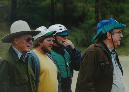
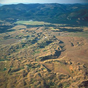
Photo by Bill Bevis.
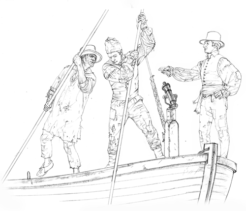
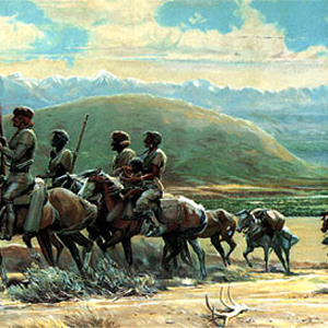
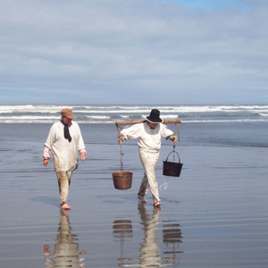
Left to right: Two concerned dugout canoe owners, one concerned expert paddler, and Joe grinning with delight
Joseph A. Mussulman (1928–2017) was the founding producer, editor and writer for Discovering Lewis & Clark. After five years of preparation and experimentation the website went online in 1998, under the auspices of a non-profit entity called VIAs Inc., and funded by grants from various sources, especially–throughout the bicentennial observance from 2003 to 2006–the Challenge Cost Share Program of the National Park Service. In 2009 the site was taken over by the Lewis & Clark Fort Mandan Foundation of Washburn, North Dakota.
Dr. Mussulman earned his bachelor’s and master’s degrees in music history and literature at Northwestern University in 1950 and 1951. As a Danforth Scholar he earned a doctorate in humanities from Syracuse University in 1967.
He has written and produced a number of interpretive programs in collaboration with audio specialist Richard H. Kuschel, also of Missoula Montana. In 1986, he wrote, narrated, and co-produced a multimedia presentation for the Blaine County Museum (MT) titled Forty Miles from Freedom, about the Non-Treaty Nez Perce Indians’ final battle with the U.S. Army, at the Bear Paw Mountains in 1877. In 2012-13 Mussulman and Kuschel revised the 20-minute onsite production and updated it in High Definition video. In 1994 their interactive self-guided audio-CD tour of Yellowstone National Park, a five-hour program produced for Tour Technologies, Inc., received first prize in the category of media productions from the National Association for Interpretation. Their Two Days to Destiny, an audio interpretive tour of the Little Bighorn Battlefield, won first place from the NAI in 1995.
Mussulman is the author of five articles on Lewis and Clark that appeared in We Proceeded On, the official journal of the Lewis and Clark Trail Heritage Foundation, Inc.: “My Boy Pomp’: About That Name,” Vol. 21, No. 2 (May 1995); “Soundscapes: The Sonic Dimensions of the Lewis and Clark Expedition,” Vol. 21, No. 4 (November 1995); “Men in High Spirits: Humor on the Lewis and Clark Trail,” Vol.22, No. 2 (May 1996); “‘In Greatest Harmoney’: ‘Meddicine Songs’ on the Lewis and Clark Trail,” Vol. 23, No. 4 (November 1997); and “Pomp’s bier was a bar,” Vol. 27, No. 1 (February 2001).
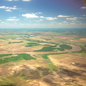
Dr. Mussulman has designed and produced maps for various books, brochures and study guides about Lewis and Clark, including 58 full-color maps illustrating the expedition’s entire route from coast to coast for the travelers’ guide, Along the Trail with Lewis and Clark, by Barbara Fifer and Vicky Soderberg (2nd ed., Helena: Montana Magazine, 2001). Those maps also appeared in the same publisher’s annual Lewis and Clark Travel Planner and Guide. They may be seen in Discovering Lewis & Clark at Discovering Lewis & Clark from the Air. In 1998, he created a poster illustrating the trail from Washington, D.C. to the Pacific, for Farcountry Press.
His other publications include a biography, Dear People . . . Robert Shaw (Indiana University Press,1979; reprint, Chapel Hill, NC: Hinshaw Music, 1996), and Music in the Cultured Generation (Evanston: Northwestern University Press, 1974). From 1987 through 1998 he was the interpretive writer and designer of Montana Afloat, a series of sixteen maps of Montana’s major floatable rivers.
Dr. Mussulman was a 1999 recipient of a Montana Governor’s Arts Award. Several years later he received an award of meritorious achievement from the Lewis and Clark Trail Heritage Foundation “for outstanding contributions in bring to this nation a greater awareness and appreciation of the Lewis and Clark expedition.” In 2005, he received the Montana Governor’s Humanities Award.
Contributions
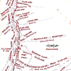
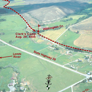
Twenty-eight and one-half miles upriver from their camp of 4 July 1806 the Indian road crossed a stream Lewis named after William Werner. At mile 31, they camped near the mouth of a stream the captain named after his dog, Seaman.
“Several horses Sliped and roled down Steep hills which hurt them verry much The one which Carried my desk & Small trunk Turned over & roled down a mountain for 40 yards & lodged against a tree, broke the Desk…”
During his trips on the Marias in June 1805 and 1806, had he not been continually on the lookout for signs of those hostile Blackfeet Indians, Lewis just might have seen some fossils of marine shellfish.
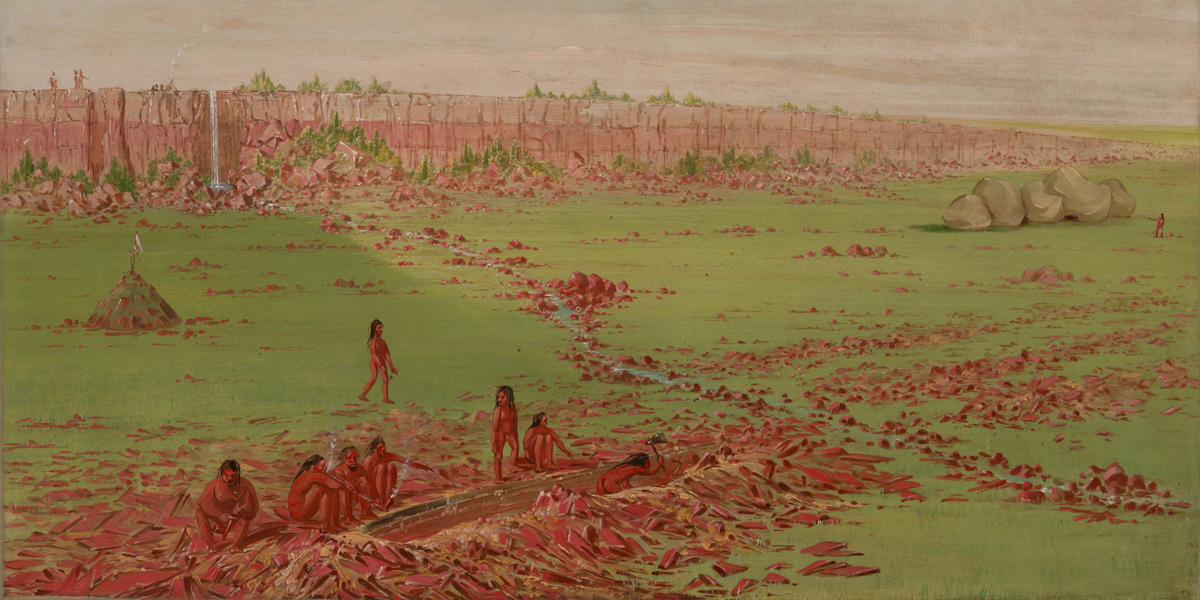
La Vérendrye’s 1728 name for Spirit Mound contains several puzzling statements. Pako’s reference to that “very fine gold-coloured sand,” suggests the “little mountain” was located in a fabulous land, an Eldorado, of precious natural riches.
One of Wheeler’s most successful efforts to amplify any part of Lewis and Clark’s route was his exploration of the Lolo Trail. For that he relied heavily on Elliott Coues’ 1893 annotations to the expedition’s narrative.
![]()
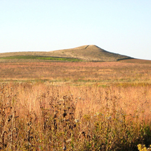
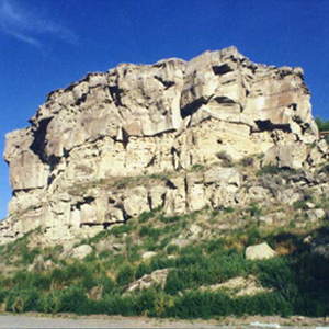
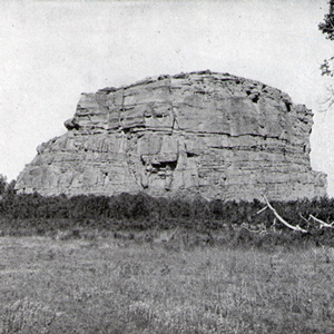
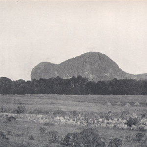
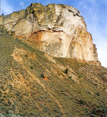
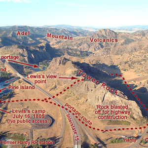
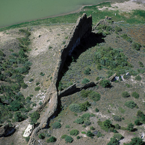
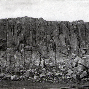
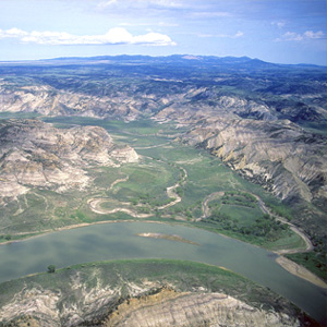
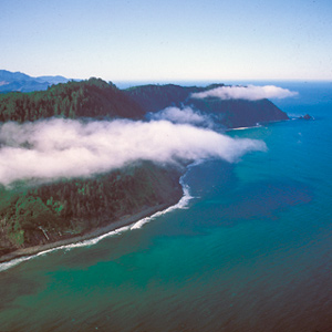
On 31 October 1805, Clark first saw this “remarkable high detached rock,” the eroded core of an ancient volcano, which he estimated stood eight hundred feet above the riverbank and was four hundred yards in circumference.
Lewis had assured Clark that their situations would be identical in every respect, beginning with rank. The fact that Clark was actually a lieutenant was a secret kept throughout the expedition.
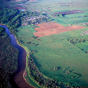
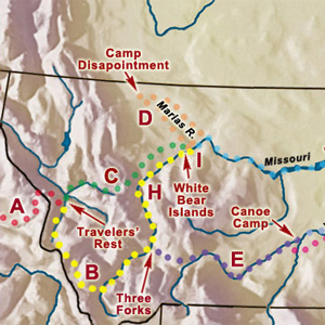
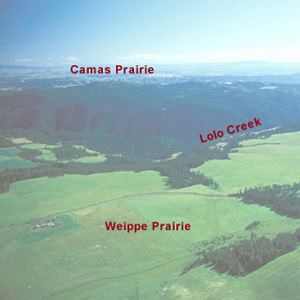
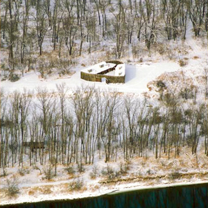
For three days the Corps rested here, gathering strength for the arduous 150-mile trek across the Bitterroot Mountains. The campsite was about two-thirds down in the photo, among the cottonwoods that shelter Lolo Creek.
At 3 o’clock in the afternoon, 11 September 1805, Toby led the Corps of Discovery out of Travelers’ Rest camp toward the Bitterroot Mountain barrier.
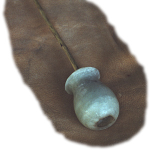
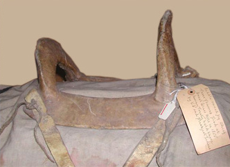
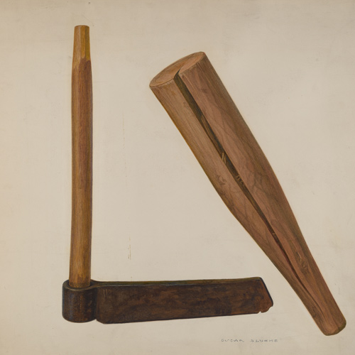
Lewis’s Branding Iron
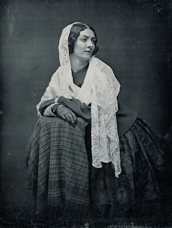
by Joseph A. Mussulman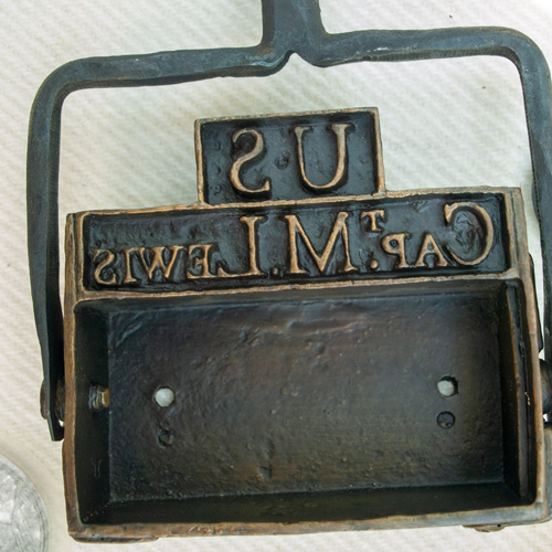
Lewis may have had this branding iron custom-made before he left the East, perhaps at Harpers Ferry, although there is no mention of it in existing records. Such tools commonly were used for marking wooden packing crates and barrels, and on leather bags, until the early 20th century.
He had gotten off to a bad start, but apparently, the captains, or at least Clark, saw something in him that was worth saving. They would name Idaho’s Lolo Creek, Collins Creek.
Lewis writes: “the bier in which the woman carrys her child and all it’s cloaths wer swept away as they lay at her feet she having time only to grasp her child.” This bier, then, is a bar or net serving to keep mosquitos from one’s personal blood supply.
The visit to this prairie hill was among the more bizarre sidelights of the whole expedition, but evidently it was not entirely unexpected. Seventy-six years earlier, explorer Pierre La Véndrye called the place the “Dwelling of the Spirits.”
They fancied they could already see and hear the Pacific Ocean, although it was still more than 20 miles away, well beyond their horizon. Clark’s famous exclamation was another instance of the captains’ habit of reacting prematurely.
Bighorn: Sheep or Goat?
by Joseph A. Mussulman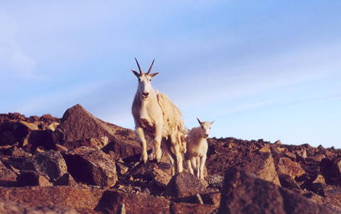
We confront the paradox that Elliott Coues pointed out in 1893—that Lewis and Clark had mistaken goats with wool … for sheep, and sheep without wool . . . for ibexes. Succeeding naturalists heightened the misunderstanding with invidious comparisons.
On the morning of 8 November 1805, the Corps’ flotilla entered a “nitch” they called Shallow Bay and paused for their midday meal near the remains of an Indian village with “great numbers of flees which [we] treated with the greatest caution and distance.”
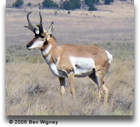
The Corps observed an Indian strategy for hunting game. As men on horseback herded pronghorns—”goats or Antelope,” Clark called them—into the river, boys swam among them and killed some with sticks, while others on shore shot them with bows and arrows.
At 4 P.M. on 1 June 1804, the expedition arrived at the mouth of the Osage River, one of the major Indian fords on the lower Missouri.
Lewis reported that a specimen of this plant “was taken the 1st of June at the mouth of the Osage River; it is known in this country by the name of the wild ginger.”
“These Springs are very beautiful to See, and we think them to be as good to bathe in &c. as any other ever yet found in the United States,” avowed Private Joe Whitehouse.
William Clark first mentioned the root cous on 1 November 1805, saying that native people living near the future Bonneville Dam site traded beads to obtain it from people up the Columbia River. To Clark, it was “cha-pel-el bread.”
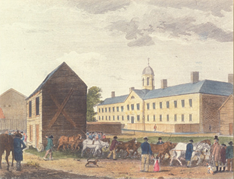
The irony inherent in the juxtaposition of the A.M.E. Church’s prime sanctuary as a symbol of fellowship and hope, with the Walnut Street Gaol (jail) as a place of isolation and despair, would not have been lost on any black person or white abolitionist.
The fourteenth of May was a day of close calls. With no time to reload their weapons, the grizzly bear hunters flung them aside and leaped over a twenty-foot-high bank into the river.
Willard had to walk back 3 miles to get his tomahawk. On his way back, he dropped his rifle in the water, and he couldn’t find the weapon in the deep mud. On that same day, Clark took note of “much fallen timber, apparently the ravages of a dreadful haricane.”
Clark and his five men “proceeded on up the river a little more than a mile to the largest fountain or Spring I ever Saw, and doubt if it is not the largest in American Known.”
Narrado tanto en inglés como en español, Daniel Flores narra la historia de una exploración paralela y sureña ahora casi olvidada.
The two captains “strolled out to the top of the hights in the fork of these rivers,” from which they had “an extensive and most inchanting view.”
Drouillard was one of the captains’ three most valuable hands. He was also the highest paid member after the captains, he shared the Charbonneaus’ tent with the family and the captains, and he was the only man Clark seemed to call by first name in the journals.
On 25 July 1806, Clark and his contingent of nine men, plus York, Toussaint Charbonneau, Sacagawea, and little Jean Baptiste, arrived at “a remarkable rock Situated in an extensive bottom, on the Star[boar]d. [south] Side of the river.”
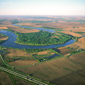
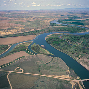
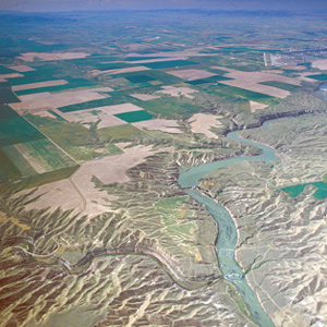
The Blackfoot River
by Joseph A. Mussulman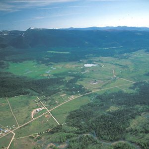
The road led Lewis and his men to the north of an “extensive high prarie rendered very uneven by a vast number of little hillucks and sinkholes.” Lewis noted: “These plains I called the prarie of the knobs.”
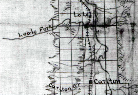
Whereas Lt. Mullan consistently referred to the creek as Lolo’s Fork, Isaac Stevens, in the published Reports and Surveys, and in all of the related maps, embellished Lo Lo with a supplementary u, making it “Lou Lou,” which led to the logical conclusion that the name was pronounced “Loo Loo.”
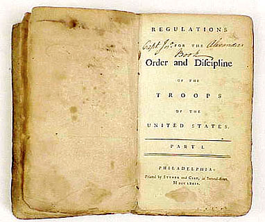
Steuben’s book was much more than a “blue book” of military regulations and procedures. It concluded with guides to character, pride and conduct for men of every rank, from regimental commanders and their subordinates, to non-commissioned officers and privates.
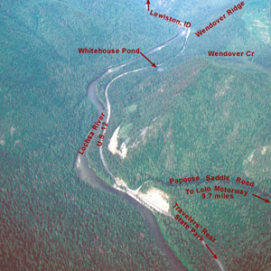
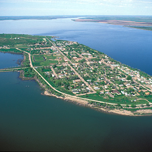
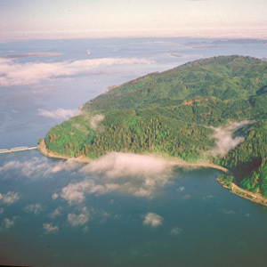
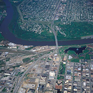
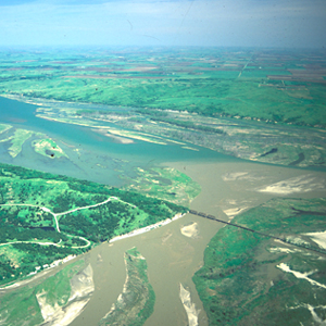
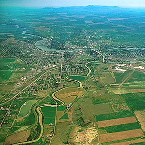
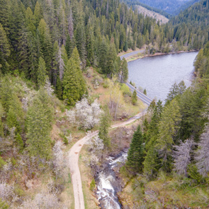
Clearwater Canoe Camp by Air
by Joseph A. Mussulman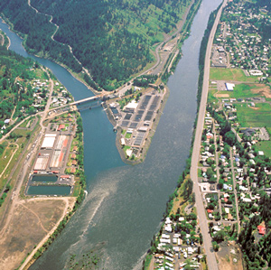
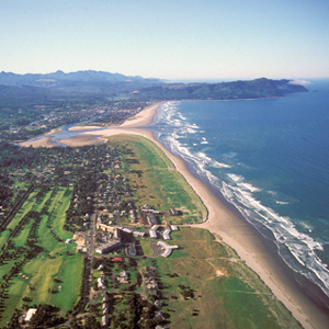
Still sick and exhausted from their recent crossing of the Bitterroot Mountains, Lewis, Clark, and their crew arrived on 26 September 1805, at what they called Canoe Camp, on the Clearwater River.
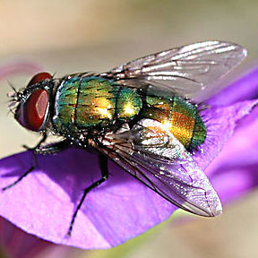
On 20 May 1805, the captains named a certain watercourse Blowing Fly Creek, “from the immence quantities of those insects found in this neighbourhood.” As Lewis explained, “they infest our meat while roasting or boiling, and we are obliged to brush them off our provision as we eat.”
Clark’s party made camp at today’s Park City, Montana, and settled in to build the new canoes and attend to other business. While a few of the men took turns with the three axes they had along, some of the rest, being nearly naked, made elk- and deer-skin clothing.
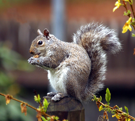
Lewis wrote his brief account of the new species on 25 February 1806: “the small grey squirrel common to every part of the rocky mountain which is timbered, difirs from the dark brown squirrel . . . only in its colour.”
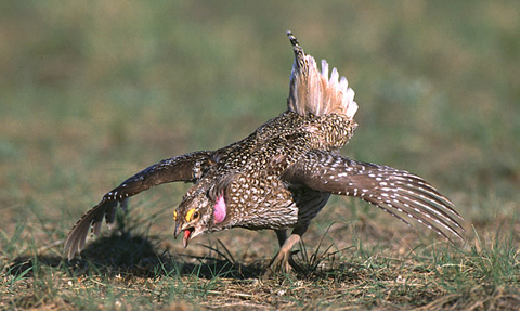
Elliott Coues, whose scientific interest centered on ornithology, in 1893 declared Lewis’s “Grouse or Prarie hen” to be the Oregon ruffed grouse, at that time classified as Bonasa umbellus sabinei (Ord) Coues.
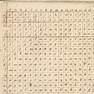
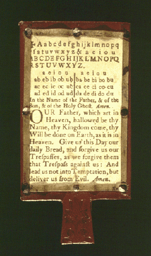
It was Thomas Jefferson who gave cryptography in America its greatest impetus. Sometime in 1803 Jefferson presented Meriwether Lewis with a cipher based on a square table or tableau used to create a substitution cipher.
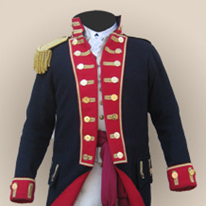
Uniforms
by Joseph A. Mussulman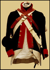
Each enlisted man, as well as the Captains, brought with them their dress uniforms which was worn for formal, official occasions such as dress reviews and parades, courts-martial, and funerals.
“This smoke must be raisd. by the Crow Indians in that direction as a Signal for us, or other bands. I think it most probable that they have discovered our trail.”
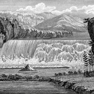
After Lewis’s preliminary sketch, later artists and photographers contributed to the visual documentation of the “sublimely grand” waterfall including Barralet, Gustavus Sohon, A. E. Mathews, and F. Jay Haynes.

The formula is simple. One molecule of sodium, a reactive metal, plus one molecule of chlorine, a poisonous gas, equals a harmless mineral that once was deemed “the fifth element,” along with earth, air, fire, and water.
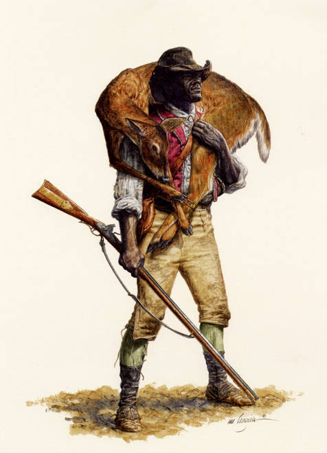
Harvesting the Hunt
by Joseph A. Mussulman
After the animal is shot, the work begins: field dressing, hauling the meat to camp, butchering, and preserving the extra meat for future meals.
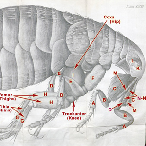
Nearly a century and a half before Lewis and Clark’s encounter with fleas en masse on the lower Columbia River, the little insect acquired an almost admirable, if not respectable, reputation, thanks to Hooke and his microscope.
Always the Wind
by Joseph A. Mussulman
On 4 June 1805, while they were exploring the Maria’s River, Lewis and his men camped “among the willow bushes which defended us from the wind which blew hard from the N. W.” Homesteaders on the plains planted Shelterbelts to shield from strong wind and blowing snow.
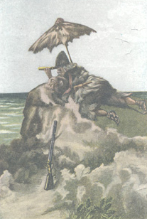
There may have been one good personal reason why Clark carried an umbrella. Beneath our skins we’re all supposed to be pretty much alike, but at the epidermal level there are some conspicuous differences that we owe to melanin.
Until he presented his services to General Washington at Valley Forge, the Continental Army still consisted merely of a number of state-sponsored militias that were entirely independent of one another, each operating according to its own rules and regulations.
Edgar S. Paxson
by Joseph A. Mussulman
Edgar Paxson captured the essence of the fast-disappearing Old West as he personally experienced it. In 1895, he painted “Over the Trail of Lewis and Clark,” his first known scene from that episode in western history.
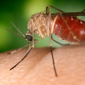
Mosquito Ills and Cures
by Joseph A. Mussulman
Symptoms of the ague, a disease that would later be called malaria, were recorded in the journals. Unknown to anyone at that time, this illness was carried by mosquitoes. What did they do to prevent bites and treat mosquito-born illnesses?
Early American Flags
by Joseph A. Mussulman
Lewis’s long list of needs for the journey would have been a large supply of American flags, to be flown on their boats, over their camps, and at their council sites. Leading up to the Lewis and Clark expedition, what did the young country’s flags look like?
Here they “formed a camp in a Butifull Plain,” erected a flagpole, ran up their large flag, and settled in to wait for the Sioux, whom they had invited to meet with them. On August 30, seventy-five Sioux men of the Yankton tribe ceremoniously entered the expedition’s camp, eager to parley.
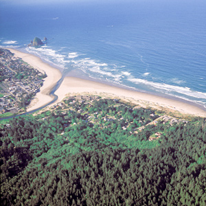
By the time Clark and his party got to present-day Cannon Beach, Oregon, on 8 January 1806, the locals had picked the dead whale’s 105-foot-long carcass clean.
Reaching the mouth of the Knife River on 27 October 1804, the expedition arrived in the midst of a major agricultural center and marketplace for a huge mid-continental region. The five permanent earth lodge communities there offered a panorama of contemporary Indian life.
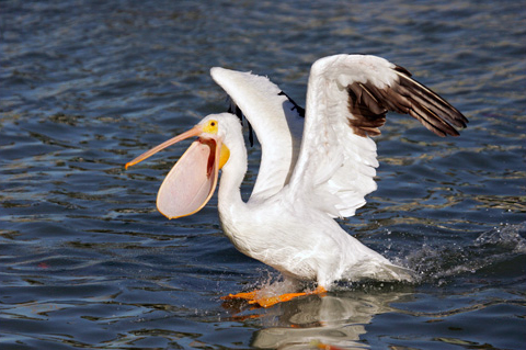
After killing one in flight, Lewis outlined the pelican’s habits of migration and reproduction, possibly relying on one of the reference books he had with him.
By his 5 June 1805 estimate, Meriwether Lewis was 38 miles up the Marias River from the expedition’s camp on the Missouri. To the northeast, he identified the Bears Paw Mountains and Sweet Grass Hills.
On 25 May 1804, about forty river-miles above St. Charles, the expedition camped near a small village at the mouth of a creek called Charrette. Its seven French families had arrived only a few years before. The family of Daniel Boone moved there sometime after 1804.
“The countrey on the North Side of the Missouri is one of the handsomest plains we have yet Seen on the river,” Clark declared. Lewis described the ragged badlands on the south side as “high broken hills….”
In 1902, Wheeler followed the Northern Pacific’s course over Bozeman Pass and the Yellowstone River promoting both the railroad and the Lewis and Clark Centennial.
Today’s Fort Clatsop stands at or near the site of the Corps’ winter encampment of 1805-06 was built on the same floor plan that Clark drew on the cover of the Elkskin-covered Journal. The rest of the present structure resembles the original only in a remote sense.
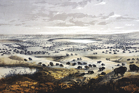
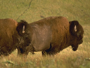
For more than a hundred years the American bison has been enshrined as a symbol of the American West in the first line of a song known around the world, “Home on the Range.”
There was no Northwest Passage by water; and the portage they found took much longer than a day. The political repercussions from that alone could be immensely embarrassing to Jefferson. Something had to be done….
F. Jay Haynes
by Joseph A. Mussulman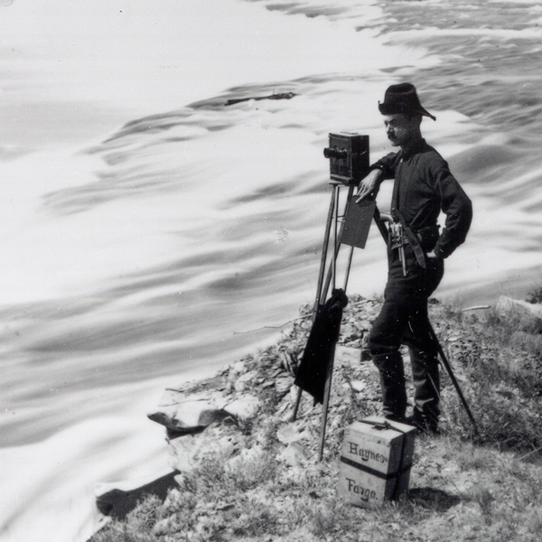
Many of the first photos in present Montana were by F. Jay Haynes. His story reflects the emergence of photography itself.
On 6 July 1806, Lewis’s eleven-man party had broken camp at the mouth of a Blackfoot River tributary they named Seamans Creek, after, and headed on up the river along the “road” that Indians living in the Rocky Mountains called the Cokahlahrishkit—the Road to the Buffalo.
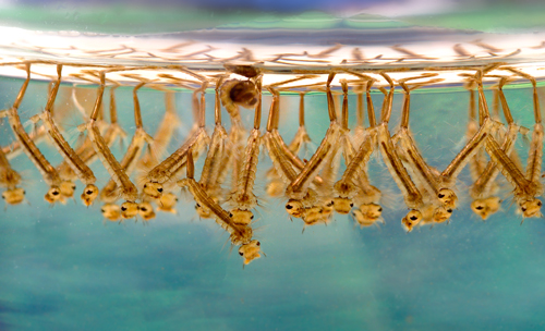
For nearly 100 years, the Lewis and Clark Expedition’s full contribution to natural science was underpublished and a disappointment to many scientists expecting to learn more about the natural history of the regions explored. When it came to the mosquito, these naturalists were doubly disappointed.
Two troops of the 1st U.S. Cavalry met their first defeat. That set in motion the heroic flight of 450 women, children and elders, 200 warriors, and their only remaining wealth—some 2,000 horses—toward the safe refuge that would forever elude them.
Cameahwait and some of his people agreed to help the Corps of Discovery carry its baggage over the divide. In the early afternoon. “We now dismounted,” wrote Lewis, “and the Chief with much cerimony put tippets about our necks such as they temselves woar.”
After passing “one continued rappid and three small cascades of abut for or five feet each,” Lewis “arrived at a fall of about 19 feet,” which he suitably named “the crooked falls” and proceeded to describe its geometry.
Fort Clatsop Detachment Orders
by Joseph A. Mussulman
The captains issued Detachment Orders showing the degree to which Lewis and Clark consistently maintained the spirit of Baron von Steuben’s Regulations for the Order and Discipline of the Troops of the United States.
At a place where “one false Step of a horse would be certain destruction,” Frazer’s pack horse took that fateful step, lost its footing and rolled with its load “near a hundred yards into the Creek,” over “large irregular and broken rocks.”

Determining the extent of the upper Missouri watershed was the single most important task Lewis and Clark faced. Their search for the westernmost source of the Jefferson River nearly cost them their lives.
Among the most faithful of the missionaries’ converts to Catholicism was a half-breed trapper named Lolo who was killed by a grizzly bear in November 1850.
The continuation of the Northern Nez Perce Trail led from their camp at Travelers’ Rest to the plains near the Great Falls of the Missouri, saving hundreds of miles from the expedition’s 1805 route.
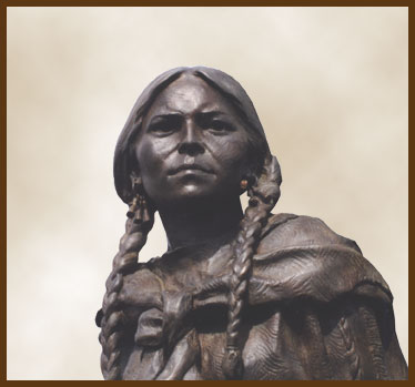
Because the Shoshone woman has been the subject of so many sculptures and paintings, especially since about 1900, we have a rich heritage of artists’ conceptions to contemplate.
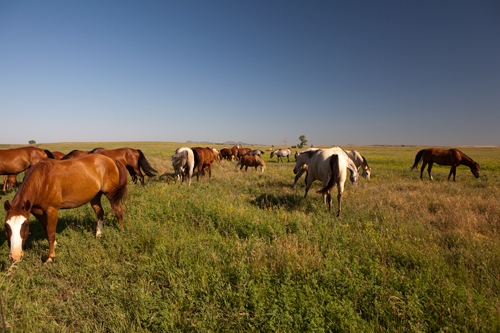
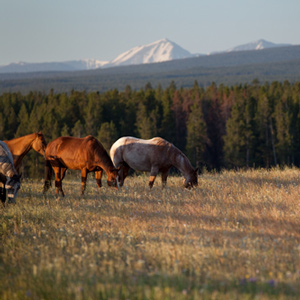
Wild Horses
by Joseph A. Mussulman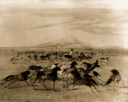
On 14 August 1805, Meriwether Lewis commented on the Shoshones’ herds: “Most of them are fine horses…. I saw several with Spanish brands on them, and some mules which they informed me that they had also obtained from the Spaniards.”
One amateur historian averred that it was “a corruption of the French name Le Louis, given to the stream and pass by early French trappers” in honor of Meriwether Lewis. Another claimed that the mystery [wo]man was named after “Lolo [i.e., Lola] Montez, a noted Spanish beauty.”
On 7 September 1805, the day after they left the Salish people at Ross’s Hole, the Corps proceeded north down the Bitterroot River valley. “The foot of the Snow toped mountains approach near the river on the left,” wrote Clark.
This is the landmark that white settlers believed Sacagawea really meant to identify as Beaverhead Rock . . . .
“I have been wet and as cold in every part as I ever was in my life,” Clark complained. “Indeed I was at one time fearfull my feet would freeze in the thin mockersons which I wore.”
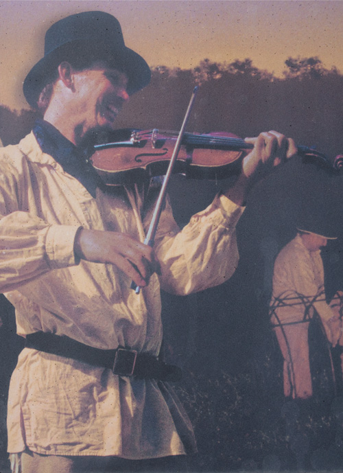
There really was no need for him to have been on the defensive. Pierre Cruzatte cast a spell over the assembled Indians with his fiddle, which was much more effective than any pompous diplomatic talk.
Lewis as Master Mason
by Joseph A. Mussulman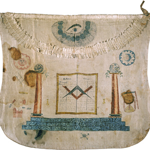
Lewis’s meteoric progress through the first three degrees of Masonry signified confidence on the part of the most prominent men of Albemarle that the 23-year-old Lewis was similarly destined for moral, civic, and political leadership.
For countless generations, Weippe Prairie (prounouced WEE-yipe), like Travelers’ Rest, was a major node in the transportation, trade, and social networks of the Rocky Mountain West.
Even in Lewis and Clark’s day, new species were being classified using a system developed by naturalist Carl Linnaeus.
Creeping down the nearly imperceptible slope of the northern high plains, this is the stream Lewis and Clark described as possessing a peculiar whiteness, being about the colour of a cup of tea with the admixture of a tablespoonfull of milk.
No more calomel! Not just an anthem, a reflection on the transition from the “Age of Enlightenment” to the “genteel tradition.”
America’s greatest ornithologist, John James Audubon, was just starting his career when Lewis and Clark returned, and there is ample evidence that he drew inspiration from Lewis and Clark’s writings.
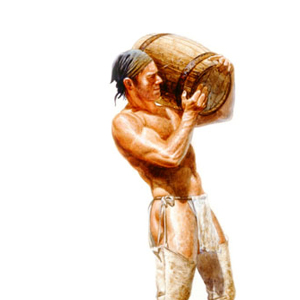
Caching Supplies
by Joseph A. Mussulman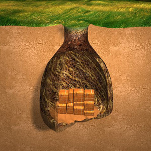
Lewis records the method for hiding and storing goods, which he learned from the French members of the Corps.

It has been remembered as “the most gloomy self-examination of the entire journal,” and “a passage of unreasonable melancholy,” of poignant sadness and self-doubt.
The Dictionary of Bias-Free Usage remonstrated that “only by a strange twist of white ethnocentrism can one be considered to ‘discover’ a continent inhabited by millions of people.” Political correctitude might suggest that we simply drop the word discovery from our Lewis and Clark lexicon, and just speak of the captains as explorers.
With Captain Clark in sole command, the Corps of Volunteers for North Western Discovery left the mouth of Wood River on 14 May 1804. The flotilla was comprised of the barge and two pirogues. Clark and the men “proceeded on under a jentle brease,” bound for St. Charles.
“the Indians give a very formidable account of the strength and ferocity of this anamal, which they never dare to attack but in parties of six, eight or ten persons; and are even then frequently defeated with the loss of one or more of their party.”
Clark shot “a Prarie Wollf, about the Size of a gray fox bushey tail head & ear like a wolf.” Lewis wrote his description of what proved to be a new species on 5 May 1805, in northeastern Montana.
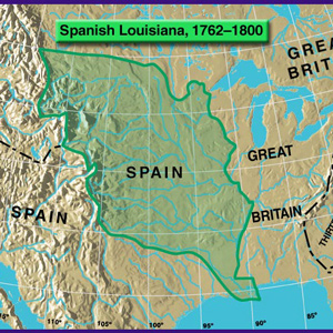
On 9 April 1682, René La Salle, claimed “possession of this country of Louisiana.” Thus, without any belligerent confrontations began the decline of one already ancient meta-culture, and the rise of a succession of new empires.
John Evans provided maps of the Missouri River and Rocky Mountains, the most significant outcome of the Mackay-Evans Expedition.
Floyd’s grave became a conspicuous point and a historic shrine on the Lewis and Clark trail almost immediately after the expedition was over. The American artist George Catlin painted Floyd’s Bluff in 1832, with the original cedar marker still in place.
In this interview, Dan Flores, A.B. Hammond Professor of History at The University of Montana, sets the scene at the time of Lewis and Clark, and then discusses some of those circumstances which brought the American bison to the brink of extinction.
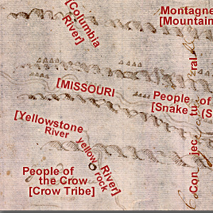
Crow Country
by Joseph A. Mussulman
The Crows called themselves Absalookas, sometimes heard as Absarokas, or “Children of the Large-beaked Bird.”
Its oak-strong, hickory-tough wood made powerful, reliable hunting bows. Early French explorers and traders translated its Indian name into bois d’arc,–”wood for a bow,” which was easily anglicized into “bodark.”
The Judith River
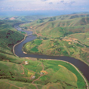
by Joseph A. Mussulman
“at the distance of 2½ miles passed a handsome river which discharged itself on the Lard. side, I walked on shore and acended this river about a mile and a half in order to examine it”
Upon the Corps’s arrival at this confluence on 25 July 1805, Lewis quickly recognized it as “an essential point in the geography of this western part of the Continent.”
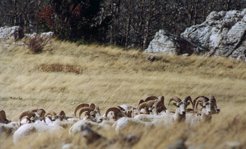
By telling the story of how these photos and videos were created, the behaviors of the bighorn sheep are described.
The story of Lewis and Clark meeting the Flathead Salish on 4 September 1805 at Ross Hole is told by one expedition member, four Salish Indians, and one western artist.
“The river appears to have forced it’s way through this immence body of solid rock for the distance of 5-3/4 miles,” Lewis observed.
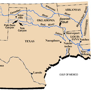
Narrated in both English and Spanish, Daniel Flores tells the story of a parallel, southern exploration now nearly forgotten.
The Corps’ journalists, in their accounts of new species of mammals they encountered on the expedition, would occasionally call to mind comparable features of domestic canids whenever it was appropriate—in terms of their sizes, morphology, and “notes” or barks.
Lewis wrote a description of the eastern gray squirrel, the first of his natural history observations, on 11 September 1803, twelve days after he left Pittsburgh on his voyage down the Ohio.
The “Deserts of America”
by Joseph A. Mussulman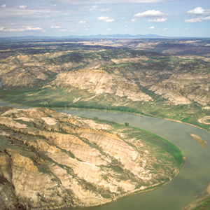
The men of the Corps of Discovery were fascinated by the varied textures, shapes and colors of the 200- to 300-foot cliffs that defined the river’s immediate borderlands. Clark judged from all he could see that “this Countrey may with propriety … be termed the Deserts of America.”
Lewis and Clark and their men camped on 9–10 September 1805 and again on 30 June though 2 July 1806 beside a stream they called “Travelers Rest Creek.” Meriwether Lewis may have seen or sensed a comparison between it and the Travelers Rest in South Carolina.
Dr. Rush had expressly indicated to Lewis that when one of his men showed the “sign of an approaching disease . . . take one or two of the opening pills” nicknamed “Rush’s Thunderbolts.”
“I ascended the hills,” Lewis wrote, “from whence I had a most pleasing view of the country, particularly of the wide and fertile vallies formed by the Missouri and Yellowstone Rivers.”
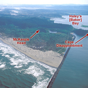
Concomly was a prominent Chinook citizen and leader whose people lived on the north side of the Columbia estuary, on the shore of Haley’s Bay. On November 17, 1805, he introduced himself to Lewis and Clark at Station Camp.

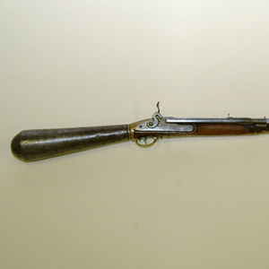
Though text, animations, and narrated video, this page provides a thorough explanation showing how a flintlock works, best practices in the field, and instructions to load and fire.
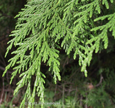
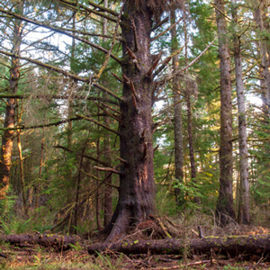
The tree that caught the Corps’ attention west of today’s Lolo Pass was a species that is unique to the Far West of North America, the western redcedar.
On the night of 4 November 1805 the expedition camped near a pond now called Post Office Lake. The next morning a weary, groggy Clark complained that he “could not Sleep for the noise” made by the numerous waterfowl.
Sheheke’s Delegation
by Joseph A. Mussulman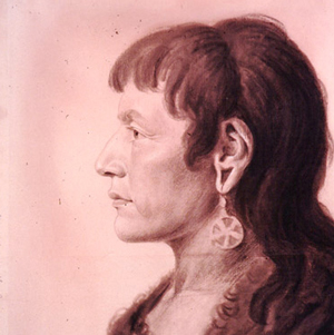
Sheheke’s diplomatic trip to Washington City and his difficult return home brought down the careers of at least two great leaders—himself, and Meriwether Lewis.
Land management introduced the pupil to the practical aspects of natural history. Jefferson recalled Lewis’s “talent for observation, which had led him to an accurate knowledge of the plants and animals of his own country, would have distinguished him as a farmer.”
“accedentaly the ball passed through the hat of a woman about 40 yards distanc cutting her temple about the fourth of the diameter of the ball.”
Thomas Rodney stated: “It is a curious piece of workmanship not easily described and therefore I omit attempting it.” Of the Indians, Lewis wrote that it “astonishes them very much, they cannot comprehend it’s shooting so often and without powder.”

Lewis reported on 26 May 1805, that on a creek he saw “several softshelled Turtles which were the first that have been seen this season; this I believe proceeded reather from the season than from their nonexistence in the portion of the river from the Mandans hither.” He was probably correct.
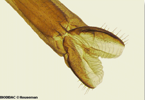
Dung Beetles
by Joseph A. Mussulman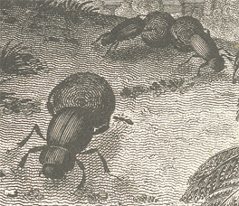
In his 261-word catalog of the insects, Lewis wrote that “a great variety of beatles common to the Atlantic states are found here likewise,” except that “the black beatle usually [c]alled the tumble bug which are not found here.”
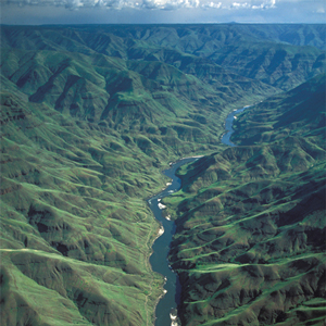
The Salmon winds tortuously through a seven-mile-long canyon where the vertical walls at that time crowded the riverbanks so tightly in several places that Clark and his party were compelled to clamber over “four mountains verry Steap high & rockey.”
York’s Fallout over Freedom
by Joseph A. Mussulman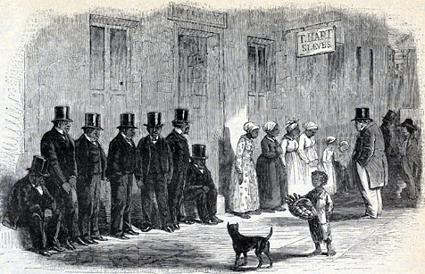
It is remarkable that we have no record of York’s words and thoughts. Insofar as the nineteenth century “slave narratives” were produced by Africans who had freed themselves, it may be conjectured that York did not leave a record of his thoughts and experiences because he was never freed.
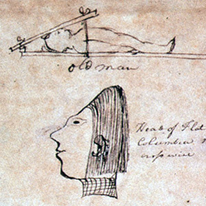
Profile Portraiture
by Joseph A. Mussulman
In 1802 the British-born Philadelphian, John Isaac Hawkins (1772-1805)5, invented a new kind of copy machine, a pantograph with which a person could produce a miniature copy of his or her profile through direct contact. He called it a physiognotrace.
With every crossing they unavoidably drifted farther downstream. Lewis recounted the climactic rafting episode of the day.
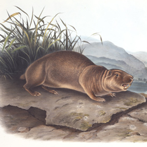
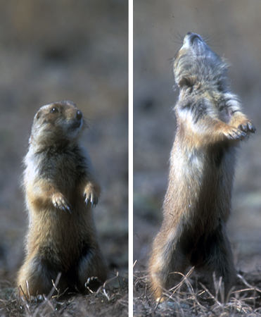
This secretive, primitive little rodent, which somewhat resembles the woodchuck and the muskrat, belongs to the same mammalian order, Rodentia, as the beaver, Castor canadensis, but otherwise they have nothing in common.
Lost Hunters
by Joseph A. Mussulman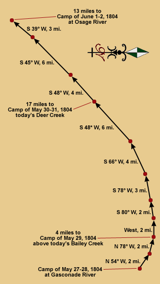
Every hunter, after following the land instead of the river, had to somehow end his day within sight or sound of the party’s camp at a location which no one could have known in advance. They were not always successful.
In a compromise with its multicultural makeup, the Corps of Discovery celebrated just three special days—Christmas Day, New Year’s Day, and Independence Day—and each must have been observed with a jovial mixture of traditions.
Flag Presentations
by Joseph A. Mussulman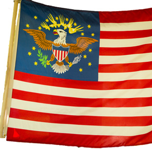
Lewis and Clark usually distributed flags at councils with the chiefs and headmen of the tribes they encountered—one flag for each tribe or independent band.
The Bears Tooth was an important landmark on the the ancient Indian road that has come to be known as the Old North Trail. It was included on Nicholas King’s 1804 map, and the captains expected to find it.
The closing of the first St. Mary’s Mission on 5 November 1850 was punctuated by the sudden death of “Lolo, the only Indian who still remained well disposed and really attached to religion.”
Meriwether Lewis’s recitation of Charbonneau’s recipe for buffalo sausage, known as “white pudding,” serves not only as documentation of a unique frontier cuisine, but also as an example of the captain’s own brand of satire.

Born on 18 August 1774, he was exactly eight months old when Paul Revere made the legendary ride that signaled the beginning of the War of Independence, and the birth of the new United States of America, which Lewis was to serve with distinction.
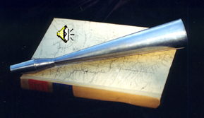
In May of 1803, Lewis bought four “tin horns”—elsewhere called “Tin blowing Trumpets” or, by Sgt. Ordway, “Sounden [Sounding] horns.” They were likely used a signals between boats and on several occasions a horn was used to call in lost hunters.
With what satisfaction and relief Lewis must have written, on 8 August 1805: “The Indian woman [Sacagawea] recognized the point of a high plain to our right which she informed us was not very distant from the summer retreat of her nation.”
The gravel road winding parallels Trail Creek, which is lined by low willows. It corresponds roughly to the Indian road that Lewis, Drouillard, Shields, and McNeal followed westward from the forks of the Beaverhead River.
Army Hygiene
by Joseph A. Mussulman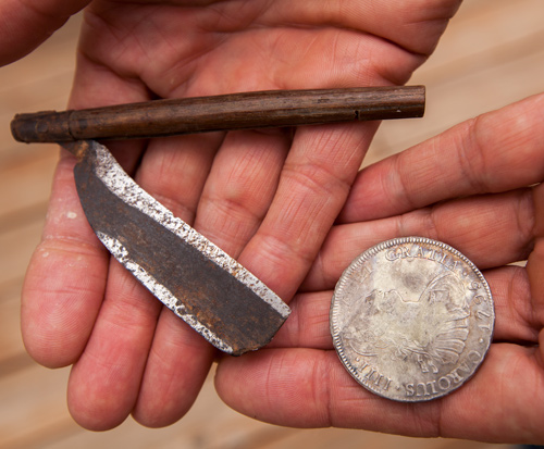
Officers were to see that their men’s hands and faces were daily “washed clean” and their hair combed. Soap was relatively expensive, and if individuals or families couldn’t manage to make their own, they just went without.
Pretending to have been insulted by their accusation, Lewis pompously declared that “if they continued to think thus meanly of us…they might rely on it that no whitmen would ever come to trade with them or bring them arms and amunition.”
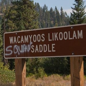
Both of the captains referred to Charbonneau’s young wife as a squaw, usually spelling it with a post-vocalic /r/—”Squar.” In the 1980s a nationwide movement arose to extirpate squaw from general use, because of its worst connotations.
On 27 December 1805, Clark wrote: “Musquetors to day, or an insect So much the Size Shape and appearance of a Musquetor that we Could observe no kind of difference.”
Private Whitehouse reported: “Camped at a Small branch on the mountain near a round deep Sinque hole full of water.”
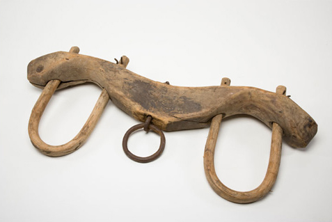
In 1806, Noah Webster defined the noun yoke as “a bandage on the neck, chain, bond, bondage, mark of servitude, couple, pair.” The word yoke can also denote a type of wooden device to harness animals that have been bred and trained to pull heavy loads.
Clark spent the night of 21 September 1805 at Twisted Hair’s camp on an island in the Middle Fork of the Clearwater River. The next morning the chief and his son accompanied him back up to the village on Weippe Prairie where he expected to rendezvous with Lewis.

As a reference, Lewis purchased the second edition (1784) of Richard Kirwan’s Elements of Mineralogy. Although Lewis and Clark had the book at hand throughout the expedition, its usefulness as a field guide was limited.
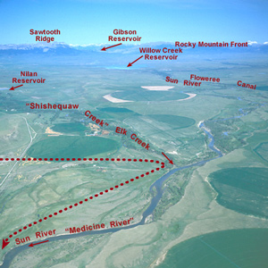
Shortly after crossing the Dearborn River, Lewis saw that the Indian road “continued along the foot of the mountain to the West of north” so he and his men cut northeast across the “tolerably level” plain toward the Sun River.
At Fort Clatsop on 5 February 1806, Reubin Field returned from a hunt with “a phesant which differed but little from those common to the Atlantic states.”

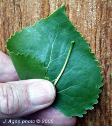
13 August 1805 near Lemhi Pass, Lewis wrote that he noticed “a species of honeysuckle much in it’s growth and leaf like the small honeysuckle of the Missouri.” He had discovered a plant that was new to the scientific community—the snowberry.
Deists in the ‘Wilderness’
by Joseph A. Mussulman
As deists in the ‘wilderness,’ Lewis and Clark simply wanted to observe and admire the surrounding world and learn to understand the relationships that held it together.
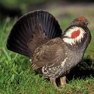
“this bird is fully a third larger than the common phesant of the Atlantic states. it’s form is much the same. it is booted nearly to the toes and the male has not the tufts of long black feathers on the sides of the neck which are so conspicuous in those of the Atlantic.”
It was “the most disagreeable time I have experienced,” Clark grumbled on 15 November 1805. “Confined on a tempiest Coast wet, where I can neither get out to hunt, return to a better Situation, or proceed on”
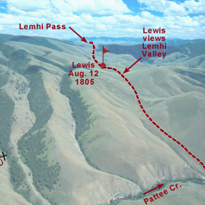
Below the summit of today’s Lemhi Pass, Lewis said that he had reached “the most distant fountain of the waters of the mighty Missouri in surch of which we have spent so many toilsome days and wristless nights.”
On the day before he reached the Great Falls of the Missouri, Meriwether Lewis wrote his own brief description of a species previously unknown to science: “The narrow leafed cottonwood grows here in common with the other species of the same tree with a broad leaf.”
The historic Map of Lewis and Clark’s Track Across the Western Portion of North America can fruitfully serve as a major palimpsest of American history as of the year in which it was created, 1810.

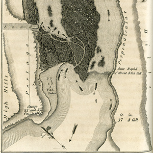
On 17 June 1805, Clark and five men set out to determine the best portage route around the Great Falls of the Missouri. On the way up the river, he stopped to also measure the fall of the river and to map the falls.
Clark was waiting with seven more recruits who would become permanent members of the contingent soon to be known as the Corps of Volunteers for North Western Discovery.
At The Dalles in 1902, a hospitable local citizen helped Wheeler make his way to the brink of the long narrow channel and chasm through which Lewis and Clark took their canoes, where he “overlooked the swirling waters as they boiled and raged.”
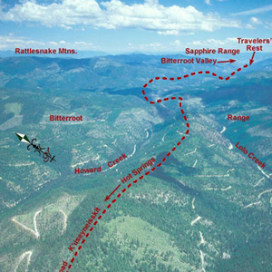
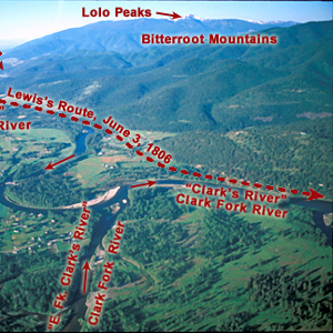
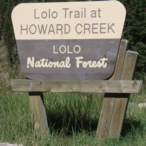
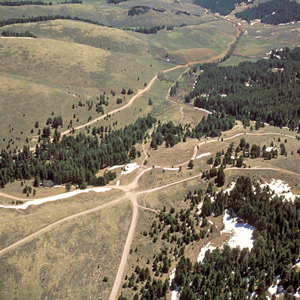
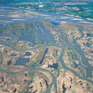
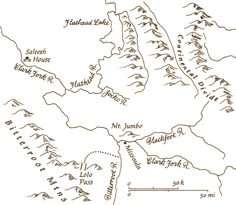
Naming the Lolo
by Joseph A. Mussulman
Even though it is highly unlikely that any of the expedition’s journalists ever heard the name, Lolo is among the most familiar and useful of all the place names in the story of the Lewis and Clark expedition. How did the Lolo get its name?
“The Indian woman recognized the point of a high plain to our right . . . . This hill she says her nation calls the beaver’s head from a conceived resemblance of its figure to the head of that animal.”
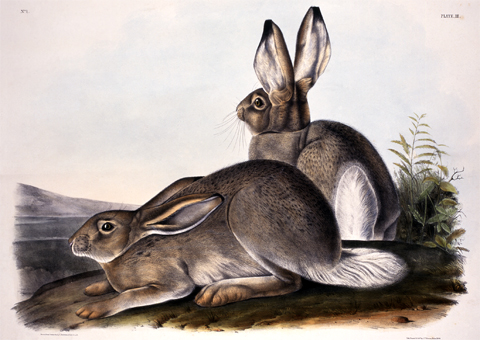
Lewis got his first close look at that “large hare of America,” when one of the Corps’ ace hunters, Private John Shields, bagged the first specimen more than 1,100 miles (by Clark’s estimate) up the Missouri River.
Lewis and Clark sometimes called it kinnikinnick, sometimes sacacommis. At Fort Clatsop on 29 January 1806, he described this useful plant.
Songs They Sang
by Joseph A. MussulmanIn response to numerous requests from teachers and community musicians, we present the following lists of songs that might have been sung by the men on the expedition, or by the folks back home.
Jews Harps
by Joseph A. Mussulman
Although nobody can determine how this tiny musical instrument was named, we do know Lewis included them in his list of Indian gifts. Whitehouse records the merriment of the Yankton Sioux playing them and dancing.
The shuttling of all the baggage and six canoes across the prairie to the upper portage camp opposite White Bear Islands began on 21 June 1805 and was completed on 2 July 1805. All in all, it was one of the most grueling undertakings on the entire expedition.
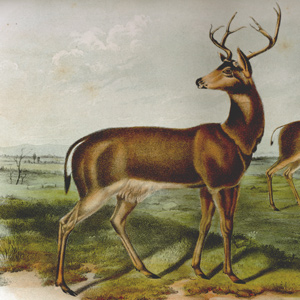
Lewis’s conviction that the “black tailed fallow deer of the coast” and the “common fallow deer” were two distinct species was sufficient to urge later investigators to try to clarify them.
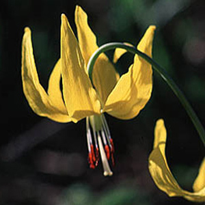
Because it appears in the Rockies at the edges of receding snowbanks it has also earned the name glacier lily. Lewis’s specimen, collected 15 June 1806 on the Clearwater River, was the one used by Pursh to describe the species.
Indians stole all the horses, so Sgt. Pryor and his three privates constructed two bull boats and floated down the Yellowstone River in hopes of catching up with Clark or Lewis.
President Jefferson directed Lewis to observe seasonal transitions as they are marked by the “times of appearance of particular birds, reptiles or insects.”
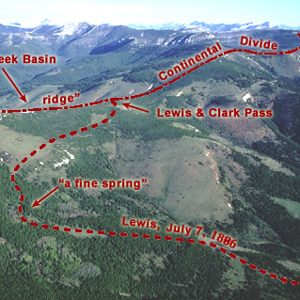
Sergeant Gass recorded that on 7 July 1806, Lewis’s detachment took a three-hour lunch break and then proceeded four miles, “when we came to the dividing ridge between the waters of the Missouri and Columbia.”
“This is a Creature so officious,” wrote the pioneer English microscopist Robert Hooke, “that ’twill be known to every one at one time or other, so busie, and so impudent, that it will be intruding it self in every ones company, and so proud and aspiring withall….”
On 25 August 1804, obedient to Jefferson’s instruction to observe Indians traditions, monuments and landmarks, Lewis and Clark went inland to visit a “conic form” rising from the plain.
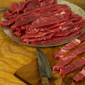
What did the captains mean when they say they stopped to jerk their meat? At the time of the expedition “jerk” simply stood for “dried meat.” This article includes a recipe.
Ordway reported that “our horses got Stung by the wasps” on 20 September 1805 while the party was making its way down the west side of the Bitterroot Mountains toward the Clearwater River. Whitehouse called them “the yallow wasps.”
When Cameahwait took Lewis into the shelter of the only leather lodge his people had been able to save from the Hidatsas’ depredations of the previous spring, Lewis knew for sure he was among good friends.
Charles Balthazar Julien Févret de Saint-Mémin (1770–1852) was a portrait artist whose works include Lewis, Clark, Chief Sheheke and his wife Yellow Corn.
“at this place there is a large rock of 400 feet high wich stands immediately in the gap which the missouri makes on it’s passage from the mountains.”
Beginning in the Late Middle Ages until the end of the nineteenth century the chase, that is, the pastime of pursuing wild animals for sport with dogs, was governed by laws promulgated by kings and queens.
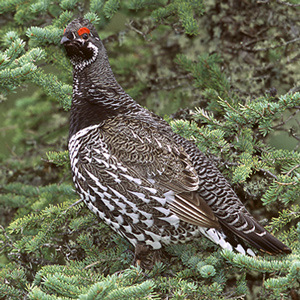
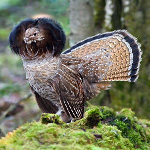
What is most remarkable about Meriwether Lewis’s work as a naturalist is that he observed and wrote so much about the plants and animals he saw. An unusual example is his description of the bird now commonly known as the spruce grouse.
On the first of August 1805, Clark and the expedition’s flotilla of eight dugout canoes pushed up the Jefferson River through “a verrey high mountain which jutted its tremendious Clifts on either Side for 9 Miles, the rocks ragide.”
During their time at the coast, the Corps saw only six sunny days; the rest brought clouds, fog, rain, and a little snow. Fifty-three were partly clear. That’s a normal winter on the west slopes of the Coast Range.
The wind against them again on 25 May 1805, the Corps had to tow their boats with ropes. Lewis observed, “the water run with great violence, and compelled us in some instances to double our force in order to get a perorogue or canoe by them.”
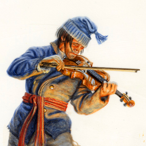
On 8 June 1806, Meriwether Lewis wrote of that evening, “we had the violin played, and [we] danced for the amusement of ourselves and the Indians.” Presumably, Pierre Cruzatte was the fiddler. It was the last mention Cruzatte’s playing the violin. Why?
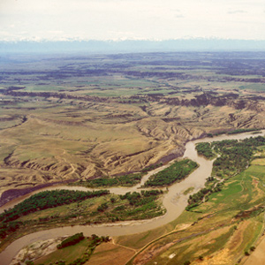
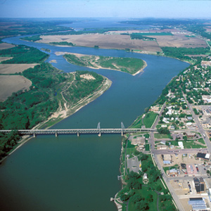
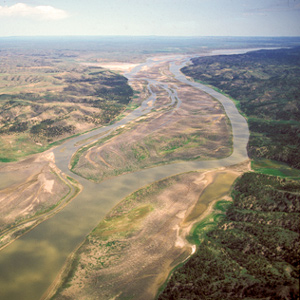
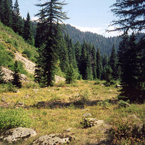
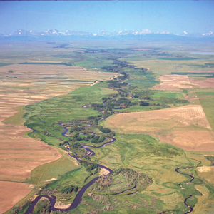
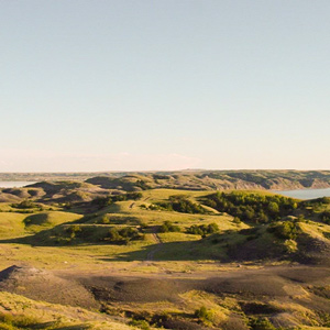
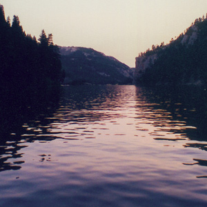
Yellowstone Canoe Camp
by Joseph A. Mussulman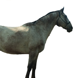
One week and a hundred miles after starting down the Yellowstone River, Clark finally found cottonwood trees large enough for building canoes. That night some Indians made off with half their horses.
![]()
“a remarkable high detached rock Stands in a bottom on the Stard [starboard, the navigator’s right] Side & about 800 feet high and 400 paces around”
Cascade Mountains at Dawn
by Joseph A. Mussulman
In 1838, a patriotic citizen started a campaign to change the Cascade Mountains into the “Presidential Range.” This was to include renaming Mount Hood after John Adams.
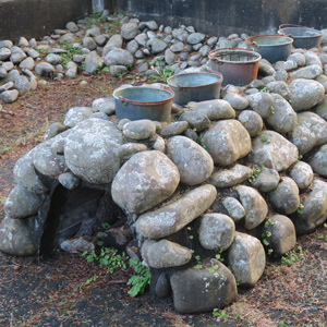
Here they built an oven of stones and, day and night for a month and a half, scooped perhaps 1,400 gallons of water from the surf, boiling it down to about twenty-eight gallons of salt.
The most remarkable trait in the Clatsop Indian physiognomy, Lewis wrote on 19 March 1806, was the flatness and width of their foreheads, which they artificially created by compressing the heads of their infants, particularly girls, between two boards.

“The whole of my party to a man except myself were fully perswaided that this river was the Missouri, but being fully of opinion that it was neither . . . I determined to give it a name and in honour of Miss Maria W____d.”
Gold Mines on the Trail
by Joseph A. Mussulman
In 1862, a prospector named John White and his partners arrived at a creek previously named for Alexander Willard of the Corps of Discovery. White hit pay dirt on one of the sandbars in the creek. Plenty of other gold-hungry pilgrims were near enough to respond within weeks.
For thousands of years sweet grass has been used as incense in spiritual and religious ceremonies, as a personal perfume, and braided into necklaces and bracelets for wearing as amulets to ward off illness and injury.
Few of their discoveries seized more interest, even controversy, from the American public. And certainly no others demanded more care than the six live specimens—including one prairie dog—that endured a four-month, 4,000-mile cage-bound odyssey to Washington City.
Pryor and six privates had successfully driven forty-one horses all the way to the Yellowstone Valley, apparently without any trouble. Then, smoke on the horizon. Twenty-four horses stolen on the twentieth. Seventeen taken on the twenty-fifth.
The story of what was known by his detractors as “Jefferson’s War,” opens for us a narrow window on a little known but intriguing episode in Meriwether Lewis’s brief position as the President’s secretary.
Meeting the Shoshones
by Joseph A. Mussulman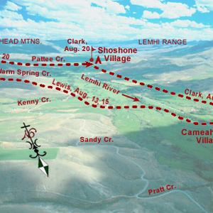
A few more Shoshones came in sight. Making all the benevolent signs and sounds he could think of, pondering ways to bring the wary Indians within talking distance, Lewis finally touched the hand of an elderly woman, and the spark of international friendship was struck.

The task of piloting the expedition’s boats efficiently through the Missouri’s windings and blind leads was the principal responsibility of Pierre Cruzatte who, as a riverman, earned the respect and confidence of every member of the party.
The U.S. Board on Geographic names declared that “Lou-Lou” and “Loo-Loo,” as well as the sometimes hyphenated “Lo-Lo,” were not to be used on maps in the future, and that the official place-name from that time forward was to be Lolo.
Here, Sergeant Gass went out with one of the hunters to retrieve the meat and hide of a buffalo the man killed the previous evening. The hunter had left his hat on the carcass “to keep off the vermin and beasts of prey,” apparently believing the scent of a human would scare them away”
“So far, we have experienced more difficulty from the navigation of the Missouri, than danger from the Savages. The difficulties which oppose themselves to the navigation of this immence river, arise from the rapidity of it’s current, it’s falling banks, sandbars, and timber”
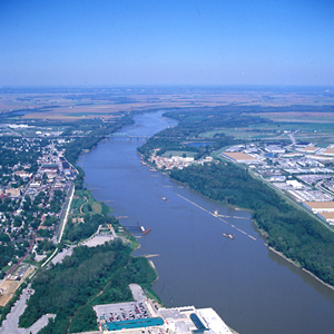
The Kansas River
by Joseph A. Mussulman
Clark was informed by one of the engagés who had traded along the Kansas that the river took its name from the Indians known as the Kanzes, or Kaw, nation which at that time dwelt on its banks.
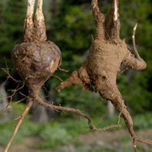
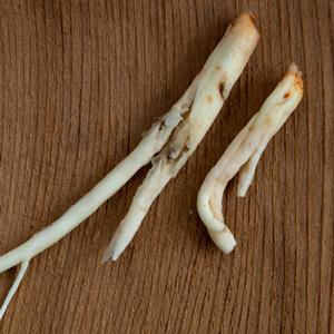
One of the roots obtained by George Drouillard on 21 August 1805 may have been a species of valerian (vuh-LEHR-ee-an), such as Valeriana edulis (vuh-leh-ree-AYE-nuh ed-YOU-lis), or edible valerian.
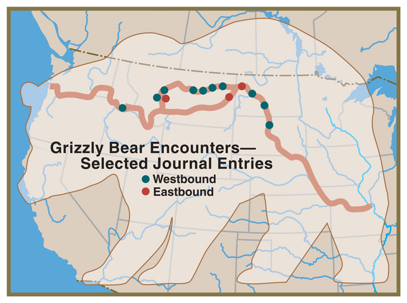
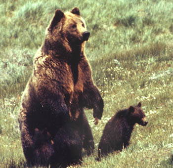
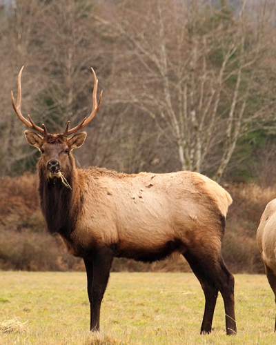
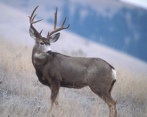
Bighorn Sheep Encounters
by Joseph A. Mussulman
During a reconnaissance assignment eight miles up the Yellowstone River on 26 April 1805, Joseph Field became the first member of the Corps to glimpse a live bighorn sheep.
On 19 July 1805, Lewis ‘doubled’ around Oxbow Bend, then 30 feet lower and maybe one-fourth as wide as it is today. Behind the river’s curve, an ancient landmark on the Indian Old North Trail, still stands out.
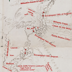
Clark’s Lookout
by Joseph A. Mussulman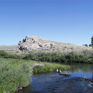
Clark arrived at this “high Point of Limestone rocks” and strolled to its low summit. This was a convenient place from which to take at least three different bearings, making of it a surveyor’s “station” or triangulation point.
Larocque at Fort Mandan
by Joseph A. Mussulman
In the fall of 1804, Larocque’s job was to take a supply of North West Company merchandise to the Mandan and Hidatsa villages and trade for furs. While there, he asked the captains if he could join the expedition.
Clark’s party continued north along the beach for four miles, to the vicinity of today’s Long Beach, Washington. Here Clark memorialized their first visit to the Pacific Ocean by marking his name and the date on a small pine tree.
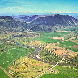
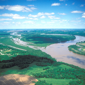
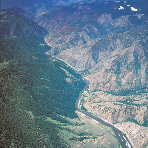
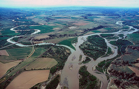
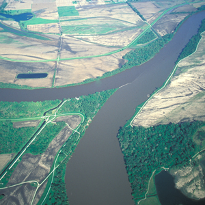
Mapping the Yellowstone
by Joseph A. Mussulman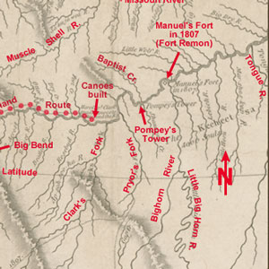
Clark’s map of 1814 shows his post-expeditionary conclusions regarding the lay of the land from just west of the Three Forks of the Missouri River, roughly 230 air miles eastward along the Yellowstone to the Tongue River.
The men of the Corps of Discovery must have been electrified by their first sighting of the pronghorn antelope at the northeast corner of today’s state of Nebraska. Naturalists were eager to find the answers to some basic questions about them.
Clark’s Fort Mandan Maps
by Joseph A. Mussulman
While wintering over at Fort Mandan, Clark made a series of maps based on Indian information and previous traders such as John Evans and François Larocque.
On 30 July 1806 Clark and his party camped near the mouth of the War har sah, or Powder River. He summarized the Yellowstone’s attractions, directing most of his attention toward opportunities for immediate expansion of the fur trade.
“As we passed on it seemed as if those seens of visionary inchantment would never have an end; for here it is too that nature presents to the view of the traveler vast ranges of walls of tolerable workmanship.”
The expedition had one major outcome that was made available to the public well before the expedition was over, the “Estimate of the Eastern Indians,” which Lewis and Clark sent back on the barge in April 1805.
Potts, might have called it a grosser Mücke (large gnat) or a Stechmücke (biting gnat). Labiche and Drouillard might have called it a cousin or a moucheron. But ever since early Colonial days it has chiefly been known in America by its Spanish name, mosquito.
Making Leather
by Joseph A. Mussulman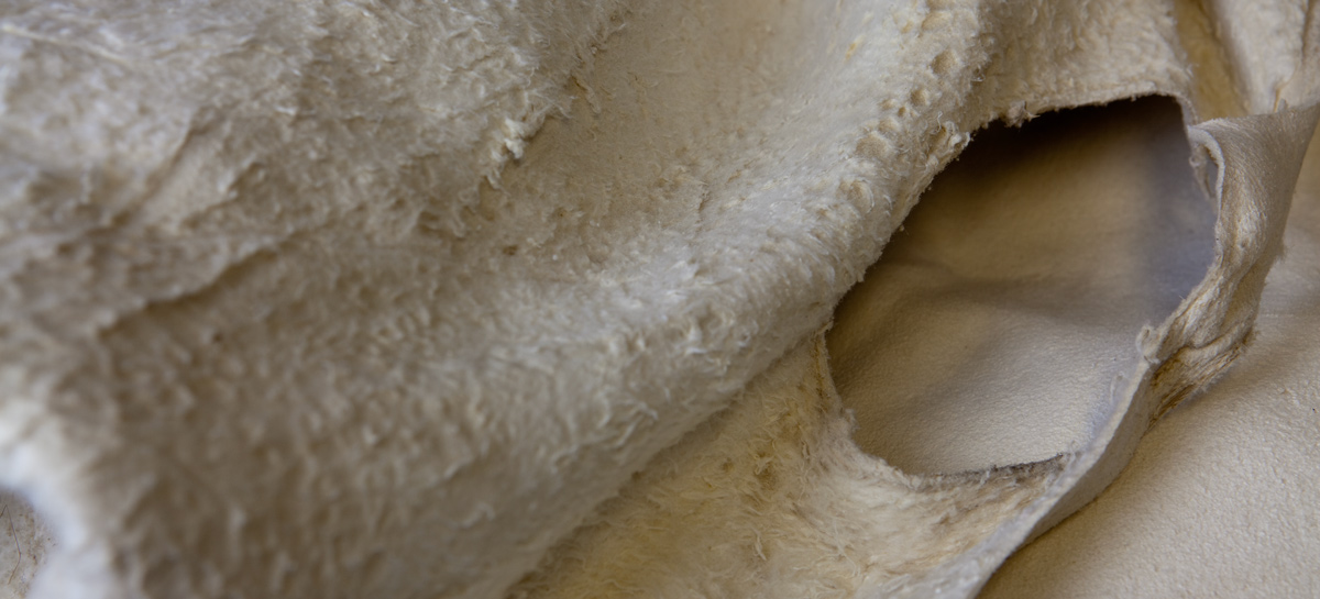
“The men of the garison are still busily employed in dessing Elk’s skins for cloathing.” Regrettably, Lewis was compelled to add that “they find great difficulty for the want of branes [brains].”
Dividing into as many as five separate details was part of a bold, diplomatic plan to achieve three of the objectives set by President Jefferson.
The verb, lolo, in the Chinook Trade Jargon, meant “to carry, load, bear, bring, fetch, transfer, lug, or pack.” Thus a “lolo” was a “carrier.”
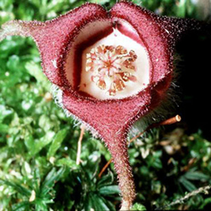
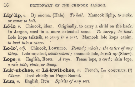
The plant’s common names include elkhorn, ragged robin, pink fairy, and deerhorn. In the spring of 1807 Lewis turned over his plant specimens to Frederick Pursh, who gave this flower the scientific name Clarkia pulchella
Clark recorded: “Capts. Lewis & Clark wintered at the enterance of a Small river opposite the Mouth of Missouri Called wood River, where they formed their party, Composed of robust Young Backwoodsmen of Character.”
The first court martial took place on 29 March 1804, when John Colter, Robert Frazer, and John Shields were called before the court. Discreetly, Clark committed no details of this one to his journal, and no record of it was entered in the Orderly Book.
The science of the orderly classification of all living and extinct organisms is called taxonomy. It comprised a hierarchical outline of descriptors extending between the most general and the most specific and Lewis and Clark had a role.
Clark produced this map of Lewis’s route sometime after the Corps was reunited on 12 August 1806, near today’s New Town, North Dakota.
Lewis learned about three unfamiliar species of edible roots–a bushel of them altogether. The Shoshones who were encamped nearby helped him sort them out, and told him how they were customarily prepared.
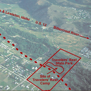
In the afternoon of 9 September 1805 they turned westward at a creek they dubbed Travelers’ Rest, today known as Lolo Creek. They stopped at a gathering place that Indians had been using for that same purpose for thousands of years.
Unaccountable ‘Artillery’ of the Rockies
by Joseph A. Mussulman
Near the Great Falls, Lewis describes loud noises “resembling precisely the discharge of a piece of ordinance of 6 pounds at the distance of three miles.” Thunder didn’t seem likely as “It was perfectly calm, clear, and not a cloud to be seen.”
“The stream appears navigable,” he had earlier confided to his journal in reference to the Bitterroot River, “but from the circumstance of their being no sammon in it I believe that there must be a considerable fall in it below”
Sgt. Gass reported, “We found our huts smoked; there being no chimneys in them except in the officers’ rooms.” Coastal Natives had devised simple, reliable ways of manipulating the balance of atmospheric pressure, temperature and air flow in what is now called the “stack effect.”
“Reubin Field wounded a moos deer this morning near our camp,” Lewis wrote on 7 July 1806, adding, “my dog much worried.”
Outfitting the Expedition
Buying supplies in Philadelphia and St. Louis
by Frank Muhly, Joseph A. Mussulman
The original shopping list contained more than 180 items, including various “Mathematical Instruments”, arms and accouterments, ammunition, clothing, camp equipage, provisions, Indian presents, medicine, and packing materials.
One can almost feel the thrill of wakening to a clear early-summer dawn at this powerful place on the pregnant plains where the Medicine meets the Missouri. Here began a five-day hiatus in Lewis’s master plan for his junket to find the boundary of British-held Canada.
The expedition arrived on 7 December 1803, witnessed the transfer of Louisiana from Spain to the United States, and metaphorically passed through its western gate on 14 May 1804. They would not return until 23 September 1806.

Of all the near-calamities the Corps of Discovery experienced, none was more dire than the one that occurred on 29 June 1805 in a normally dry ravine a short distance above the Great Fall. The principals were Charbonneau, Sacagawea, Jean Baptiste, York, and William Clark.
Lewis displays his talent for seeing the world metaphorically. Perhaps he wrote this vignette as he slapped at mosquitoes, waved off gnats, or plucked barbed spines from his feet.
On the day before he left Camp Fortunate for the last time, Lewis described, with typical attention to detail, the usual caparison of the Shoshone Horse”–halter, saddle, and all other trappings.
On 23 July 1803, the captains sent Drouillard and Cruzatte to an Otoe Indian village to invite the chiefs to come hear of the change of national allegiance from Spain to the United States and to learn “the wishes of our Government to Cultivate friendship with them.”
By the evening of 17 September 1805, their seventh sleep west of Travelers’ Rest, it was obvious to the captains that the Indians’ assurance that they could cross the mountains in six days was false, whereas the prediction that they would find no game there was all too true.

On 28 December 1805, the officers detailed three enlisted men to proceed to the Ocean and “at Some Convenient place form a Camp and Commence makeing Salt with 5 of the largest Kittles . . . .”
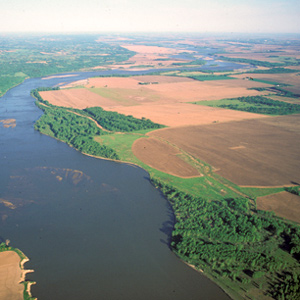
This oxbow was once part of the main channel of the Missouri, but by 1804 the river had already cut it off, turning it into a lake “6 leagues [eighteen miles] around.”
The word has two faces, one benign, the other brutish. The first springs from its etymological history, and represents the face of pure innocence. On the darker side, it is closer to the Latin cognate, saevus, meaning brutal, cruel, barbarous, violent and severe.
In 1806, Lewis, Drouillard, Joe Field, and Reubin Field made a second excursion up the Marias, this time on horseback. The four men reached the northernmost point of the Expedition’s exploration on 22 July 1806, camping on the south side of today’s Cut Bank Creek.
The party “Came too, under a high point of rocks on the Lard. Side below a creek”—Quenett (“salmon”), now Mill Creek—a “Situation well Calculated to defend our Selves,” and duly named their bivouac “Fort Rock Camp.”
The most serious hunting mishap, and surely the most memorable episode in Lewis’s frequently referenced “chapter of accedents,” was the moment on 11 August 1806 when Pierre Cruzatte shot him in the buttocks.
Lewis had no reason to write about the common or fallow deer of the East Coast, although in using it for the purpose of comparison, he gave quite a clear picture of it. John Godman’s 1828 description relied partly on Lewis and Clark’s journals.

During the portage around the Falls of the Columbia River, as Biddle paraphrased it, “we found that the Indians had camped there not long since, and had left behind them multitudes of fleas.”
Among the “objects worthy of notice” President Jefferson instructed Meriwether Lewis to watch for en route were saltpetre deposits and salines. By “salines” Jefferson meant salt flats, salt marshes, salt pans, salt springs, and rock or “fossil” salt deposits.
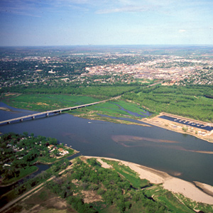
On 1 June 1804, the expedition arrived at the mouth of the Osage River, one of the major Indian trail intersections on the lower Missouri. From the height on the point, Clark wrote: “I had a delightfull prospect of the Missouries up & down, also the Osage R. up.”
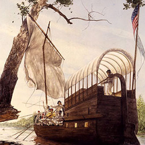
The Pirogues
by Joseph A. Mussulman
The two pirogues served as supplementary cargo carriers accompanying the barge from the mouth of the Missouri to the Mandan villages, one of which became the command boat on the return trip from the Marias River to St. Louis.
Guard Duty
by Joseph A. Mussulman
During their journey up the Missouri to the Mandan villages, security procedures were outlined in the detachment orders of 26 May 1804. The detachment orders setting forth procedures for the security of Fort Clatsop, were issued on 1 January 1806.
“from the colour of it’s water we called it Milk river.” He wondered whether this might be the river the Hidatsas had called “the river which scoalds at all others.”
Indigenous Forestry
by Joseph A. Mussulman
Archaeological evidence indicates that deliberate burning of forests and fields has been occurring on the North American continent for at least the past 10,000 to 20,000 years.
The Expedition’s Flags
by Joseph A. Mussulman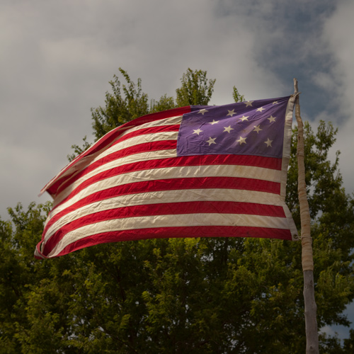
The expedition’s supplies included an unknown number of American flags. Those that the journals refer to only as being “of second size,” and “of third size,” were given to selected Indian leaders as tokens of peace.
Dugout Canoes
by Joseph A. Mussulman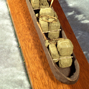
Altogether, the men carved 15 dugout canoes. At Fort Mandan they hewed 6 from cottonwood logs. West of the Rockies they used ponderosa pine logs to craft five new canoes. On the Yellowstone, Clark made two small dugouts a few miles above today’s Billings.
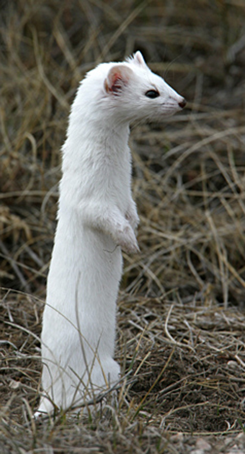
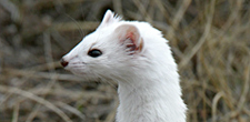
The captains saw their first white weasel at Fort Mandan on 9 November 1804. At Fort Clatsop on Christmas Day, 1805, Sacagawea gave Clark “2 Doz wesels tales.”
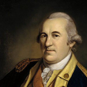
William Clark (1784–1838)
by Joseph A. Mussulman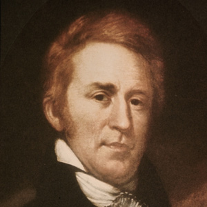
Clark was a highly intelligent man, and in terms of the practical knowledge required to make his way in the wilderness, to lead men, and to succeed in the world of frontier politics, he was highly educated and consummately effective.
“We hoisted Sail,” wrote Ordway, and “ran verry fast a Short time. Broke our mast.” The party “came to” on the west side of the Niobrara. There the men made a new mast from the trunk of a tall, sturdy red cedar, which apparently lasted at least until they reached the Mandan villages.
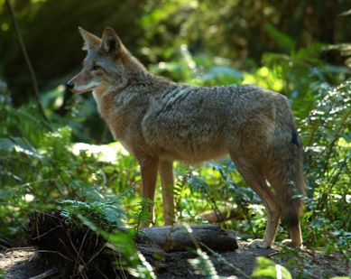
“we killed a few Pheasants, and I killd a prarie woolf [coyote] which together with the ballance of our horse beef and some crawfish which we obtained in the creek enabled us to make one more hearty meal.
“…this I could plainly See would be the extent of our journey by water, as the waves were too high at any Stage for our Canoes to proceed any further down ….”
In 1804-5-6 Lewis and Clark called all rough or relatively precipitous elevations, wherever they saw them, “broken” lands; the topography along this 149-mile stretch of the Wild and Scenic Missouri River was clearly the worst they had ever seen.
The Shoshones, like all other Indian people, had owned, bred, trained, used, and loved dogs from the dimmest days of their own origins. What was it, then, about this dog that thrilled them so? Lewis called it sagacity.
Lewis mentioned two species of tobacco, possibly Nicotiana quadrivalvis and N. rustica—a Mexican species called Aztec tobacco—that the Arikara cultivated.
Flathead Salish, Kutenai, Shoshoni, and Nez Perce people all regard the bitterroot with solemn reverence. No other root may be harvested until the elder women of the tribe have conducted the annual First Roots ceremony.
A highlight of 8 August 1804 was a profusion of feathers floating like a froth on the water. The feathers went on for three miles “in such quantities as to cover pretty generally sixty or seventy yards of the breadth of the river.”
It wasn’t until May 1806 that Lewis had occasion to expand on his Fort Clatsop Grizzly Bear observations. This article adds recent insights and an interview with Charles Jonkel.
It is a remarkable fact that Lewis’s planning for the expedition resulted in a surplus of four essential commodities: lead for bullets and powder to fire them, ink to write with and paper to write on. It was equally significant, as far as most of the men were concerned, that they ran short of tobacco and whiskey.
The Tambourine
by Joseph A. Mussulman
Instruments resembling tambourines are mentioned several times in the journals, but always in descriptions of Indian music, except for Sergeant Ordway’s comment on New Year’s Day of 1805.
The Corps of Discovery had been, as James Ronda phrased it, “only the latest in a long series of traders and travelers” to visit the tribes living along the Missouri. The Mandans had been visited in 1738 by la Vérendrye from his base on the Assiniboine River.
Port and Shipyard
by Joseph A. Mussulman
Kensington was one of the two shipbuilding areas at Philadelphia. The other was at Humphrey’s Shipyard. The tree may have been the one beneath which William Penn consummated his peace treaty with the Lenni Lenape Indians.
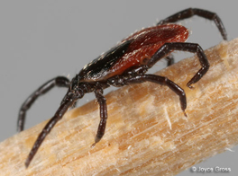
In the vicinity of Beacon Rock on 5 April 1806, Clark dutifully looked around for signs that spring had begun. He noticed that “the tick has made it’s appearance.” The ticks waiting for hosts in the vicinity Beacon Rock in April 1806 were likely of the species Ixodes pacificus.
Lewis was still at Camp Fortunate directing the digging of a cache and the making of packs and pack-saddles for the portage across the divide. Meanwhile, Clark and his contingent left to see whether the Salmon River was as bad as Cameahwait had said.
Lewis’s simple, orderly concept of the Rocky Mountains began to crumble. The truth was, this was not the easy portage to the Pacific Ocean they had expected from the beginning. Countless “chains” of mountains still intervened.
Portraits of William Clark
by Joseph A. Mussulman
Four portraits and one statue by five different artists show a diverse interpretation of the likeness of William Clark.
The printing of pictures employed a 350-year-old technology based on a process called intaglio—from an Italian word meaning to “cut in”—in which lines and dots were incised into a metal sheet called a plate.
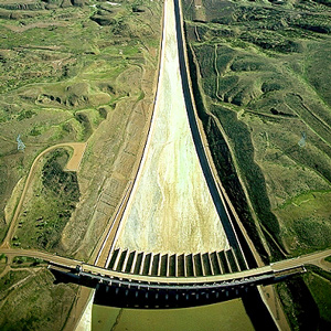
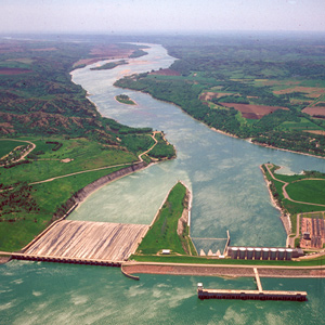
Tiber Dam
by Joseph A. Mussulman
Tiber Dam was part of an extensive project starting in 1952 to mitigate flooding, generate electricity, irrigate the deserts of the Northern Plains, and ensure ample water to float commercial river traffic below Sioux City, Iowa.
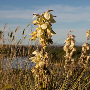
None of the expedition’s journalists made any note of yucca, although in writing of Lemhi-Shoshone Indian dress, Meriwether Lewis mentioned “a small cord of the silk-grass” which at least one scholar has interpreted as referring to the yucca.
Upon its return from the Pacific coast in the spring of 1806, the expedition camped on the Clearwater River near present-day Kamiah from 14 May 1806 until 10 June 1806, waiting for the snow to melt on the crest of the Bitterroot Mountains.
On the evening of 14 November 1803, Lewis and Clark camped on the point between the Ohio and Mississippi Rivers. By now they had rowed, poled, dragged, and occasionally sailed their boats a total of 981 miles.
While constructing Fort Clatsop, Clark recorded two significant transactions: “The Indians left us to day after brackfast, haveing Sold us 2 of the robes of a Small animal for which I intend makeing a Capot.”
Illnesses at Fort Clatsop
by Joseph A. Mussulman
The rainy weather, monotonous diet, and crisis over the lack of basic materials to carry out a routine tanning of hides for clothes must have eroded their mental and physical health.
In the late afternoon of Sunday, 2 June 1805, the Corps of Discovery “came too on the Lard. side in a handsome bottom of small cottonwood timber opposite to the entrance of a very considerable river.” They now faced a crucial question: Which river was the Missouri?
It was a hard and dangerous day’s work getting past the wooded bluff called Arrow Rock on 9 June 1804. It was a “disagreeable and Dangerous situation,” wrote Clark.
The first written record of a man named Lolo appeared in the field notes of David Thompson while at today’s Kettle Falls on the Columbia River. Fifteen years later, trader John Ashley mentions a “Mr. Lolo.”

Clark reported, “the indian woman who has been of great Service to me as a pilot through this Country recommends a gap in the mountain more South which I shall cross.” This was one of the few times Sacagawea acted as the guide.
Fort Clatsop’s location was chosen in part because, as some Clatsop Indians had advised the captains, there were more elk on the south side of the river than on the north. The subspecies found there was named in 1898 to honor Theodore Roosevelt.
Early American Entomology
by Joseph A. Mussulman
There were only four notable 18th century naturalists who showed much interest in America’s insects: a young Englishman named Mark Catesby, Finnish botanist Peter Kalm, Philadelphian William Bartram, and Reverend Frederick Melsheimer of New Hampshire.
Homeward bound in April 1806, the Lewis and Clark Expedition traveled through the Columbia Gorge and pitched camps on its north side. Their passage was tense and unpleasant, with Indians taking small goods regularly.
By the evening of 15 June 1805, Clark had gotten the canoes and the white perogue as close to the Great Falls as possible, and the next afternoon Lewis joined him at the “lower portage camp,” a mile below the mouth of Belt Creek.
In the vicinity of Elk Point, South Dakota, the captains found a variety of unfamiliar minerals, including what Clark believed were arsenic and cobalt. “Capt. Lewis in proveing the quality of those minerals was near poisoning himself by the fumes & taste.”
They had sketched out a plan for their fort, but it seemed that finding a level spot at least fifty feet square would be next to impossible.
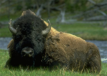
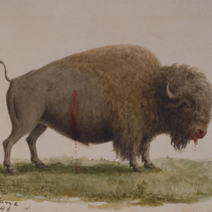
To some extent, the Corps of Discovery used buffalo much as the Indians did–for clothing, blankets, tents, saddle pads, and moccasins for both men and horses. After railroads, demand for buffalo robes soared, the iconic animal’s downfall was swift.
In the four days between 21 and 24 August 1805, Clark explored fifty-two miles down the Salmon River (he named it Lewis’s River) from today’s North Fork, Idaho. All he saw was a continuous series of rapids.
When the captains saw Nez Perces with several fresh chinook salmon, “fat and fine,” which the Indians said came from “Lewis’s River,” known today as the Salmon River, they dispatched Sgt. John Ordway and two privates to buy some.
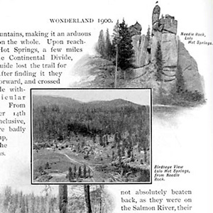
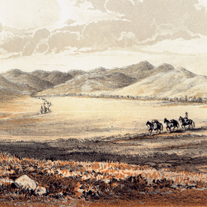
The Northern Pacific Railway had identified two new attractions within its Wonderland—a centennial commemoration of the historic Lewis and Clark expedition, plus extensive segments of the original trail within sight of its rails.
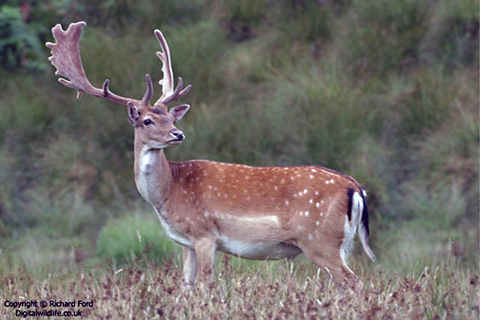
Lewis and Clark used the word fallow mainly in reference to the color of the Virginia whitetail. Few, probably, had ever seen a picture of a European fallow deer, and may have been unaware that this species’ distinctive antlers were not round like those of indigenous North American deer.
Early American Hunting
by Joseph A. Mussulman
Governor William Bradford of the Massachusetts Bay Colony hired the local Indians to hunt for the colony. Early Americans later learned several hunting methods from Indians such as relaying, driving, and still hunting.
As he started over the mountains at today’s Bozeman they observed several Indian and buffalo roads heading northeast across the mountains. Clark reported, “the indian woman who has been of great Service to me as a pilot through this Country recommends a gap.”
On the Salmon River, Clark “saw to day [a] Bird of the woodpecker kind which fed on Pine burs it’s Bill and tale white the wings black every other part.” Later, Meriwether Lewis had time to study and describe it with his usual thoroughness.
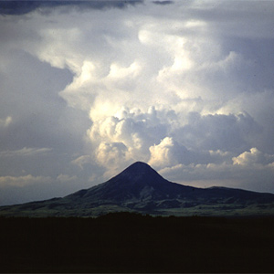
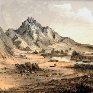
“This mountain has a singular appearance. it is situated in a level plain, it’s sides stand nearly at right angles with each other and are each about a mile in extent … from it’s figure we gave it the name of fort mountain.”
Daniel Boone was sixty-nine years old in 1803, too old to go traipsing out to the Pacific Ocean. But Lewis’s “qualifycations” suggest that Boone would have been precisely the kind of hunter he hoped to find.
At 3 p.m. on 7 October 1805, the Corps loaded their five new dugout canoes–four large ones plus a small one “to look ahead”–and set out down the Clearwater River toward the Columbia and the Pacific beyond.
The huge meander called the Big Bend, or Grand Detour, had been a well-known Missouri River landmark for many years when the Corps of Discovery arrived at its lower bend on 19 September 1805.
Lewis describes one of the richest resources of the Pacific northwest coast: Sitka spruce, western hemlock, grand fir, perhaps the Pacific silver fir, and Douglas-fir.
Thrapples
by Joseph A. MussulmanOf four Yankton Sioux, Sgt. Ordway wrote: “They had each of them a Thrapple made of a fresh buffelow hide dressed white with Some Small Shot in it and a little bunch of hair tied on it.”
William Clark, pushing on in advance of the hungry men of the Corps, came upon two adjacent Indian villages totaling about 30 lodges on Weippe Prairie. They gave him and his six hunters “roots in different States, Some round and much like an onion which they call quamash.”
Fort Clatsop’s Legacy
by Joseph A. Mussulman
One of the first writers to devote special attention to the question of Fort Clatsop’s post-history was Olin D. Wheeler, who visited the site with Coboway’s grandson, Silas B. Smith, in 1900, and wrote briefly of it.
Lt. John Mullan surveyed the Northern Nez Perce road across the Bitterroot Range in 1853-54 to assess its suitability as a railroad route. He never met anyone named Lolo, but was told by an Iroquois guide and interpreter that the creek was called the “Lo Lo Fork,” or “Lo Lo’s Fork.”
The day’s “succession of curious adventures wore the impression on my mind of inchantment,” he mused. “It now seemed to me that all the beasts of the neighbourhood had made a league to distroy me.”
Lewis attested that his men were “in excellent health and sperits, zealously attached to the enterprise, and anxious to proceed; not a whisper of murmur or discontent to be heard among them, but all act in unison, and with the most perfect harmony.”
On his return to the mouth of the Marias, Lewis found Sacagawea gravely ill. He had his men cross the river “to procure the water of the Sulpher spring,” “the virtues of which,” Lewis asserted, “I now resolved to try on the Indian woman.”
The expedition’s enlisted men were obliged to comply with the basic military rules and regulations contained in two distinct official documents that had been written in the initial heat of the Revolutionary War.
They paced off the distance across “the gouge,” wrote Clark, and found it to be about a mile and a quarter; he estimated the distance around the oxbow to be thirty miles.
Late in the day on 19 July 1805, Lewis and his party entered a canyon between “the most remarkable clifts that we have yet seen.” They seemed to rise “from the waters edge on either side perpendicularly to the hight of 1200 feet.”
Traveling through the Marias River country with anthropologist George Bird Grinnell, Wheeler met Wolf Calf, one of the Indian survivors of Lewis’s encounter with the Blackfeet.
Pryor Creek begins in the Pryor Mountains 50 miles from its mouth, but coils into nearly 100 miles of creek bottom by the time it empties into the Yellowstone. Local lore maintains that Pryor traveled up this creek to those mountains.
Drouillard spotted the first “Deer with black tales” on 5 September 1804, on the cliffs upstream from the mouth of the Niobrara River in northeast Nebraska. By 10 May 1805 Lewis had seen enough specimens to write an 800-word description of the new species.
On 23 January 1806, Lewis dispatched Howard and Werner to the Salt Camp on the ocean beach, to bring back a supply of salt. When they had not returned by the 26th, Lewis feared they had gotten lost.
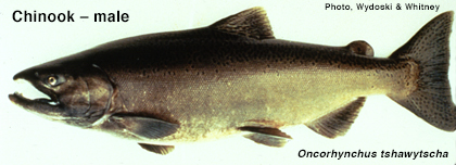
Meriwether Lewis and William Clark observed and described four fish belonging to the Salmonid family that were previously unknown to scientists, and that were basic foods for thousands upon thousands of Indians west of the Rockies.
In 1798 a German actor-playwright-turned-printer named Alois Senefelder (1771-1834) discovered the principle of lithography, relying upon simple chemical principles—the mutual repulsion of oil and water, and the mutual attraction of water and salt.
The orator spoke of the promises of “regions yet groaning under unviolated forests.” Lewis responded similarly: “With you I trust, that the discoveries we have made will not long remain unimproved.”
In a purely physical sense, the expedition was held together by rope. Rope for handling the barge, the pirogues and the canoes. Rope to secure sails and anchors, and for towing. Rope for fastening packages, assembling tents, and controlling horses.

Around 1900, Olin D. Wheeler, initiated an inquiry into the source and meaning of the name Lolo. He secured the aid of Judge Frank Woody of Missoula, who in turn discussed the matter with some other “old-timers.”
Lewis, Clark, and their crew must have passed the mouth of the Wabash about 5 November 1803. The captains had crisscrossed the area in the course of their military duties, and in 1792 Clark had gained one of his first experiences in river navigation.
On 16 June 1804, Clark took a long walk through a “butifull extensive Prarie” to look for an old fort on Evans’s map, built by the French thereabouts more than eighty years earlier. The party spent three days here making new oars and ropes, and hunting.
Holidays at Fort Clatsop
by Joseph A. Mussulman
At dawn the captains were roused, according to Clark, by “the discharge of the fire arm[s] of all our party & a Selute, Shoute and a Song which the whole party joined in under our windows, after which they retired to their rooms [and] were Chearfull all the morning.”
After two hours of “labour and fatigue,” at one point drawing themselves up by bushes and roots, they reached the summit of Bald Mountain. Clark’s description paraphrased by Biddle states, “Here one of the most delightful views in nature presents itself.”
Clark was pleased that his men appeared “much Satisfied with their trip beholding with estonishment the high waves dashing against the rocks & this emence ocean.”
The Corps of Discovery arrived at the mouth of the Platte on 21 July 1804, noting first of all that “the Current of This river Comes with great Velocity roleing its Sands into the Missouri, filling up its Bend….”
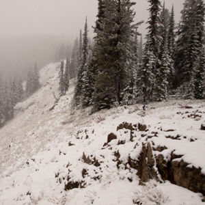
Although none of the journalists mentioned it, the very presence of last winter’s snow on those mountains in late September must have aroused the feeling that crossing the Rockies was going to be even tougher than they had figured.
Clatsop Cone Hats
by Joseph A. Mussulman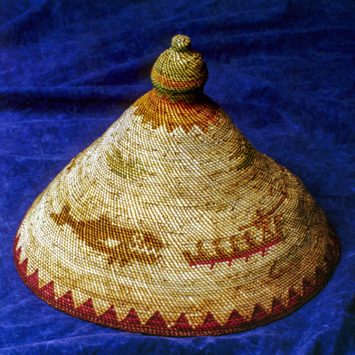
They could come up with nothing in the way of hats that was as practical as the style perfected by the Clatsops and Chinooks.
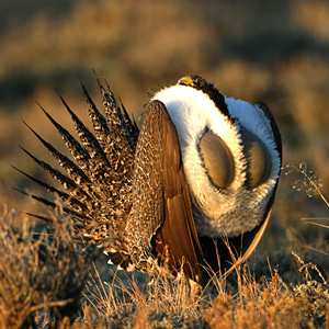
“The Heath Cock or cock of the Plains is found in the Plains of Columbia and are in great abundance from the enterance of Lewis’s river to the mountains which pass the Columbia between the Great falls and Rapids of that river.” Thus we have a historic account of sage grouse range and abundance.
The Corps of Discovery arrived in the vicinity on 20 October 1804, having worked their way some 1,450 miles up the Missouri in 155 days. That day, wildlife was the main attraction.

Poets and philosophers have meditated on it. The early Roman naturalist Pliny the Younger (ca. 30-ca. 112 AD) complained, “Who gave the mosquito so terrifying a voice, infinitely greater than it should be in comparison to the size of its body?”
On 11 July 1805 while making canoes above the Falls of the Missouri, Clark wrote “Musquitors verry troublesom, and in addition to their torments we have a Small Knat, which is as disagreeable.”
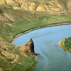
Clark remarked on this “high Steep black rock riseing from the waters edge” as they passed it on 31 May 1805, but he did not give it a name. Citadel Rock, so called during the steamboat era for its fortress-like presence, was an igneous intrusion into a layer of sandstone.
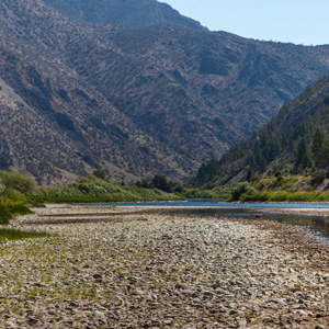
On 1 August 1805, Clark and the expedition’s flotilla of eight dugout canoes pushed up the Jefferson River through “a verrey high mountain which jutted its tremendious Clifts on either Side for 9 Miles, the rocks ragide.” They emerged into a “wide exte[n]sive vallie.”
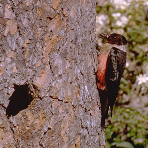
On 27 May 1806, while the expedition was camped in the vicinity of modern Kamiah, Idaho, on the Clearwater River, Lewis described a bird that was “new to science,” with his typical mixture of minute detail and genuine admiration.
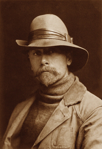
Edward Sheriff Curtis’s monumental collection of photographs was intended to be the ultimate documentation of the then-apparent end of traditional Indian life-ways. The consummation of thirty years’ work, it was enabled by substantial patronage from the wealthy financier J. P. Morgan.
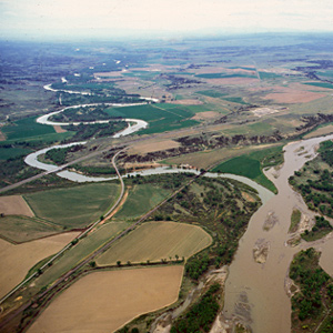
The stream Clark named for Nathaniel Pryor meanders from its montane sources in the mountain range that now bears Pryor’s name to join the Yellowstone River in the area where Pryor began his ill-fated diplomatic mission.
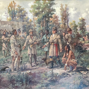
At Lewis’s right is Clark’s servant, York, dressed in blue as befitted a personal slave at that time. The Indian squatting at Lewis’s left hand is Toby, the Shoshone guide the captains had hired to lead them across the Bitterroot Mountains toward the Columbia River.
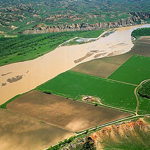
Somewhere in this vicinity, on 29 April 1805, Lewis shot his first grizzly bear and promptly began his detailed study of the fascinating species. Other game was astonishingly abundant, too.
Hugh Heney
by Joseph A. MussulmanHeney expressed his willingness to help the Americans in dealing with the Indians—perhaps seeing this as a way of subverting the Hudson’s Bay Company’s power among the Indians in that part of the continent.
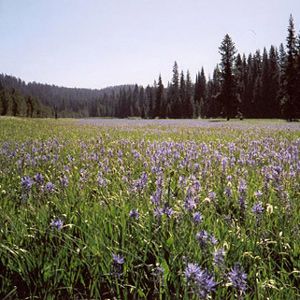
Lewis acknowledged it was “a pretty little plain of about 50 acres plentifully stocked with quawmash” and “one of the principal stages or encampments of the indians”
Jefferson the Violinist
by Joseph A. Mussulman
One of Thomas Jefferson’s favorite compositions was the Sonata for Violin and Continuo, Opus 5, written by Corelli. Using a violin such as Jefferson owned, violinist Samuel Taylor plays the theme and two of the variations.
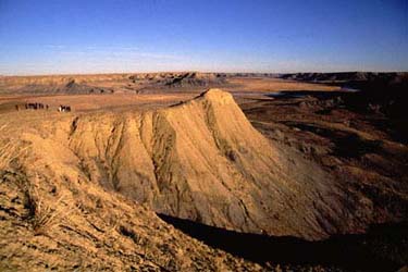
Some blame the ruin of the Blackfeet people on the Lewis and Clark Expedition. The story is far too complicated to be told fully in a few hundred words. Many foul deeds on both sides led up to the “the greatest slaughter of Indians ever made by U.S. troops.”
Hunting
by Joseph A. Mussulman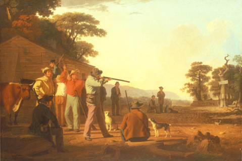
Target shooting contests were an important part of American frontier life from the late 17th century until the end of the 19th. Competition was also an important part of Lewis and Clark’s plans to hone the marksmanship of the Corps’ most promising hunters.
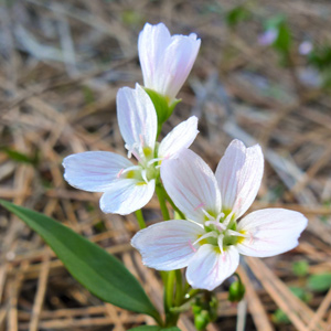
On 25 June 1806, on the branch of Hungery Creek where they “nooned it,” Sacagawea brought the captains “a parcel of roots” that Lewis immediately recognized as the kind Drouillard had given him ten months earlier.
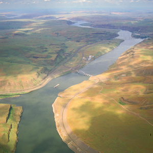
Now they entered a four-mile-long torrent, its climax a “narrows or narrow rapid” through which a channel 25 yards wide was confined between “rugid rocks” for a solid mile and a half.
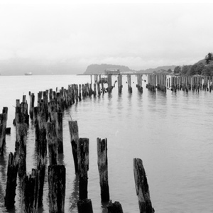
As the Corps rounded Tongue Point the wind rose hard from the west, and heavy seas with torrential rain forced them back to the east shore of the narrow isthmus, where they huddled for ten miserable days.
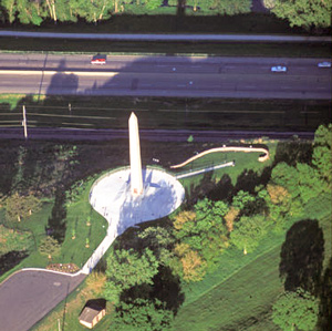
On 20 August 1804, the Corps proceeded thirteen miles, while young Floyd quickly grew worse. A little past noon they landed, and presently Floyd said, “I am going away.”
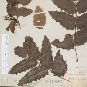
In his journal for 12 February 1806, Lewis described the plant that now goes by the name Berberis aquifolium, which he had first noticed in the vicinity of the Cascades of the Columbia River, about 145 miles from the ocean.
“I sliped at a narrow pass of about 30 yards in length and but for a quick and fortunate recovery by means of my espontoon I should have been precipitated into the river down a craggy pricipice of about ninety feet.”
Camp Disappointment by Air
by Joseph A. Mussulman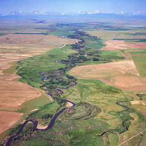
On 19 July 1806 Lewis intersected the Marias River six miles above the point where he had ended his exploration of its lower reaches the previous spring. He and his party now continued northwest along the Marias reaching its most northern point.
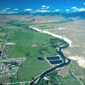
On the 23 August 1805, the centuries-old fantasy of a “water route across the continent for the purposes of commerce” dissolved in the roar of an unimaginable torrent–one of the most dangerous, unforgiving rivers in North America, that would later be called “The River of No Return.”
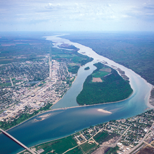
Lewis and Clark first met the Teton Sioux on 25 September 1804. One of Jefferson’s primary political objectives for the expedition was to create a peace treaty and trade agreement them, the most potent military and economic force on the lower Missouri.
Church in St. Charles
by Joseph A. Mussulman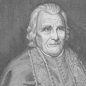
On the first Sunday after leaving Camp River Dubois, Joseph Whitehouse wrote that some of the party “went to church, which the french call Mass, and Saw their way of performing &c.”
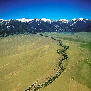
“We proceeded on and passed a large beautiful bottom,” wrote Pvt. Joseph Whitehouse on 2 August 1805, “and Prairies lying on both sides of the River.” On each side of the valley, Sergeant Gass observed, “there is a high range of mountains . . . with some spots of snow on their tops.”
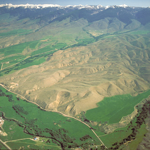
Lewis and his four companions crossed over the dividing ridge on the west side of the upper Missouri River basin and the Columbia drainage, then descended a dusty, well-traveled Indian road for some miles down into a “handsome little valley” among the sources of the Columbia River basin.
Trail Graffiti
by Joseph A. Mussulman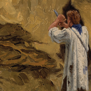
Members of the Lewis and Clark expedition carved, burned, or painted their names or initials and the dates when they did so, more than fourteen times according to the journals. They were practicing what had long been European explorers’ legitimate means for claiming dominion over other people’s land.
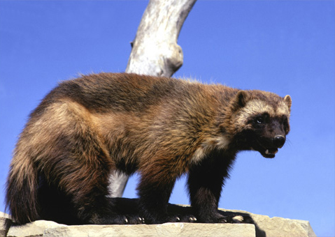
Lewis referred to it as a “tyger cat.” Even Carl Linneaus, the father of modern taxonomy, couldn’t decide whether the wolverine belonged to the weasel family or the dog family.
They encountered several rapids that nineteenth of October, including “a verry bad one” about two miles long. Clark climbed a 200-foot “clift” from which he could see many miles across the high desert.
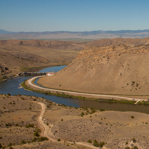
Before arriving at the three forks of the Missouri, Whitehouse wrote that they “passed some rough rockey hills, which we expect from the account we have from the Indian Woman that is with us, to be the commencement of the Second chain of the Rockey Mountains.
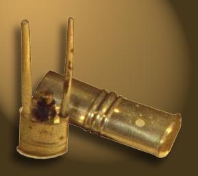
None of their tons of supplies, not even the guns, powder, and bullets with which they fed themselves, were ultimately as important as the pens, ink, and paper they carried, and protected from the elements.
The Falls of the Missouri
by Joseph A. Mussulman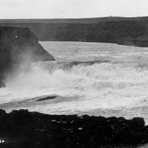
From Indian information the previous winter, the captains knew they would encounter a great falls in the Missouri River. What they found was a 14-mile-long series of waterfalls and rapids that drops 473 feet.
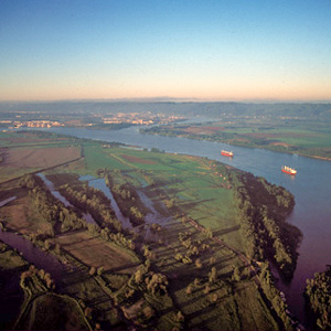
Islands had hidden it from view on the westbound trip, but early on 2 April 1806 some Indians visiting their camp happened to mention it. Clark picked six of his soldiers, hired an Indian guide, and went back to see it.
The Monongahela River joins the Allegheny River at the apex of Pittsburgh’s “golden triangle” to form the river called Ohio—an Iroquois word meaning “big and beautiful.” After the Revolutionary War, Pittsburgh quickly grew into a gathering-place and jumping-off point.
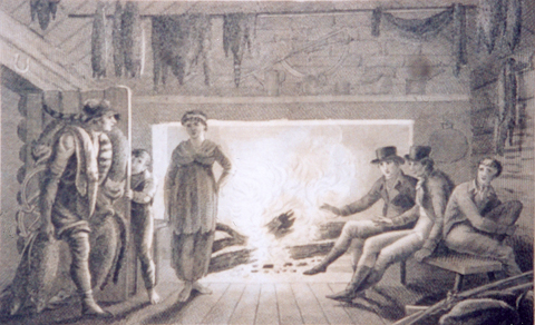
Alexander Wilson’s epic poem The Foresters, was a tediously versified 2,210-line diary of his twelve hundred mile round-trip hike from Philadelphia to Niagara Falls in the autumn of 1804.
Classifying Bighorn Sheep
by Joseph A. Mussulman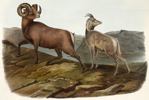
The first naturalist to publish an honest admission of uncertainty over the respective identities of the wild sheep and goat of North America was John Davidson Godman (1794-1830). Audubon and Bachman contributed illustrations and descriptions.
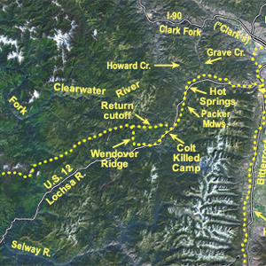
The quest for that ultimate understanding still goes on. Revolutionary is the new means of expanding the worldwide scope at new levels of analysis—the orbiting space platform represented by the Landsat program. The discovery continues.
Lewis had contracted with a wagoner to haul a substantial part of his baggage from Pittsburgh to Wheeling. In 1803 there were only a few thousand miles of decent wagon roads in the seventeen states, and Wheeling was the western terminus of one of the newest of them.
After some eight months of planning and discussion, President Thomas Jefferson handed his twenty-eight-year-old secretary, Captain Meriwether Lewis, a letter containing instructions for the conduct of one of the most significant undertakings in American history.
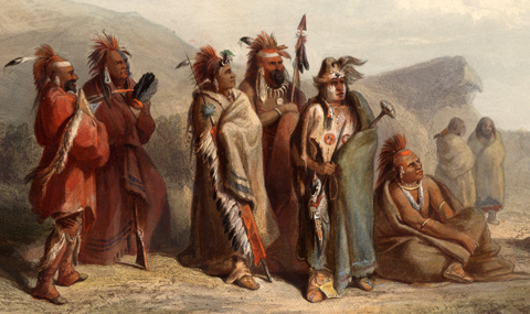
Several vexillologists have speculated that Lewis and Clark might have carried some “Indian presentation flags” with seventeen stripes, plus the Great Seal in the canton with seventeen stars either surrounding the eagle or inside the Glory.
The Mouth of the Missouri
by Joseph A. Mussulman
The Missouri River still contributes its tint a few miles north of St. Louis. It is difficult to determine exactly how much, and how often, the confluence of the Missouri and the Mississippi Rivers changed during the nine decades after the Lewis and Clark Expedition.
The relatively uncomplicated sound key of the expedition itself can readily be imagined. The natural soundscape of the expedition’s trail is harder to reconstruct.
Too Né’s Delegation
by Joseph A. Mussulman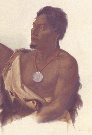
A delegation of chiefs from the Arikara, Ponca, Omaha, Otoe, Iowa, and Missouria nations sailed down the Missouri with Corporal Warfington on the expedition’s keelboat in the spring of 1805. Early in January, 1806, President Jefferson greeted them in Washington City with a formal speech.
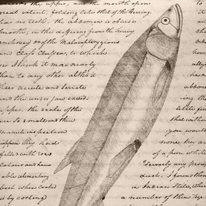

On 24 February 1806, Meriwether Lewis recorded that the Clatsop Indian chief, Coboway, came to the fort to sell some hats, some sturgeon, and “a species of small fish which now begin to run, and are taken in great quantities.”
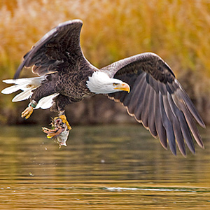
En route to the Pacific Ocean, Lewis and Clark saw both species of eagles that are native to North America: the black-and-white one called the bald eagle, and the brown-and-gold one commonly known as the golden eagle, but which the explorers knew as the grey eagle.

The French explorer Samuel de Champlain found the vegetable growing in Indian gardens along the Saint Lawrence seaway and carried specimens of it back to France in 1603, where its root soon became a staple food for humans.
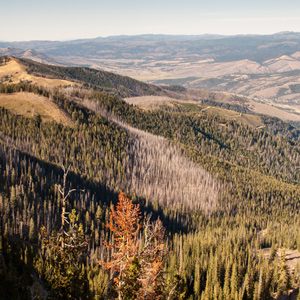
Continuing north up the North Fork Salmon River, they leave a good Indian road and must cut their own trail. Were they lost? Sergeant Gass’s laconic remark gives us a hint: “This was not the creek our guide wished to have come upon.”
Mapping the Falls
by Joseph A. Mussulman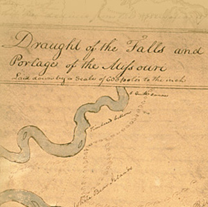
The falls of the Missouri comprised the most remarkable of all the “remarkeable points” that Clark described and mapped in conscientious obedience to an order from Thomas Jefferson to take observations “with great pains & accuracy.”
The use of a lever as a tool for measuring weight in terms of current standards of weights and measures may be at least as old as labor and commerce. It embodies a classic proposition in elementary mechanics.
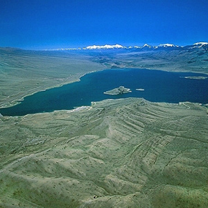
Today the confluence of the Beaverhead River and Horse Prairie Creek is submerged at left of the large island (photo center) in Clark Canyon reservoir, beneath eighty feet of water when the reservoir is full.
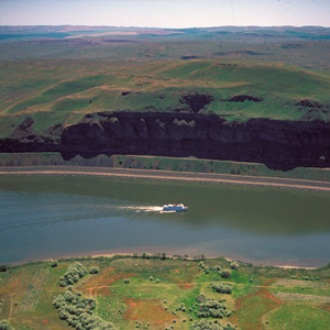
The boating didn’t improve on 14 October 1805. At the head of a particularly bad three-mile-long rapid, three canoes “Stuk fast for some time . . . and one Struk a rock in the worst part.”
The Woodlands
Repository of plant specimens
by Catharine P. Fussell, Joseph A. Mussulman, Timothy Preston Long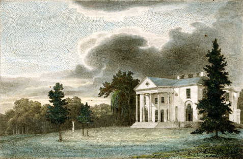
Lewis sent plant specimens to William Hamilton who cultivated them in his garden at The Woodlands outside of Philadelphia.
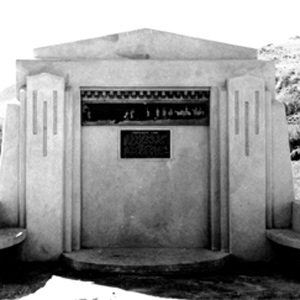
Sacagawea informed Clark that “she had been in this plain frequently and knew it well,” that the creek they were following was a branch of the Big Hole River, and that “when we assended the higher part of the plain we would discover a gap in the mountains”
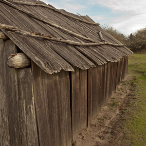
In mid-March the men stole a Clatsop canoe as recompense for Indians’ theft of 6 elk carcasses the men had shot, even though the tribe’s chief had already made restitution for the elk by giving the captains three free dogs.
Above Montana’s Lolo Creek, Lewis noticed a flower: “in shape and appearance like ours”—in Virginia, of course—”only that the corolla is white, marked with small veigns of pale red longitudinally on the inner side.”
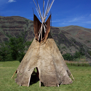
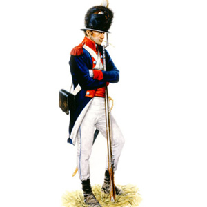
Pryor was assigned several special missions from exploring the Sandy River to escorting Mandan Chiefs to Washington City. He would barely survive his adventures on the Yellowstone River.
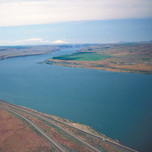
This scene’s most arresting feature is still the “high mountain of emence hight covered with Snow” on the photo’s horizon. Clark mistook it for Mount St. Helens. The Indians called the mountain Pahtoe. Since 1838 it has been known as Mount Adams.
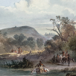
The two captains and ten of the enlisted men climbed the hill to visit the grave of one of the most notorious and controversial leaders of the Omaha Nation, whose name was Washinga Sahba—Blackbird.
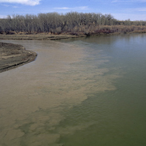
Clark first called it the “Tanzey.” Apparently Lewis dubbed it Rose River, for he noted that “the wild rose which grows here in great abundance in the bottoms of all these rivers is now in full bloom, and adds not a little to the beauty of the cenery.”
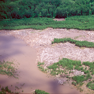
The Missouri spawned countless hazards such as a drift or raft of logs—an embarras, or “obstacle,” as the French engagés called it.
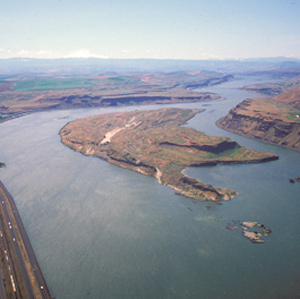
Near the west end of the island, they passed a sizeable tributary local Indians called To war ne hi ooks. The journalists left us no hint that the word they heard as Towarnehiooks was a Chinookan expression meaning “enemies.”
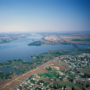
In the afternoon of 16 October 1805, the expedition portaged around “the last bad rapid as the Indians Sign to us”–the last on the Snake River, that is–and soon arrived at the “Great River of the West,” the Columbia.
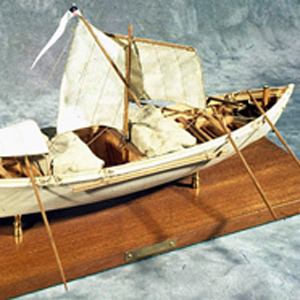
Charbonneau’s ultimate test of faith came as a boatman, on a day when he was at the helm of the white pirogue. After a sudden gust of wind, he panicked and turned the boat sideways to the wind, turning the boat over.

Salt served functions that were equally as important as dietary needs: drying meat—namely, and tanning hides for clothing and moccasins.
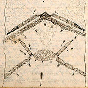
Clark visits a Shoshone camp on the west bank of the Lemhi River near today’s Salmon City, where he and his men are fed on “Sammon boiled, and dried Choke Cher[rie]s,” and taken on a sight-seeing trip to the nearby permanent fishing weirs.
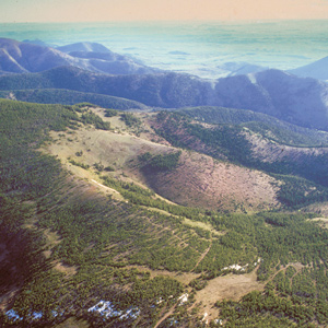
Lewis and Clark Pass is six miles north of Rogers Pass, where Montana Highway 200 crosses the Continental Divide. The concept of the continental divide, and the term itself, would emerge only after another fifty years of western exploration.
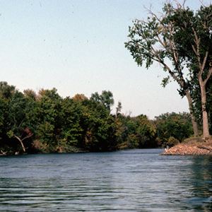
The Corps left the white pirogue at the mouth of this stream and followed it part of the way to the storied Spirit Mound. During the years between the day the Corps passed it and today, its mouth has migrated about 2.5 miles southeast.
Dyes and Shellac
by Joseph A. Mussulman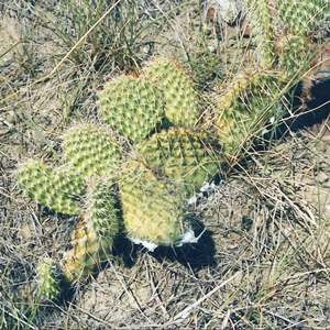
A brief account of the dyes and shellacs used at the time of the Lewis and Clark expedition.
Early Bighorn Specimens
by Joseph A. Mussulman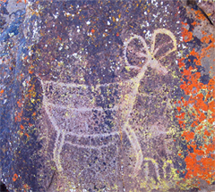
In 1800 a Scottish explorer shot several specimens in the Canadian Rockies and brought back hides, heads and horns for study by American and British zoologists, including Dr. George Kearsley Shaw of the British Museum, whose study was published in 1804.
Even if someone had invited him to sing them, it is probable that he as well as many of his listeners would have considered it ill-mannered if not illegal to do so.
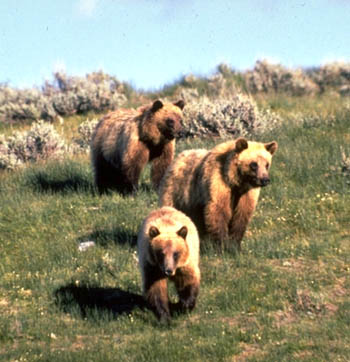
The anecdotes about their experiences with grizzly bears which the members of the Corps of Discovery brought home were gory enough to guarantee that they would be passed along. What are the legends? What are facts?
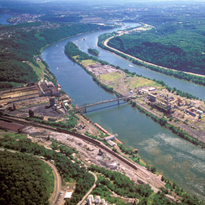
They camped for that night somewhere on the big island now known as Brown’s. When darkness fell the two canoes, which carried most of Lewis’s most valuable supplies, were still behind. “Ordered the trumpet to be sound[ed],” he wrote, “and they came up in a few minutes.”
After passing the salt works and continuing along the “round Slippery Stones under a high hill,” Clark related, “my guide made a Sudin halt, pointed to the top of the mountain and uttered the word Pe Shack which means bad, and made Signs that we . . . must pass over that mountain.
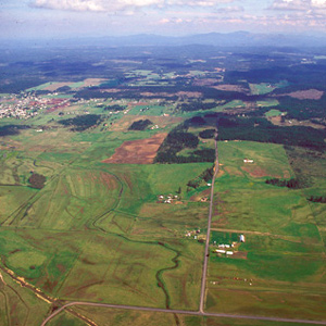
For countless generations, Weippe Prairie (prounouced WEE-yipe), like Travelers’ Rest, was a major node in the transportation, trade, and social networks of the Rocky Mountain West.
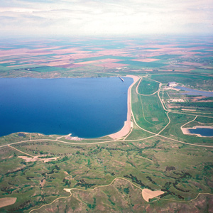
On the evening of 25 September 1804 after a negative encounter with the Lakota Sioux, the Corps camped on a nearby island Clark called “bad humered Island.” The next morning, the Indians had a change of heart.
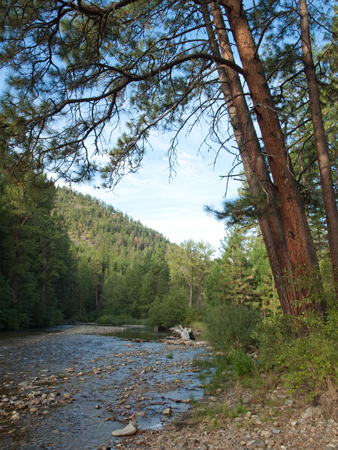
Lewis and Clark’s name “Travelers Rest” was too site-specific to simultaneously function equitably with the creek, the peak, the hot springs, the pass, and all the rest. By the time settlers began moving into the region, the old name was basically meaningless.
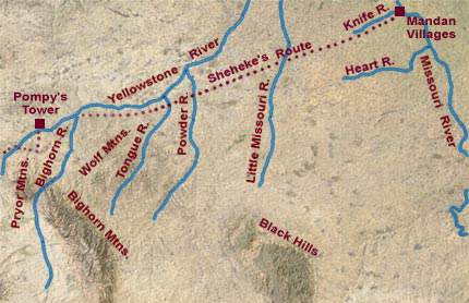
Via the shorter route, Pryor would have arrived at the Knife River villages by about 6 August 1806. A trip to see Hugh Heney at Fort Assiniboine would take another two weeks.

“The prickly pear is now in full blume,” he wrote on a mild early-summer day in 1805, “and forms one of the beauties as well as the greatest pests of the plains.”
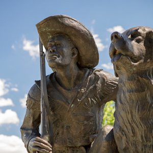
After splitting up into five separate details over five weeks earlier, all the members of the Corps of Discovery were finally reunited 142 miles downriver from the mouth of the Yellowstone.
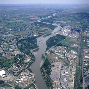
Pryor was to proceed downriver to the mouth of the Bighorn River, where Clark, with the canoes, would help him and his detail across the Yellowstone to its south bank. But they happened upon a good fording place at today’s Billings, and seized the opportunity.
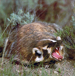
No doubt Lewis was preoccupied with the preservation process, for his entry was shorter. “It is a carniverous anamal . . . . it’s eye are small black and piercing.”
The Osage Delegations
by Joseph A. Mussulman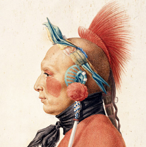
They were “certainly the most gigantic men we have ever seen,” Jefferson wrote on 12 July 1804. A dozen Osage men and two boys had arrived in Washington City the previous day, escorted by Pierre Chouteau.
Aerial photographer Jim Wark and scholar Joseph A. Mussulman offer a fascinating new perspective on the Corps of Discovery’s historic journey. From Monticello in the east to Fort Clatsop on the Pacific Ocean, the entire 2004 book is provided online with updates by Mussulman.
The White Cliffs
by Joseph A. Mussulman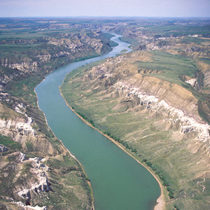
Under cloudy skies on the morning of 31 May 1805, the expedition “proceeded at an early hour,” and roped their flotilla of six cottonwood dugout canoes and two big pirogues into one of the most famous riverscapes on the Missouri.
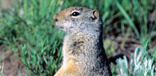
Labiche brought a specimen into Long Camp on the Clearwater River and four days later, Meriwether Lewis penned one of his longest and most meticulous descriptions of any small mammal.
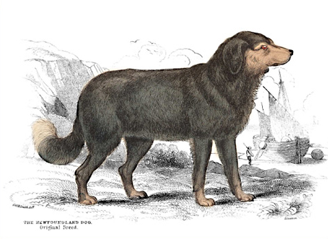
The original Newfoundland was smaller, the body more slender, forehead more arched, the muzzle sharper, and “nearly all of a totally black colour, excepting a bright rust coloured spot above each eye.”
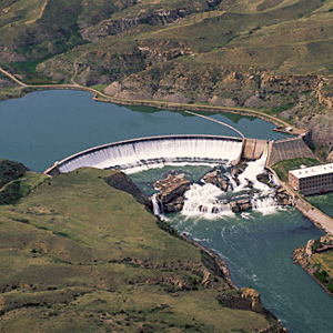
Shortly before noon on the 13 June 1805, Lewis’s ears “were saluted with the agreeable sound of a fall of water,” which “soon began to make a roaring too tremendious to be mistaken for any cause short of the great falls of the Missouri.”
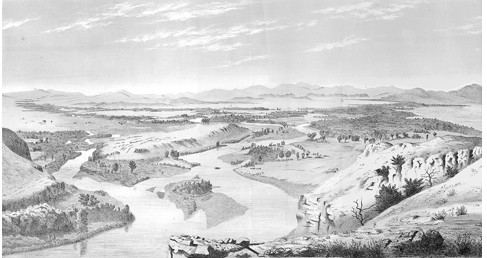
After the expedition, the Three Forks area would see the death of Potts and Drouillard, the start of Colter’s famous run, and an emerging frontier lifestyle in Gallatin City, later to be known as Three Forks, Montana.
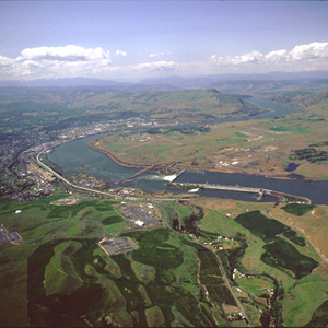
Bonneville Dam, was the first dam to be built on the Columbia River. The slackwater pool it impounds, called Lake Bonneville, eliminated the Cascades as a barrier to commercial shipping, and provided a deep, navigable channel for barges and tugs.
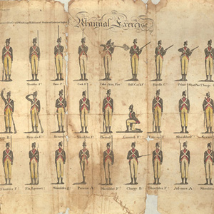
The first major objective of basic training was mastery of the “Manual Exercise,” or manual of arms. It involved 27 commands from the sergeant, calling for 56 motions by the recruit. The single command, “Prime and Load,” involved fifteen motions.
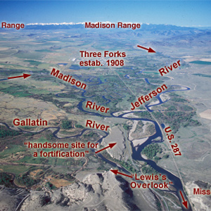
Lewis and his canoes slowly approached the forks, “the current still so rapid that the men are in a continual state of their utmost exertion to get on, and they begin to weaken fast from this continual state of violent exertion.” He described the “extensive and beatifull plains and meadows.”
Clark evidently began compiling a map of the Northern Rockies after meeting with Hugh Heney at Fort Mandan on 18 December 1804, and continued adding information acquired from other traders, as well as from Indians. The reality, he would find, was much different.
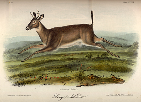
One of the most confusing terms in Lewis and Clark’s lexicon of quadrupeds was the adjective long-tailed—or longtailed. At the Three Forks on 29 July 1805, he compounded the ambiguity.
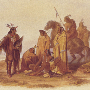
While stinging from having so many of his horses stolen, Clark wrote a speech to the Crow Indians imploring them to return the booty. After all, he needed those horses to complete the captain’s bold diplomatic plan.
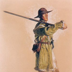
While traveling down the Ohio and wintering at Camp River Dubois, the captains searched for army recruits accustomed to the ways of the woods. If they were to survive, the expedition needed hunters.
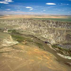
The Indians invited the Americans to share a campsite that night. At daybreak, despite the soldiers’ watchfulness, the Indians tried to steal the Americans’ guns and horses. That immediately erupted into a skirmish.
Lead Powder Kegs
by Joseph A. Mussulman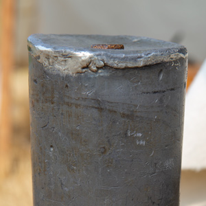
Lewis ordered 52 lead canisters specially made to carry and protect the expedition’s gunpowder.
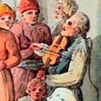
The principal catalyst for their musical diversions was undoubtedly Private Pierre Cruzatte, whose official duty was as a boatman, but who also played the fiddle.
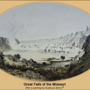
“I wished for the pencil of Salvator Rosa, or the pen of Thompson, that I might be enabled to give to the enlightened world some just idea of this truly magnifficent and sublimely grand object, which has from the commencement of time been concealed from the view of civilized man”
This is where, in 1828, John Jacob Astor’s American Fur Company built Fort Union, which remained the axis of Indian-American commerce on the Upper Missouri until the late 1860s.
Colter left a legacy of western lore, not the least of which was his famous run from the Blackfeet Indians and his exploration of “Colter’s Hell.” Yet his contributions to the expedition were also many.

Bitterroot Valley businessman John Owen counted no Lolos among the customers he dealt with at Fort Owen, but he occasionally hired one as a trail-hand.
Lewis and Clark could never have imagined a pit like the one in this photograph. Opened in 1997, it is about twelve miles east of the Missouri River and sixty miles north of Bismarck, North Dakota. In the background is a postglacial tarn called Coal Lake.
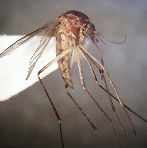
“Our trio of pests still invade and obstruct us on all occasions, these are the Musquetoes eye knats and prickley pears, equal to any three curses that ever poor Egypt laiboured under.”
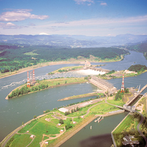
The Bonneville Dam, completed in 1938, raised the level of this part of the Columbia seventy-two feet and permanently obliterated the place Lewis and Clark called the “Great Shute.”
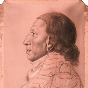
The Osage were experienced traders, exchanging horses and Indian slaves for French guns, knives, axes, kettles, and other metal objects. After the 1760s, the Osage adopted a new economic system of planting gardens in permanent villages, summer hunts in the plains, and fur-trapping in the winter.
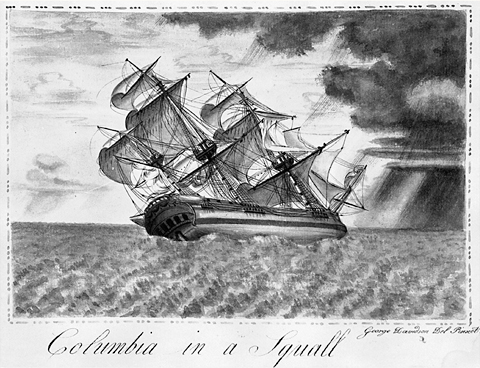
The Corps of Discovery was but one of a great number of expeditions by land and sea made between 1770 and 1870 across the North American continent in search of a Northwest Passage. Lewis knew much about the mouth of the Columbia River.
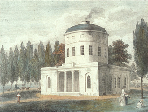
Although it would be many years before the entire city had access to pure water, the completion of the Water Works in 1800 helped to reduce the threat of epidemics and provided a foundation for continued urban growth.

Each peace medal given out was usually accompanied by a commission, also called a parole, which is the French word for promise..
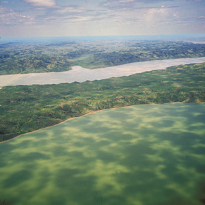
On 19 May 1805, the expedition camped on the east side of the neck, or “gouge,” in the Missouri River where the Musselshell River joins it. It had been an exhausting day.
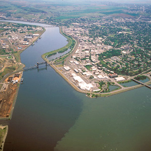
The Corps’ four-day trip to this point from Canoe Camp on the Clearwater in their five crowded dugouts was a taste of things to come.
The Yellowstone Badlands
by Joseph A. Mussulman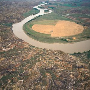
Around midday he passed the mouth of a tributary “40 yards wid Shallow and muddy,” the banks of which can be faintly discerned near the horizon in the picture, and identified it as the stream the Mandan chief Sheheke had called Oak-tar-pon-er.
He spent most of his 70 years at Fort Kamloops in British Columbia and is not known to have traveled as far south as today’s Lolo, Montana.
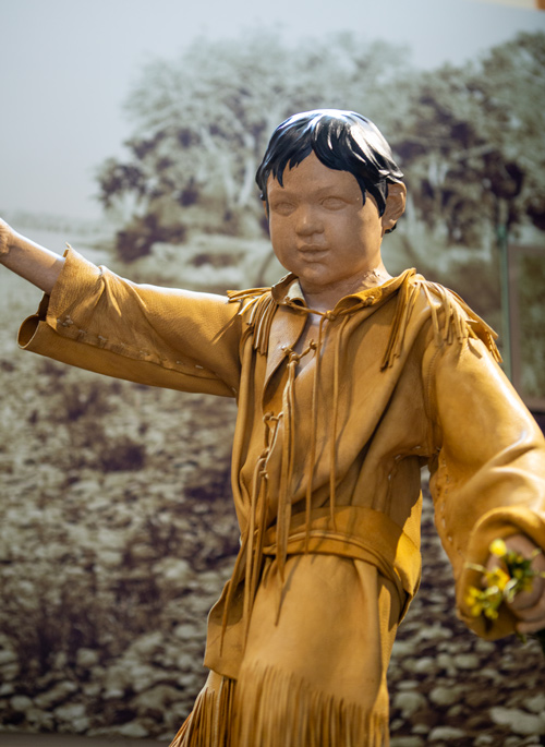
Clark’s affection for Sacagawea’s little boy, Jean Baptiste, becomes evident while canoeing down the Yellowstone River. This article analyzes Clark’s offer to his father, Toussaint Charbonneau, to raise the child.
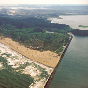
Private Whitehouse thought his captains had named Cape Disappointment “on account of not finding Vessells there,” but it had received the name years earlier.
The species remained nameless until John James Audubon dubbed it neglecta because, he wrote in 1840, although “the existence of this species was known to the celebrated explorers of the west, Lewis and Clark . . . no one has since taken the least notice of it.”
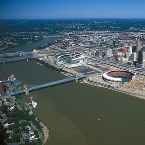
“Finding my men much fatiegued with the labour to which they have been subjected in descending the river, I determined to recruit [rest] them by giving them a short respite of a few days, having now obtained the distance of five hundred miles.”
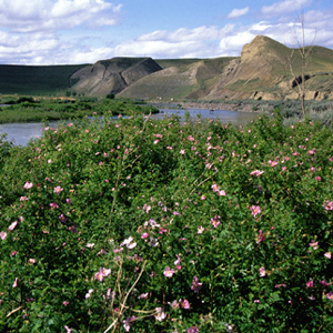
Meriwether Lewis was sufficiently familiar with the genus back home to recognize the new species he termed the “small rose of the prairies,” which he found on 5 September 1804, in present-day Nebraska near the mouth of the Niobrara River.
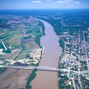
On Sunday, 3 June 1804, the expedition left its camp at the mouth of the Osage River and proceeded five miles upstream to the mouth of the Moreau River. There, Clark wrote, he and George Drouillard, “Saw much sign of war parties of Inds. having Crossed from the mouth of this Creek.”
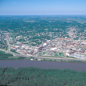
Pvt. Robert Frazer came close to being the expedition’s first fatality, for he was “verry Sick, struck with the Sun.” Probably his affliction would be diagnosed today as either heat exhaustion or sunstroke.
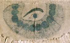
Did they pray? The answer is yes, they did—to invoke the catch-phrase their journalists sometimes used to generalize about the habits of others—”in their way.”
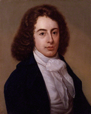
To the European Romantics, the gritty names those American explorers uttered sounded like throwbacks to a cruder, more barbarous epoch, boding ill for the future of poetic taste in the New World. In 1815, Robert Southey found plenty of evidence.
Mapping the Lolo Trail
by Joseph A. Mussulman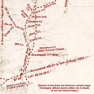
Clark did not randomly insert wiggly lines merely to hint at the topography around K’useyneiskit. By comparing his sketches with a modern USGS map we can make reasonably good guesses as to what drainages he actually saw.
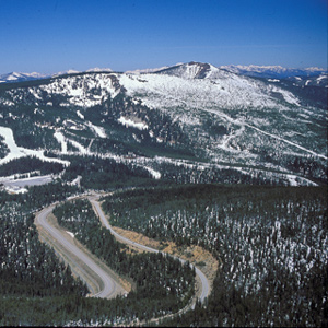
Where did they camp? This was not the only time Toby was unsure of himself, nor that the captains were temporarily baffled, but it is perhaps the one that most readily invites study and discussion.
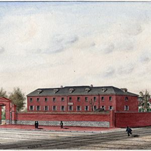
Considering all he had to do to prepare for the expedition, Lewis was fortunate in that he could rely on a small cadre of Army personnel to help him assemble, pack, and ship his supplies.
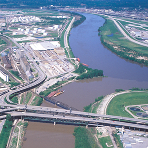
The expedition’s campsite from 26 June 1804 to 28 June 1804 was near the wooded point that protrudes at the confluence of the Kansas and Missouri Rivers.
Why was it so important that Meriwether Lewis was willing to risk his life in a region occupied by the “Pahkees” or Minnetares, the Assiniboines, and other people whom he had been led—by their enemies, of course—to believe were “vicious and illy disposed”?
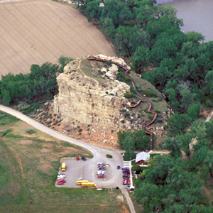
For countless generations this conspicuous sandstone formation had been a distinctive feature in the homeland of the Crows.
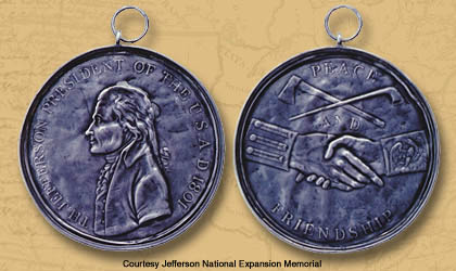
One of the tasks assigned to the expedition was to replace the French, Spanish, and English peace medals previously gifted to North American Indians with those from the United States. The gifts symbolized mutual loyalty in trade and, at least to the Indians, military protection.
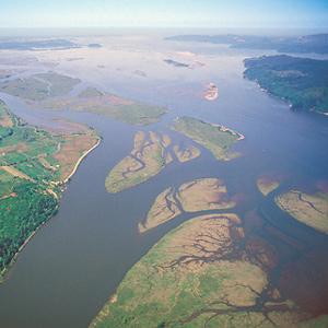
When the sky cleared briefly at about noon on 7 November 1805, a rising cheer may have startled the myriad waterfowl in the area, for Clark wrote, “we are in view of the opening of the Ocian, which Creates great joy.”
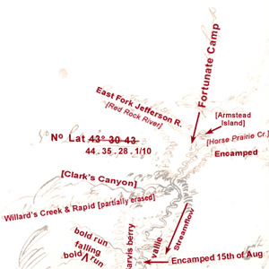
Lewis: “here I halted and examined those streams and readily discovered from their size that it would be vain to attempt the navigation of either any further.”
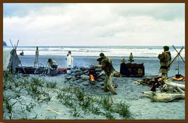
Early Roman soldiers received an allowance of salt, which was called a salarium—a “salary.” A good soldier had to be “worth his salt.” What sort of salaries did the men of the Corps of Discovery earn?
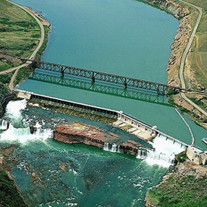
After briefly contemplating the Crooked Falls on 14 June 1805, Lewis followed the sound of “a tremendious roaring” to “one of the most beautifull objects in nature,” a fifty-foot-high cascade “with an edge as regular and as straight as if formed by art.”
The Hunters’ Final Tally
by Joseph A. Mussulman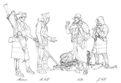
Historian Arlen Large tallied the journalists’ references to hunters by name, and came up with a list of nine who were mentioned in connection with “hunting episodes” a total of twenty-five times or more–a purely arbitrary cutoff number. George Drouillard led the list.
The Clearwater Canoe Camp
by Joseph A. Mussulman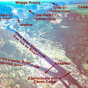
Still sick and exhausted from their recent crossing of the Bitterroot Mountains, Lewis, Clark, and their crew arrived on 26 September 1805, at what they called Canoe Camp, on the Clearwater River.
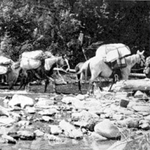
Loading and handling a packhorse is hard work. It demands not only a great deal of physical strength and endurance, but also an eye for balancing a load on the first try, a head full of horse sense, the patience of a saint, and lots of experience.

The Corps camped for the night of 11 July 1804 on “Newfound Island” to “rest the men who are much fatigued.” Five men explored the Big Nemaha River and climbed to the top of “a high artificial Noal”—an Indian burial site—to gain “an emence, extensive & pleasing prospect of the Countrey around.”

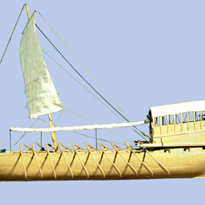
Meriwether Lewis listed a “Keeled Boat” in his pre-expedition shopping list, but after he finally got it, he and the other journalists of the Corps of Discovery simply called it “the boat” (190 times) or, less often, “the barge” (32 times).
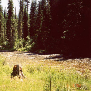
Snow was falling in the high country above them on the morning of 14 September 1805 when, after striking camp two miles downstream from Packer Meadows, the Corps slogged down the Glade Creek canyon through rain and sleet.
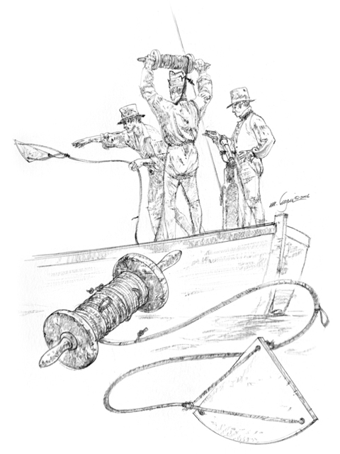
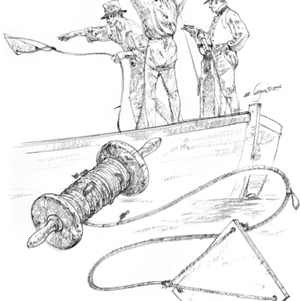
This device was typically used for measuring the speed of a vessel at sea, but it could also be used to measure the velocity of a river’s current. It consisted of four parts: a log-ship, or log-chip; a specially calibrated log-line; a reel to hold the log-line; and a log-glass, or sand-glass.
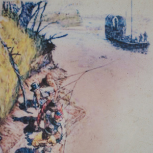
His name appears only one time, when he is listed as a member of Corporal Warfington’s detachment bringing the keelboat back from Fort Mandan. He may not have even made it that far.
Spacing between tents, as well as lines of tents, was strictly measured. Privates’ tents, accommodating 6 men each, were between the sergeants’ tents; all were two feet apart. The “sink,” or latrine, was to be 60 paces (300 feet) in front of the first line of tents.
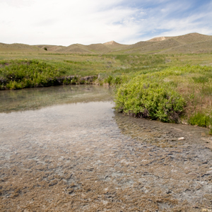
Clark establishes a camp at the beginning of the portage around the Great Falls of the Missouri. Lewis returns to find Sacagawea seriously ill. He gives her medicine and water from Sulpher Spring.
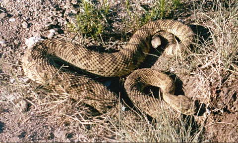
Lewis awoke to find “a large rattlesnake coiled on the leaning trunk of a tree under the shade of which I had been lying.” It certainly wasn’t the first rattlesnake seen on the trip, but he killed this one, and took time to study it.
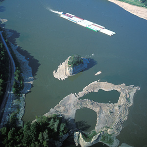
In 1673 French explorers Père Marquette and Louis Joliet listened to local Indians’ warnings about this place and erected a cross atop the ninety-foot-high rock to disempower the demons said to be lurking in the treacherous whirlpool at its base.
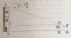
This article shows methods for measuring heights and distances as described by Owen’s Dictionary of Arts and Sciences (1754), a book in the expedition’s traveling library.
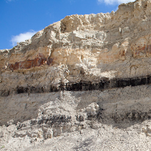
Lewis and Clark sometimes called this coal “carbonated wood” because sometimes they could see the outlines of woody stems and other plant remains. Coal geologists call it lignite, but Lewis and Clark were essentially correct in their description.
Grouse
by Joseph A. Mussulman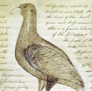
Why did Lewis call the spruce grouse, blue grouse, and Oregon ruffed grouse “Three species of Pheasants?” What species did he actually see?
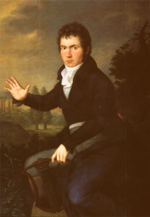
On 7 April 1805 three ‘heroic’ events occurred. The expedition set off from Fort Mandan, and Beethoven premiered his Third Symphony, the “Eroica,” dedicated to Napoleon Bonaparte. It was also the day Great Britain and Russia sealed a fateful alliance against that French emperor.