After crossing the Yellowstone, Clark and Pryor would part ways.
Early on the morning of 24 July 1806 Pryor was to proceed downriver to the mouth of the Bighorn River, where Clark, with the canoes, would help him and his detail across the Yellowstone to its south bank. Clark didn’t know precisely where the Bighorn was—”which we suppose to be at no geat distance,” for he had only Sheheke‘s sketch map to work from. Actually it was almost 100 miles downstream from their Canoe Camp at present-day Park City, Montana,[1]The Canoe Camp was 392 miles (ca. 631 km) from the mouth of the Yellowstone by today’s measurement—and this river has not changed its channel appreciably within the past 200 years. The mouth … Continue reading but they happened upon a good fording place at today’s Billings, and seized the opportunity.
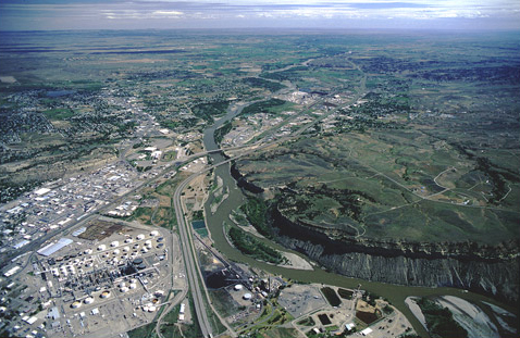
Opposite the city (pop. 100,000) of Billings, Montana is the landmark William Clark identified on 24 July 1806 as “a high clift of yellowish Gritty Stone on the Stard Side.” It is now known as Sacrifice Cliff. Six miles back up the Yellowstone from this rimrock, Clark had his detachment’s 26 remaining horses driven across to the south side of the river, then ferried Sgt. Pryor, with Pvts. Shannon and Windsor, across in the dugout catamaran. Pryor’s route took them southeast (right) of the cliff and parallel to the river for the next two days.
Pryor’s First River
Yellowstone River at Billings, Montana
View northeast, down the Yellowstone
© 2001 Airphoto, Jim Wark. All rights reserved.
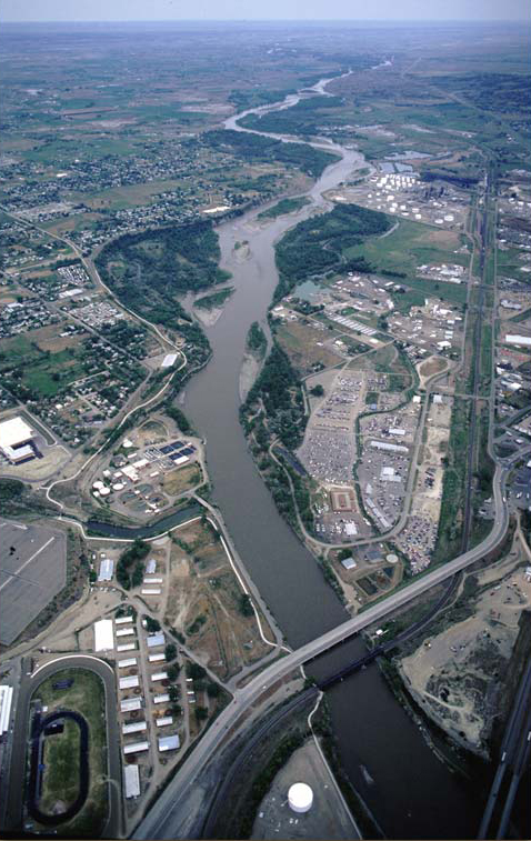
That night Clark and the rest of his party camped a little below a “bold” stream that was 35 yards (32 meters) wide, which he labeled “Pryers river.” It entered the Yellowstone at the far edge of the refinery in the accompanying photo. It may have qualified as a river back then, but nowadays it is more suitably known as Dry Creek. Perhaps that is why the next morning, on second thought, some eight miles farther downstream—in the distance, about where the Yellowstone bends north for the second time in this view—he labeled another watercourse “Pryors Creek.” Inexplicably, “Pryor’s River” made the cut for Clark’s final map, which accompanied Nicholas Biddle‘s 1814 paraphrase of his and Lewis’s journals, while the longer, more substantial “Pryors Creek,” which is still labeled with that name on modern maps, was overlooked.
Notes
| ↑1 | The Canoe Camp was 392 miles (ca. 631 km) from the mouth of the Yellowstone by today’s measurement—and this river has not changed its channel appreciably within the past 200 years. The mouth of the Bighorn was probably at about mile 296. River Mile Index of the Yellowstone River (Water Resources Division, Montana Department of Natural Resources and Conservation, 1976), 29, 41. |
|---|