John L. Allen is a former chairman of the Department of Geography and emeritus professor of geography at the University of Wyoming in Laramie. His publications, numbering more than thirty titles to date, reflect his broadly varied interests, including the exploration of the American West, human impacts on natural environments and related landscape changes, and images of the West. Among students of the Lewis and Clark expedition, Professor Allen’s best-known work is Lewis and Clark and the Image of the American Northwest (reprint, New York: Dover, 1975). Originally published under the title Passage through the Garden: Lewis and Clark and the Image of the American Northwest, it remains among the most authoritative and frequently-referenced works in the literature.
Other major works of authored or edited by Professor Allen include Explorers from Ancient Times to the Space Age (New York: Macmillan, 1999); Student Atlas of World Geography (4th ed., New York: McGraw-Hill, 2004); A Continent Comprehended (Lincoln: University of Nebraska Press, 1997); Jedidiah Smith and the Mountain Men of the American West (New York: Chelsea House, 1991); Student Atlas of Environmental Issues (New York: McGraw-Hill, 1997); Student Atlas of Anthropology (New York: McGraw-Hill, 2004); and the three-volume North American Exploration (University of Nebraska Press, 1997).
Contributions to this Site
Celestial Reckoning
by John Logan Allen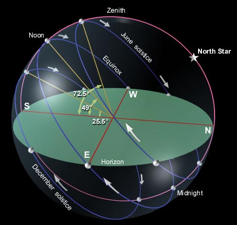
Thomas Jefferson was as interested in the methods and equipment for “ascertaining by celestial observation the geography of the country” as with any other single aspect of the Expedition. As faithfully as they could, the captains complied with the President’s wishes.
Indian Maps
by John Logan Allen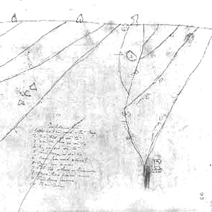
The native peoples encountered by Lewis and Clark differed from non-Indians in their manner of linking space and time, distance and direction. The reasons were primarily the result of the contrasting needs of the hunter-gatherer and subsistence farmer versus those of the commercial farmer, townsman, or tradesman.
Formal Navigation
by John Logan Allen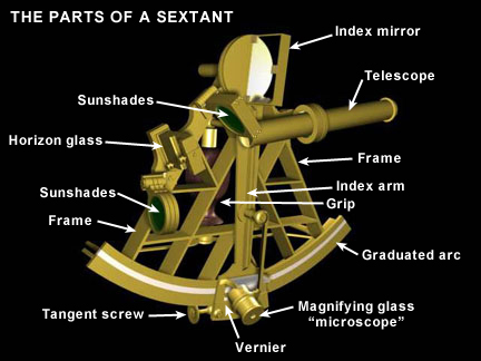
Much of what Lewis and Clark had to do in terms of their own mapmaking was to ascertain the accuracy of Indian information by doing what we call today “ground truthing” and “celestial reckoning” using the instruments they carried.
Mapping Unknown Lands
by John Logan Allen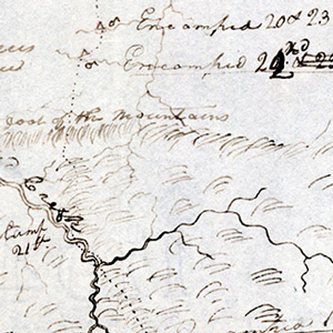
Geography professor John Logan Allen explains the tasks and methods used to map the lands traveled by the Lewis and Clark Expedition.
Mental Mapping
How we get around
by John Logan Allen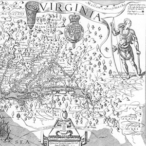
In traveling across the landscape of the real world between the Mississippi and the Pacific, Clark constructed his mental maps before his actual maps. He looked at the west side of landmarks as well as the east side, and fit everything into an imaginary grid system before ever putting it down on paper.
Jefferson’s Geographic Directive
by John Logan Allen
Mapping is the human equivalent of an animal marking its territory by leaving scent, spoor, or other traces. Jefferson’s instructions to fix the trading route to the Pacific by observation meant that Lewis and Clark should mark territory.
Experience the Lewis and Clark Trail
The Lewis and Clark Trail Experience—our sister site at lewisandclark.travel—connects the world to people and places on the Lewis and Clark Trail.
![]()
Discover More
- The Lewis and Clark Expedition: Day by Day by Gary E. Moulton (University of Nebraska Press, 2018). The story in prose, 14 May 1804–23 September 1806.
- The Lewis and Clark Journals: An American Epic of Discovery (abridged) by Gary E. Moulton (University of Nebraska Press, 2003). Selected journal excerpts, 14 May 1804–23 September 1806.
- The Lewis and Clark Journals. by Gary E. Moulton (University of Nebraska Press, 1983–2001). The complete story in 13 volumes.
This site is provided as a public service by the
![]()
Lewis and Clark Trail Alliance
with additional funding from the following:

