In the Corps’ westward crossing of the Bitterroots, 16 September 1805 was one of the worst days of the expedition. “I have been wet and as cold in every part as I ever was in my life,” Clark complained. “Indeed I was at one time fearfull my feet would freeze in the thin mockersons which I wore.”
Recrossing those mountains on the way back in June 1806 was no less toilsome. With home fires on their minds, the Corps left Weippe Prairie, roughly 140 miles west of Travelers’ Rest, on 15 June 1806 only to find snow “in every derection from 6 to 8 feet deep,” obscuring the path and covering the forage for their sixty horses. Prudence required them to send two men back to hire Indian guides. On 24 June 1806 they set out again, led by three Nez Perce whom Clark called “most admirable pilots.” On the thirtieth Clark triumphantly reported: “Descended the mountain to Travellers rest leaveing those tremendious mountanes behind us–in passing of which we have experienced Cold and hunger of which I shall ever remember.” Not the least of their discomforts was the lack of shelter at night. Sometime before they reached the site of what came to be called Camp Chopunnish [now called Long Camp], back in mid-May, their tents had become useless from wear and tear, and they were compelled to build shelters of willow poles and grass, as many Indians did. But high on the ridges and peaks of the snowy Bitterroot Mountains they had neither the time nor the materials for that recourse.
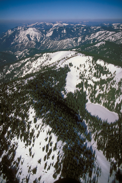
Among those then-nameless peaks, where the Corps measured progress one discomfort, mishap or crisis at a time, the captains and their men reached the highest point on their entire journey–7,036′ DED (Digital Elevation Database) above sea level.[1]For these facts the author is indebted to the master trail historian Steve Russell, of Iowa State University (ret.) That would have been on the ridge north of the rock cairn that is now known as the “Indian Post Office.”[2]The Corps passed the Indian Post Office on 16 September 1805, and camped near it on the night of 27 June 1806. They could not have known that, however. Barometers were still too fragile for such a journey, and there was no other way to measure altitude.
The Bitterroot Mountains are not very high compared with the Rockies in Colorado or Canada. Their loftiest summit, Trapper Peaks, which the Corps of Discovery would have seen on 7 September 1805, tops out at an exceptional 10,157′ DED. On average, however, the Bitterroots are nearly twice as high as Easterners had expected the Rocky Mountains to be, and they were also wider, ridge after ridge. As Lewis pessimistically summarized it, their portage across the Bitterroots consisted of “140 miles of high Steep ruged Mountain, 60 miles of which is Covered from 2 to 8 feet deep with Snow in the last of June.”
From Discovering Lewis & Clark from the Air
Photography by Jim Wark
Text by Joseph Mussulman
Reproduced by permission of Mountain Press
Notes
| ↑1 | For these facts the author is indebted to the master trail historian Steve Russell, of Iowa State University (ret.) |
|---|---|
| ↑2 | The Corps passed the Indian Post Office on 16 September 1805, and camped near it on the night of 27 June 1806. |