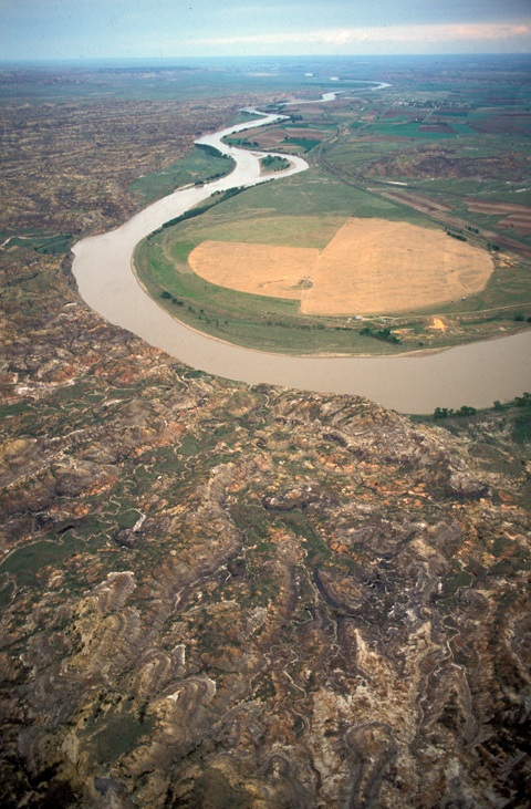
On 30 July 1806, Clark and his party camped near the mouth of the War har sah, or Powder River, just to the right of the view in this photograph. The next day, eager to reunite with Lewis and his men, Clark’s contingent covered, by his estimate, sixty-six miles. He remarked on the colors and shapes of the land—”various Coloured earth,” some of it red, much of it coal black, all of it “washed into Curious formed mounds & hills and . . . cut much with reveens.” In too much of a hurry to climb up and look around, he saw only the ragged river edge of the dramatic Terry Badlands.[1]See also Larocque’s Yellowstone Journey
Around midday he passed the mouth of a tributary “40 yards wid Shallow and muddy,” the banks of which can be faintly discerned near the horizon in the picture, and identified it as the stream the Mandan chief Sheheke (Big White) had called Oak-tar-pon-er. Years later it came to be called O’Fallon Creek, reportedly after Clark’s nephew, Benjamin O’Fallon, who served as a federal Indian agent until the 1820s.
On the north side of the river a center-pivot irrigation system defines the shape of a farmer’s cultivated field.
From Discovering Lewis & Clark from the Air
Photography by Jim Wark
Text by Joseph Mussulman
Reproduced by permission of Mountain Press
Notes
| ↑1 | See also Larocque’s Yellowstone Journey |
|---|