Several sites along the Lewis and Clark National Historic Trail have been designated as High Potential Historic Sites by the U.S. National Park Service based on public nominations. The pages below tell the expedition’s story as they visited these areas.
August 13, 1805
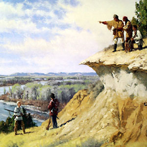
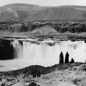
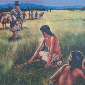
Shoshone diplomacy
Shoshone Village, ID and Clark’s Lookout, MT In the Lemhi River valley, Shoshone diplomacy includes greetings, a flag presentation, a pipe ceremony, and revelry late into the night. Back on the Beaverhead River, Clark takes bearings from Clark’s Lookout, and several men fish.
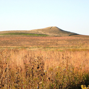
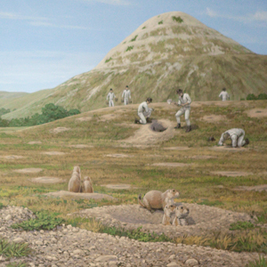
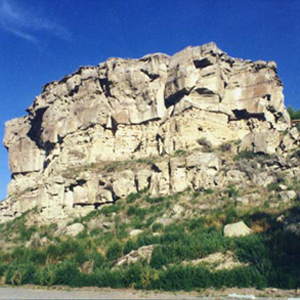
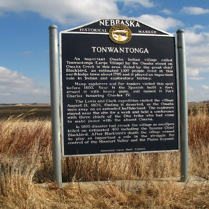
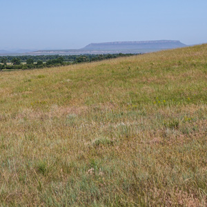
The visit to this prairie hill was among the more bizarre sidelights of the whole expedition, but evidently it was not entirely unexpected. Seventy-six years earlier, explorer Pierre La Véndrye called the place the “Dwelling of the Spirits.”
September 7, 1804
Prairie dog town
Old Baldy [The Tower], SD The expedition encounters its first village of prairie dogs. They pour barrels of water down burrow holes eventually catching one as a specimen. Hunter George Shannon is still missing.
May 8, 1805
The 'River that Scolds all Others'
Clark explores the Milk River, and Sacagawea brings him breadroot, an important Indian food source. After finding recent Assiniboine activity, Lewis wishes to avoid any encounter with that Tribe.
May 29, 1805
Bison terrorizes camp

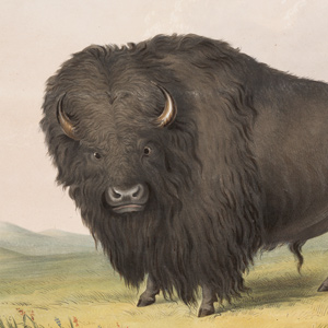
When a bison runs amok, Lewis’s dog Seaman saves the day by diverting it away from camp. They pass “Judieths River” and camp above the “slaughter river” where numerous dead bison have washed ashore.
July 22, 1804
White Catfish Camp
Near present Bellevue, Nebraska, the expedition sets up a camp that would be known as White Catfish Camp. The captains find a shady place near to rest and arrange a council with the Otoes.
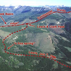
Sergeant Gass recorded that on 7 July 1806, Lewis’s detachment took a three-hour lunch break and then proceeded four miles, “when we came to the dividing ridge between the waters of the Missouri and Columbia.”
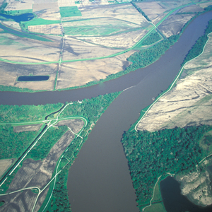
The huge meander called the Big Bend, or Grand Detour, had been a well-known Missouri River landmark for many years when the Corps of Discovery arrived at its lower bend on 19 September 1805.
The shuttling of all the baggage and six canoes across the prairie to the upper portage camp opposite White Bear Islands began on 21 June 1805 and was completed on 2 July 1805. All in all, it was one of the most grueling undertakings on the entire expedition.
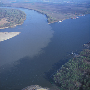
Mouth of the Yellowstone
When Captain Lewis arrived at the mouth of the great river in late April 1805, he saw a “rich, delightful land, broken into valleys and meadows, and well supplied with wood and water.”
On 25 July 1806, Clark and his contingent of nine men, plus York, Toussaint Charbonneau, Sacagawea, and little Jean Baptiste, arrived at “a remarkable rock Situated in an extensive bottom, on the Star[boar]d. [south] Side of the river.”
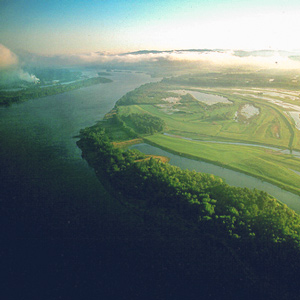
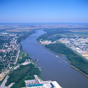
The Mouth of the Missouri
by Joseph A. Mussulman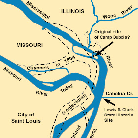
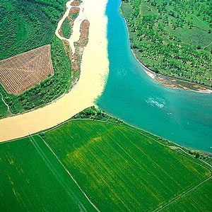
The Missouri River still contributes its tint a few miles north of St. Louis. It is difficult to determine exactly how much, and how often, the confluence of the Missouri and the Mississippi Rivers changed during the nine decades after the Lewis and Clark Expedition.
April 25, 1805
Lewis on the Yellowstone
Seaman disappears during the night but fortunately returns in the morning. Lewis and a small detachment then advance to the Yellowstone River while Clark commands the boats.
July 24, 1805
Turned side upwards
Scouting ahead, Clark sees hills “fallen half down & turned Side up-wards”. The boats pass the Crimson Bluffs, Sacagawea assures Lewis the river will remain navigable, and they camp at Yorks Islands.
On the night of 4 November 1805 the expedition camped near a pond now called Post Office Lake. The next morning a weary, groggy Clark complained that he “could not Sleep for the noise” made by the numerous waterfowl.
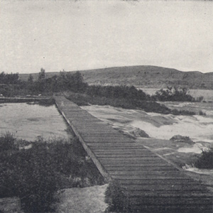
August 11, 1804
Honoring Blackbird

Near Badger Lake, IA The captains climb a high hill where they place a flag at the grave of Blackbird, an Omaha chief and prolific trader. They then continue up the Missouri River camping near Badger Lake, Iowa.
April 30, 1806
Crossing the sandy plain
The expedition sets out on the Travois Road passing through sagebrush and sand dunes. They camp on the Touchet River north of present Walla Walla. Lewis describes eating dog, river otter, and horse.
“The Indian woman recognized the point of a high plain to our right . . . . This hill she says her nation calls the beaver’s head from a conceived resemblance of its figure to the head of that animal.”
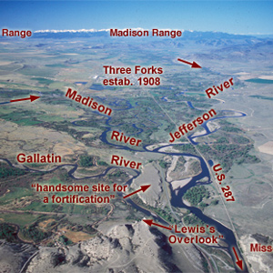
Lewis and his canoes slowly approached the forks, “the current still so rapid that the men are in a continual state of their utmost exertion to get on, and they begin to weaken fast from this continual state of violent exertion.” He described the “extensive and beatifull plains and meadows.”
In the afternoon of 16 October 1805, the expedition portaged around “the last bad rapid as the Indians Sign to us”–the last on the Snake River, that is–and soon arrived at the “Great River of the West,” the Columbia.
![]()
“a remarkable high detached rock Stands in a bottom on the Stard [starboard, the navigator’s right] Side & about 800 feet high and 400 paces around”
May 23, 1804
Lewis escapes death
Lewis climbs the pinnacles of Tavern Rock, slips, and manages to escape with the help of his knife. In Tavern Cave, Clark adds his name among the graffiti left by earlier travelers.
Late in the day on 19 July 1805, Lewis and his party entered a canyon between “the most remarkable clifts that we have yet seen.” They seemed to rise “from the waters edge on either side perpendicularly to the hight of 1200 feet.”
Reaching the mouth of the Knife River on 27 October 1804, the expedition arrived in the midst of a major agricultural center and marketplace for a huge mid-continental region. The five permanent earth lodge communities there offered a panorama of contemporary Indian life.
The party “Came too, under a high point of rocks on the Lard. Side below a creek”—Quenett (“salmon”), now Mill Creek—a “Situation well Calculated to defend our Selves,” and duly named their bivouac “Fort Rock Camp.”
On his return to the mouth of the Marias, Lewis found Sacagawea gravely ill. He had his men cross the river “to procure the water of the Sulpher spring,” “the virtues of which,” Lewis asserted, “I now resolved to try on the Indian woman.”
August 26, 1804
Promoting Private Gass
Opposite Bow Creek, NE Patrick Gass is promoted to sergeant. Camp is across from an old Omaha village.
October 26, 1804
Mitutanka Village
Mitutanka Village, Knife River, ND The expedition arrives as the first Mandan village, Mitutanka. Due to his sore neck, Clark is unable to join Lewis on his visit to the village. Many Indians visit, and they meet Hugh McCracken, a free fur trader.
May 30, 1805
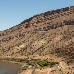
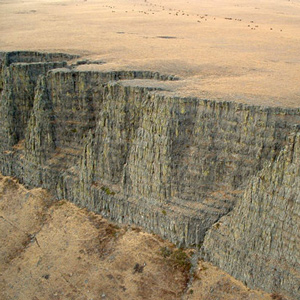
The White Cliffs
The men find that towing the boats among the white cliffs of the Upper Missouri River Breaks is harder than usual. Lewis tests the humidity, and Pvt. Whitehouse describes an empty Atsina camp.
The White Cliffs
by Joseph A. Mussulman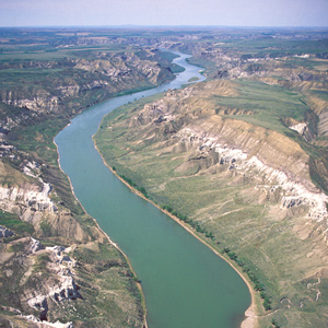
Under cloudy skies on the morning of 31 May 1805, the expedition “proceeded at an early hour,” and roped their flotilla of six cottonwood dugout canoes and two big pirogues into one of the most famous riverscapes on the Missouri.
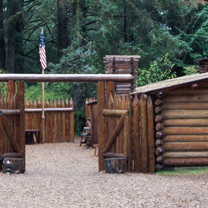
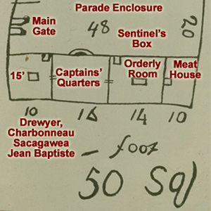
Today’s Fort Clatsop stands at or near the site of the Corps’ winter encampment of 1805-06 was built on the same floor plan that Clark drew on the cover of the Elkskin-covered Journal. The rest of the present structure resembles the original only in a remote sense.
July 21, 1804
Passing the Platte
At midday, the boats arrive at the mouth of the Platte where they remark on the sandy river’s effect on the Missouri. Before continuing, the captains take a pirogue one mile up the Platte.
“…this I could plainly See would be the extent of our journey by water, as the waves were too high at any Stage for our Canoes to proceed any further down ….”
June 23, 1804
Clark's night away
Winds prevent the boats from making more than 3½ miles, but they finally arrive at the future site of Fort Osage. While hunting , Clark mires in mud and is forced to spend the night away from the boats.
Snow was falling in the high country above them on the morning of 14 September 1805 when, after striking camp two miles downstream from Packer Meadows, the Corps slogged down the Glade Creek canyon through rain and sleet.
July 12, 1804
Willards' court martial
The expedition takes a day at the Big Nemaha River to rest and wash clothes. Pvt. Willard is tried and found guilty of sleeping while on guard duty. His sentence is “One hundred lashes on his bear back”.
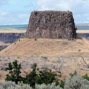
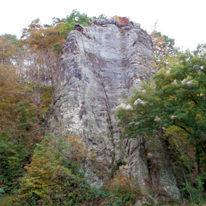
“This mountain has a singular appearance. it is situated in a level plain, it’s sides stand nearly at right angles with each other and are each about a mile in extent … from it’s figure we gave it the name of fort mountain.”
Building Fort Clatsop
A rush job
December 10, 1805 marked the beginning of work on the Corps’ third winter garrison. They worked as fast as they could, and the daily, mostly intermittent rain showers punctuated by gale-lashed torrents, strengthened their resolve.
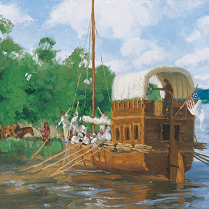
With Captain Clark in sole command, the Corps of Volunteers for North Western Discovery left the mouth of Wood River on 14 May 1804. The flotilla was comprised of the barge and two pirogues. Clark and the men “proceeded on under a jentle brease,” bound for St. Charles.
On the evening of 25 September 1804 after a negative encounter with the Lakota Sioux, the Corps camped on a nearby island Clark called “bad humered Island.” The next morning, the Indians had a change of heart.
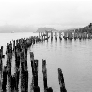
As the Corps rounded Tongue Point the wind rose hard from the west, and heavy seas with torrential rain forced them back to the east shore of the narrow isthmus, where they huddled for ten miserable days.
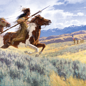
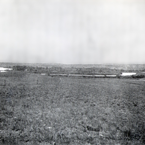
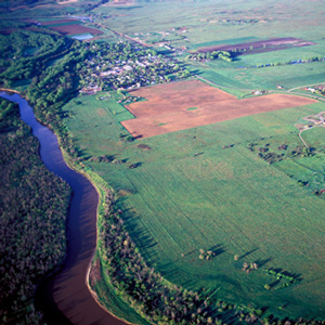
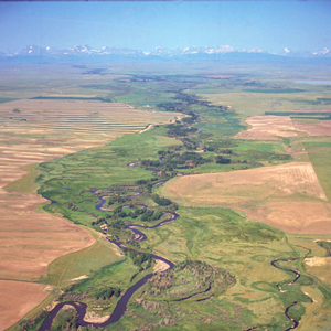
August 25, 1804
Visiting Spirit Mound
Spirit Mound, SD The captains take a large party to explore Spirit Mound. Instead of finding devils, they suffer from excessive heat and witness birds eating swarms of flying ants.
![]()
In 1804 and in the presence of the Lewis and Clark expedition the little village, built and designed to be an outpost of the fur trade, shed its ambiguous Spanish-French parentage and took on full American citizenship.
December 12, 1803
Rivière à Dubois arrival
Winter Camp at Wood River, IL Clark takes the boats past Florissant village, now a suburb of St. Louis, and then arrives at the Riviére á Dubois just below the confluence of the Missouri and Mississippi rivers. Lewis is in St. Louis collecting data.
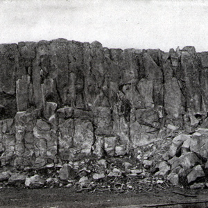
Hat Rock
The enlisted men must have recognized it at a glance, this pile of columnar basalt all together resembling a well-weathered gentleman’s hat with a work-worn brim. Two centuries later, it would be one of the few Lewis and Clark landmarks left above Columbia River.
June 7, 1804
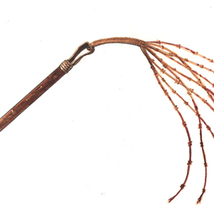
"white red & blue flint"
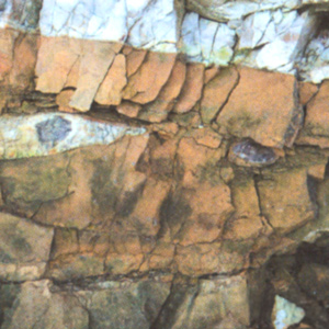
As they travel up the Missouri, the journalists have noticed images painted and carved on the limestone bluffs. Today, Clark finds rattlesnakes and cliffs inlaid with “white red & blue flint”.
The Corps of Discovery reached a many-faceted barrier, Celilo Falls, which required a portage. The falls proved to be the beginning of fifty-some river miles that also held The Short and Long Narrows (jointly called The Dalles), and ended with the lengthy Cascades of the Columbia.
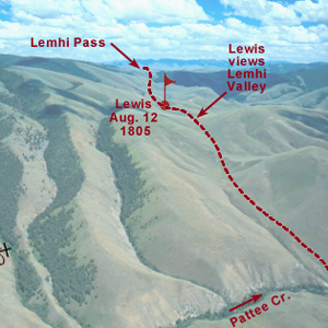
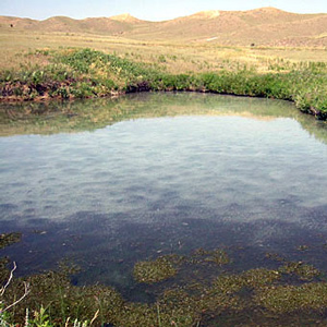
Below the summit of today’s Lemhi Pass, Lewis said that he had reached “the most distant fountain of the waters of the mighty Missouri in surch of which we have spent so many toilsome days and wristless nights.”
Continuing north up the North Fork Salmon River, they leave a good Indian road and must cut their own trail. Were they lost? Sergeant Gass’s laconic remark gives us a hint: “This was not the creek our guide wished to have come upon.”
December 7, 1803
Cahokia arrivals
Meramec River, MO to Cahokia, IL
Lewis traveling by land, and Clark by river, arrive at Cahokia. Lewis meets two useful locals, John Hay and Nicholas Jarrot who help him negotiate entering Spanish territory.
“at this place there is a large rock of 400 feet high wich stands immediately in the gap which the missouri makes on it’s passage from the mountains.”
Lewis acknowledged it was “a pretty little plain of about 50 acres plentifully stocked with quawmash” and “one of the principal stages or encampments of the indians”
August 20, 1804
Burying Sgt. Floyd
Sioux City, IA Clark spends most of the night attending to Sergeant Floyd who is gravely ill. The expedition leaves Fish Camp, but soon stops near present-day Sioux City, Iowa to intern Sergeant Floyd with a full military ceremony. The former Spanish governor of Louisiana reports on several American expeditions in contested Spanish territory.
Clark and his five men “proceeded on up the river a little more than a mile to the largest fountain or Spring I ever Saw, and doubt if it is not the largest in American Known.”
June 4, 1804
Climbing Sugar Loaf Rock
A “nightingale” sings all during the night. During the day, a rope catches on a tree and breaks the barge’s mast. Clark ascends a high hill—now called Sugar Loaf Rock—with hopes to find lead ore.
August 13, 1804
The Omaha's Big Village
Fish Camp, Homer, NE The expedition passes old Fort Charles, a starting point for a previous exploration of the upper Missouri. They camp on a sandbar east of present-day Homer, Nebraska naming the camp Fish Camp. Men are sent to invite the Omahas to council.
By the evening of 15 June 1805, Clark had gotten the canoes and the white perogue as close to the Great Falls as possible, and the next afternoon Lewis joined him at the “lower portage camp,” a mile below the mouth of Belt Creek.
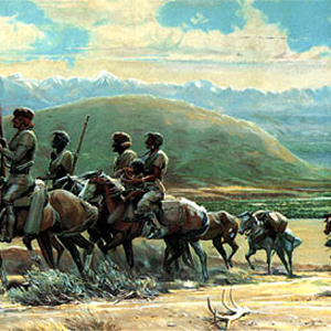
In 1806, Lewis, Drouillard, Joe Field, and Reubin Field made a second excursion up the Marias, this time on horseback. The four men reached the northernmost point of the Expedition’s exploration on 22 July 1806, camping on the south side of today’s Cut Bank Creek.
For countless generations, Weippe Prairie (prounouced WEE-yipe), like Travelers’ Rest, was a major node in the transportation, trade, and social networks of the Rocky Mountain West.
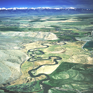
As he started over the mountains at today’s Bozeman they observed several Indian and buffalo roads heading northeast across the mountains. Clark reported, “the indian woman who has been of great Service to me as a pilot through this Country recommends a gap.”
July 14, 1805
Launching the new canoes
Lewis remarks on the view of Square Butte from their canoe camp near present Ulm, Montana. Sgt. Ordway brings the remaining dugouts, the two new canoes are launched, and all is made ready for departure.
June 1, 1804
Mouth of the Osage
After a hard day, the expedition stops at the mouth of Osage River where the captains make celestial observations late into the night. Lewis also collects a specimen of wild ginger, Asarum canadense.