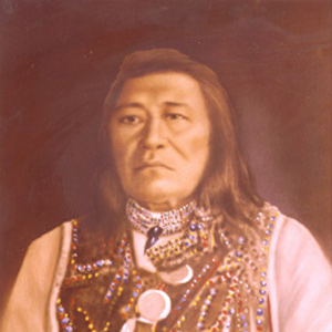
Aided by the Lemhi Shoshone Chief Cameahwait, Sacagawea‘s brother, they begin a slow process to acquire horses and to move necessary equipment and supplies across Lemhi Pass. A Lemhi Shoshone guide named Toby joins them. Between the Lemhi and Bitterroot valleys they stumble across the Lost Trail divide. They buy more horses from the Salish and proceed down the Bitterroot River to Travelers’ Rest.
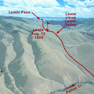
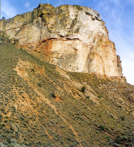
Below the summit of today’s Lemhi Pass, Lewis said that he had reached “the most distant fountain of the waters of the mighty Missouri in surch of which we have spent so many toilsome days and wristless nights.”
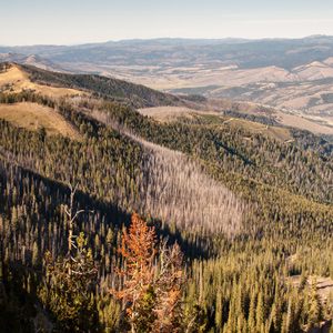
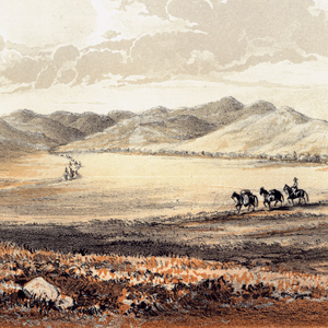
After trading for horses with Sacagawea’s people, the expedition turned north and then west, on what would indisputably be the most exhausting and debilitating segment of the entire journey, the passage across the Bitterroot Mountains.
When Cameahwait took Lewis into the shelter of the only leather lodge his people had been able to save from the Hidatsas’ depredations of the previous spring, Lewis knew for sure he was among good friends.
Meeting the Shoshones
by Joseph A. Mussulman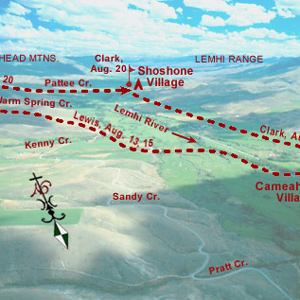
A few more Shoshones came in sight. Making all the benevolent signs and sounds he could think of, pondering ways to bring the wary Indians within talking distance, Lewis finally touched the hand of an elderly woman, and the spark of international friendship was struck.
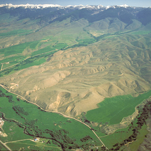
Lewis and his four companions crossed over the dividing ridge on the west side of the upper Missouri River basin and the Columbia drainage, then descended a dusty, well-traveled Indian road for some miles down into a “handsome little valley” among the sources of the Columbia River basin.
Cameahwait’s Geography Lesson
by J. I. Merritt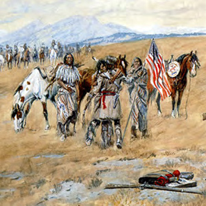
When Meriwether Lewis and William Clark encountered the Shoshone Indians in August 1805, one or the other—or more likely both, sat down with Cameahwait, the chief of the tribe’s Lemhi band, to learn as much as possible about the region’s geography.
Pretending to have been insulted by their accusation, Lewis pompously declared that “if they continued to think thus meanly of us…they might rely on it that no whitmen would ever come to trade with them or bring them arms and amunition.”
Cameahwait and some of his people agreed to help the Corps of Discovery carry its baggage over the divide. In the early afternoon. “We now dismounted,” wrote Lewis, “and the Chief with much cerimony put tippets about our necks such as they temselves woar.”

It has been remembered as “the most gloomy self-examination of the entire journal,” and “a passage of unreasonable melancholy,” of poignant sadness and self-doubt.
August 19, 1805
Trading for a mule
Lemhi River, ID and Fortunate Camp, MT Clark’s heads towards the Salmon River and trades for a mule. Lewis starts a multi-day essay describing Shoshone lifestyle and manners. Sacagawea’s first husband extracts payment from Charbonneau.
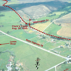
Lewis was still at Camp Fortunate directing the digging of a cache and the making of packs and pack-saddles for the portage across the divide. Meanwhile, Clark and his contingent left to see whether the Salmon River was as bad as Cameahwait had said.
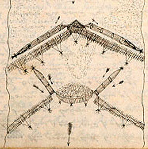
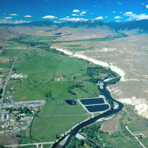
Clark visits a Shoshone camp on the west bank of the Lemhi River near today’s Salmon City, where he and his men are fed on “Sammon boiled, and dried Choke Cher[rie]s,” and taken on a sight-seeing trip to the nearby permanent fishing weirs.
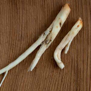
Lewis learned about three unfamiliar species of edible roots–a bushel of them altogether. The Shoshones who were encamped nearby helped him sort them out, and told him how they were customarily prepared.
On the 23 August 1805, the centuries-old fantasy of a “water route across the continent for the purposes of commerce” dissolved in the roar of an unimaginable torrent–one of the most dangerous, unforgiving rivers in North America, that would later be called “The River of No Return.”
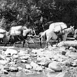
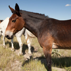
Loading and handling a packhorse is hard work. It demands not only a great deal of physical strength and endurance, but also an eye for balancing a load on the first try, a head full of horse sense, the patience of a saint, and lots of experience.
August 26, 1805
Past the Great Divide
Lemhi River Valley, ID Having finally portaged all the baggage past the great divide, Lewis writes his last regular journal entry for the year, worried how they will cross the Bitterroot Mountains. Clark’s group moves to a Lemhi Shoshone village.
August 27, 1805
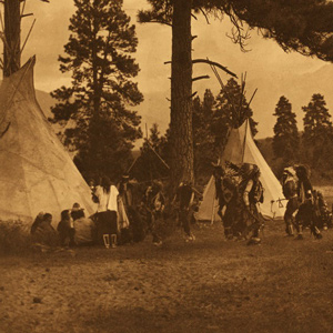
Flag ceremony
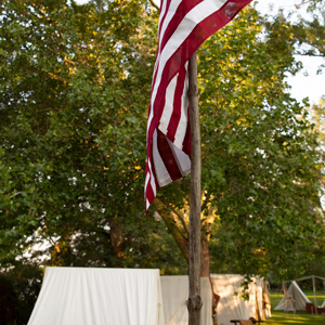
Lemhi River Valley, ID After a flag ceremony at the Upper Lemhi village, Lewis commences horsetrading. In the evening, the Lemhi Shoshones dance and sing. Further down the Lemhi River, Clark’s group hunts while waiting for Lewis to arrive.
The Salmon winds tortuously through a seven-mile-long canyon where the vertical walls at that time crowded the riverbanks so tightly in several places that Clark and his party were compelled to clamber over “four mountains verry Steap high & rockey.”
Continuing north up the North Fork Salmon River, they leave a good Indian road and must cut their own trail. Were they lost? Sergeant Gass’s laconic remark gives us a hint: “This was not the creek our guide wished to have come upon.”
Where did they camp? This was not the only time Toby was unsure of himself, nor that the captains were temporarily baffled, but it is perhaps the one that most readily invites study and discussion.
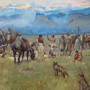
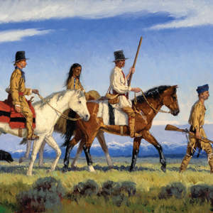
The story behind Charles M. Russell’s 1912 painting of the expedition meeting the Bitterroot Salish at Ross’ Hole, one of the great works of Western American art.
The story of Lewis and Clark meeting the Flathead Salish on 4 September 1805 at Ross Hole is told by one expedition member, four Salish Indians, and one western artist.
September 5, 1805
Council with the Salish Flatheads
Ross’ Hole, MT A Salish council is held using five different languages: Salish-Shoshone–Hidatsa–French–English. Gifts are exchanged, and then horse-trading commences.
On 7 September 1805, the day after they left the Salish people at Ross’s Hole, the Corps proceeded north down the Bitterroot River valley. “The foot of the Snow toped mountains approach near the river on the left,” wrote Clark.
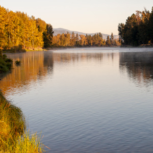
“The stream appears navigable,” he had earlier confided to his journal in reference to the Bitterroot River, “but from the circumstance of their being no sammon in it I believe that there must be a considerable fall in it below”
September 8, 1805
Mountains to the left and right
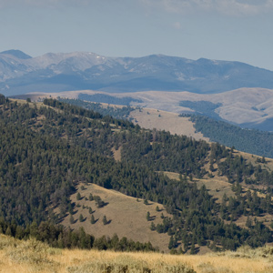
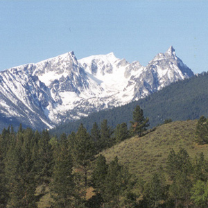
Bitterroot River Valley, MT The expedition proceeds north through the broad Bitterroot valley with the snow-capped Bitterroot Mountains to the west and the mostly barren Sapphire mountains to the east. They find two Indian horses and a colt and also find a new pest, brittle prickly pear.
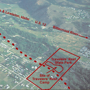
In the afternoon of 9 September 1805 they turned westward at a creek they dubbed Travelers’ Rest, today known as Lolo Creek. They stopped at a gathering place that Indians had been using for that same purpose for thousands of years.
Lewis and Clark and their men camped on 9–10 September 1805 and again on 30 June though 2 July 1806 beside a stream they called “Travelers Rest Creek.” Meriwether Lewis may have seen or sensed a comparison between it and the Travelers Rest in South Carolina.
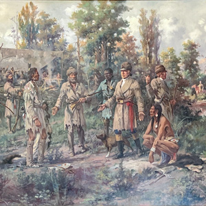
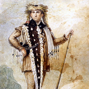
At Lewis’s right is Clark’s servant, York, dressed in blue as befitted a personal slave at that time. The Indian squatting at Lewis’s left hand is Toby, the Shoshone guide the captains had hired to lead them across the Bitterroot Mountains toward the Columbia River.