Heading home, the expedition crosses the Bitterroot Mountains on the Northern Nez Perce Trail, also known as the Lolo Trail. After dividing forces at Travelers’ Rest, Lewis’s group continues up the Blackfoot River crossing the Rocky Mountains at present-day Lewis and Clark Pass. His group then descends to the buffalo-rich plains of the Sun River and returns to their old camp above the Great Falls of the Missouri. (For Clark’s return journey, see Clark on the Yellowstone.)
![]()
Imagine a time when all travel was on foot. This ancient time was the beginning of travel across the rugged Bitterroot Mountains for the Indian tribes of the northwest United States. This is a story of travel in those mountains from ancient times up to the present.
Haystack Butte
Known as Shishequaw Mountain
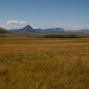
Today’s iconic Haystack Butte was a landmark already known to Lewis and Clark as Shishequaw Mountain. Seeing it from Lewis and Clark Pass, 7 July 1806, provided Lewis with a reference point on Nicholas King’s 1803 map.
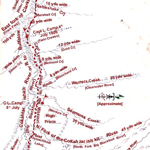
Clark produced this map of Lewis’s route sometime after the Corps was reunited on 12 August 1806, near today’s New Town, North Dakota.
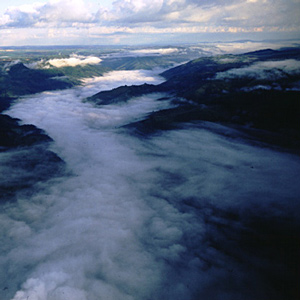
On 23 March 1806, once again battling the rising spring runoff, as it had each of the two previous years on the Missouri, the Corps of Discovery started up the Columbia River towards home.
June 10, 1806
Leaving Long Camp
After a nearly 6-week stay at Long Camp waiting for mountain snows to melt, the expedition travels to the “quawmash flatts”—Weippe Prairie, Idaho. Lewis botanizes and taste-tests Columbian ground squirrel.
June 12, 1806
The beautiful Weippe Prairie
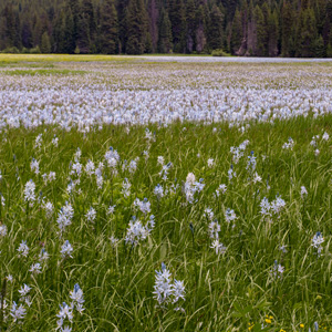
At Weippe Prairie in present Idaho, the expedition waits for the Bitterroot Mountain snow to melt. The warmer weather brings mosquitoes and camas blooms. Lewis collects two more plant specimens.
June 17, 1806
Retreat from Cache Mountain
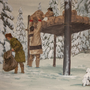
The expedition follows Hungery Creek before climbing towards the Bitterroot Divide. They encounter deep snows with no grass for their horses, cache non-essential cargo on a platform, and go back down.
June 19, 1806
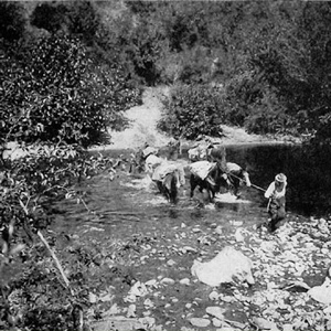
Fishing for steelhead
Despite the fine grass and camas at their camp on Eldorado Creek, they plan to move back to Weippe Prairie. Most of the expedition members spend the day hunting, fishing for “Salmon Trout”, and searching for stray horses.
June 23, 1806
Three Nez Perce guides
While waiting at Weippe Prairie for mountain snow to melt, the hunters imitate bleating fawns to call in the does. Three Nez Perce guides arrive, and all is made ready to cross the Bitterroot Mountains.
June 27, 1806
The Smoking Place
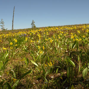
The expedition pauses at the Smoking Place where they see yellow glacier lilies and “Stupendeous Mountains” covered with snow. They push hard along Bitterroot Mountain ridges and encamp at Spring Mountain.
Rocky Point Views
One last view
They crossed over the peak without pausing for one last view of “those tremendious mountanes . . . in passing of which,” Clark would assert two days later, “we have experienced Cold and hunger of which I shall ever remember.”
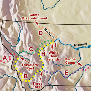
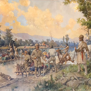
Dividing into as many as five separate details was part of a bold, diplomatic plan to achieve three of the objectives set by President Jefferson.
The continuation of the Northern Nez Perce Trail led from their camp at Travelers’ Rest to the plains near the Great Falls of the Missouri, saving hundreds of miles from the expedition’s 1805 route.
With every crossing they unavoidably drifted farther downstream. Lewis recounted the climactic rafting episode of the day.
Twenty-eight and one-half miles upriver from their camp of 4 July 1806 the Indian road crossed a stream Lewis named after William Werner. At mile 31, they camped near the mouth of a stream the captain named after his dog, Seaman.
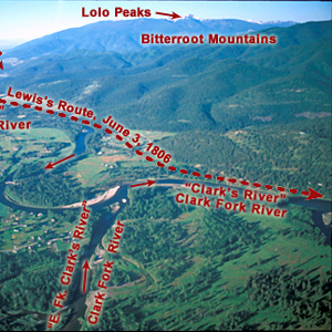
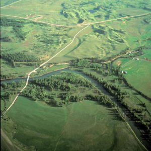
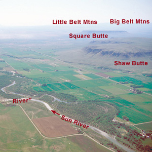
The Blackfoot River
by Joseph A. Mussulman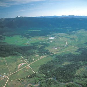
The road led Lewis and his men to the north of an “extensive high prarie rendered very uneven by a vast number of little hillucks and sinkholes.” Lewis noted: “These plains I called the prarie of the knobs.”
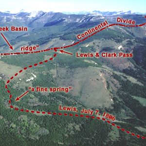
Sergeant Gass recorded that on 7 July 1806, Lewis’s detachment took a three-hour lunch break and then proceeded four miles, “when we came to the dividing ridge between the waters of the Missouri and Columbia.”
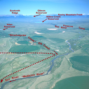
Shortly after crossing the Dearborn River, Lewis saw that the Indian road “continued along the foot of the mountain to the West of north” so he and his men cut northeast across the “tolerably level” plain toward the Sun River.
Down the Sun River
Through the "Battle Hills"
Meriwether Lewis has tempted fate and his “chapter of accidents” again by re-entering the domain of the people he had repeatedly been advised to steer clear of—the Blackfeet, Siksikas, Atsinas, and Assiniboines.
One can almost feel the thrill of wakening to a clear early-summer dawn at this powerful place on the pregnant plains where the Medicine meets the Missouri. Here began a five-day hiatus in Lewis’s master plan for his junket to find the boundary of British-held Canada.
July 12, 1806
Navigating rivers
At mouth of the Sun River, Lewis deals with missing horses. He then crosses the Missouri in bull boats. Clark continues down the Jefferson River where Pvt. Howard’s canoe crashes into a sweeper.