Olin D. Wheeler’s major contribution to the enhancement of Lewis and Clark studies was his inclusion of numerous illustrations. The Trail of Lewis and Clark, 1804-1904 contained photographic reproductions of 8 portraits; 8 photos of important artifacts, such as Pvt. Shannon’s “housewife,” or pocket sewing kit; 15 maps; 24 manuscript documents, including copies of several pages from the original journal pages provided him by Reuben Thwaites; and 24 copies of paintings by prominent American and Euro-American artists. For his travels, see Wheeler’s “Trail of Lewis and Clark”.
Featured Photographs
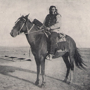
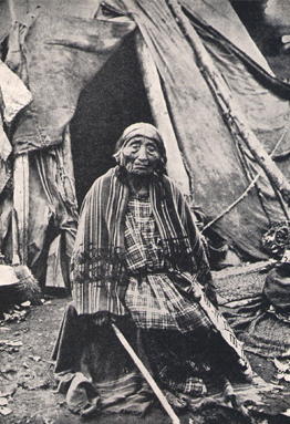
Traveling through the Marias River country with anthropologist George Bird Grinnell, Wheeler met Wolf Calf, one of the Indian survivors of Lewis’s encounter with the Blackfeet.
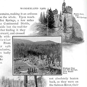
The Northern Pacific Railway had identified two new attractions within its Wonderland—a centennial commemoration of the historic Lewis and Clark expedition, plus extensive segments of the original trail within sight of its rails.
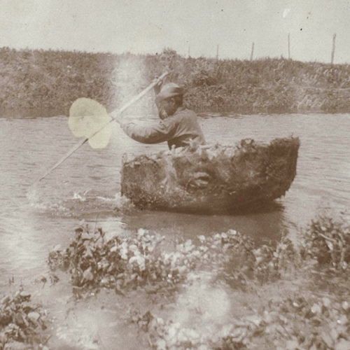
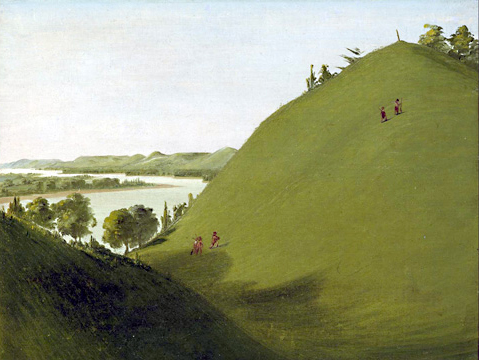
Indians stole all the horses, so Sgt. Pryor and his three privates constructed two bull boats and floated down the Yellowstone River in hopes of catching up with Clark or Lewis.
In 1902, Wheeler followed the Northern Pacific’s course over Bozeman Pass and the Yellowstone River promoting both the railroad and the Lewis and Clark Centennial.
Hidatsa Territory
Becoming the Fort Berthold Reservation
After leaving Fort Mandan on 7 April 1805, the expedition traveled for several days through Hidatsa territory. Much of that area would become the Fort Berthold Reservation of the Three Affiliated Tribes, a coalition of Hidatsa, Mandan, and Arikara.
June 10, 1806
Leaving Long Camp
After a nearly 6-week stay at Long Camp waiting for mountain snows to melt, the expedition travels to the “quawmash flatts”—Weippe Prairie, Idaho. Lewis botanizes and taste-tests Columbian ground squirrel.
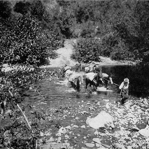
After Lewis’s preliminary sketch, later artists and photographers contributed to the visual documentation of the “sublimely grand” waterfall including Barralet, Gustavus Sohon, A. E. Mathews, and F. Jay Haynes.
May 14, 1806
Establishing Long Camp
The expedition moves to a former Nez Perce habitation across the Clearwater River from present Kamiah, Idaho. With the help the Nez Perce, baggage, horses, and people are ferried across the river.
The party “Came too, under a high point of rocks on the Lard. Side below a creek”—Quenett (“salmon”), now Mill Creek—a “Situation well Calculated to defend our Selves,” and duly named their bivouac “Fort Rock Camp.”
The shuttling of all the baggage and six canoes across the prairie to the upper portage camp opposite White Bear Islands began on 21 June 1805 and was completed on 2 July 1805. All in all, it was one of the most grueling undertakings on the entire expedition.

On 28 December 1805, the officers detailed three enlisted men to proceed to the Ocean and “at Some Convenient place form a Camp and Commence makeing Salt with 5 of the largest Kittles . . . .”
Upon its return from the Pacific coast in the spring of 1806, the expedition camped on the Clearwater River near present-day Kamiah from 14 May 1806 until 10 June 1806, waiting for the snow to melt on the crest of the Bitterroot Mountains.
November 2, 1805
Last of the rapids
Crown Point, OR At the lower rapids of the Cascades, non-swimmers carry baggage, and the boatmen paddle the empty canoes. The entire corps then paddles twenty miles passing Beacon Rock and leaving the rapids of the Columbia River behind.
Floyd’s grave became a conspicuous point and a historic shrine on the Lewis and Clark trail almost immediately after the expedition was over. The American artist George Catlin painted Floyd’s Bluff in 1832, with the original cedar marker still in place.
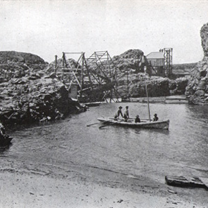
At The Dalles in 1902, a hospitable local citizen helped Wheeler make his way to the brink of the long narrow channel and chasm through which Lewis and Clark took their canoes, where he “overlooked the swirling waters as they boiled and raged.”
Lewis writes: “the bier in which the woman carrys her child and all it’s cloaths wer swept away as they lay at her feet she having time only to grasp her child.” This bier, then, is a bar or net serving to keep mosquitos from one’s personal blood supply.
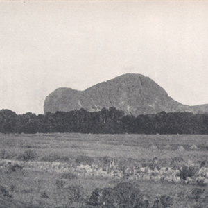
This is the landmark that white settlers believed Sacagawea really meant to identify as Beaverhead Rock . . . .
“we killed a few Pheasants, and I killd a prarie woolf [coyote] which together with the ballance of our horse beef and some crawfish which we obtained in the creek enabled us to make one more hearty meal.
Columbia Gorge Waterfalls
by John W. Jengo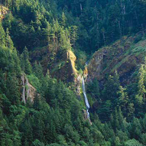
William Clark: “Saw 4 Cascades caused by Small Streams falling from the mountains on the Lard. Side.”
One of Wheeler’s most successful efforts to amplify any part of Lewis and Clark’s route was his exploration of the Lolo Trail. For that he relied heavily on Elliott Coues’ 1893 annotations to the expedition’s narrative.
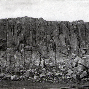
Late in the day on 19 July 1805, Lewis and his party entered a canyon between “the most remarkable clifts that we have yet seen.” They seemed to rise “from the waters edge on either side perpendicularly to the hight of 1200 feet.”
The story Wheeler wished to tell can be found in his book’s subtitle: “A story of the great exploration across the Continent in 1804-06; with a description of the old trail, based upon actual travel over it, and of the changes found a century later.”
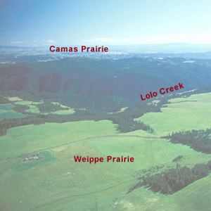
For countless generations, Weippe Prairie (prounouced WEE-yipe), like Travelers’ Rest, was a major node in the transportation, trade, and social networks of the Rocky Mountain West.
Fort Clatsop’s Legacy
by Joseph A. Mussulman
One of the first writers to devote special attention to the question of Fort Clatsop’s post-history was Olin D. Wheeler, who visited the site with Coboway’s grandson, Silas B. Smith, in 1900, and wrote briefly of it.
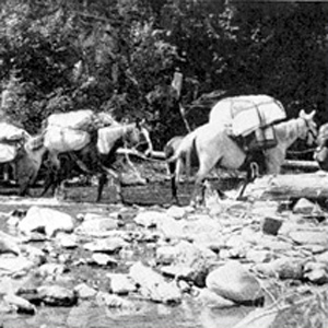
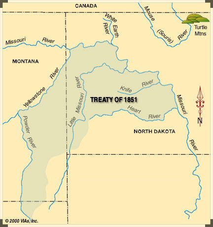
Loading and handling a packhorse is hard work. It demands not only a great deal of physical strength and endurance, but also an eye for balancing a load on the first try, a head full of horse sense, the patience of a saint, and lots of experience.
Lewis’s Branding Iron
by Joseph A. Mussulman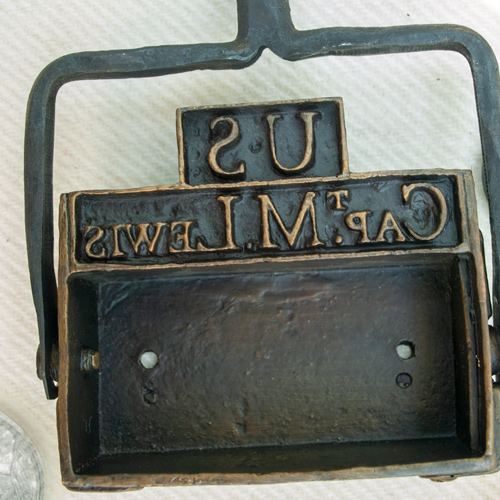
Lewis may have had this branding iron custom-made before he left the East, perhaps at Harpers Ferry, although there is no mention of it in existing records. Such tools commonly were used for marking wooden packing crates and barrels, and on leather bags, until the early 20th century.
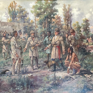
At Lewis’s right is Clark’s servant, York, dressed in blue as befitted a personal slave at that time. The Indian squatting at Lewis’s left hand is Toby, the Shoshone guide the captains had hired to lead them across the Bitterroot Mountains toward the Columbia River.
Clark and his five men “proceeded on up the river a little more than a mile to the largest fountain or Spring I ever Saw, and doubt if it is not the largest in American Known.”