Monticello, VA Thomas Jefferson discusses the location of the “Rio Norte” with Secretary of the Treasury Albert Gallatin who has hired a cartographer to draw a map for the Expedition’s use.
Carte de la Louisiane et du Cours du Mississipi (1718—detail)
By Guillaume Delisle (1675–1726)
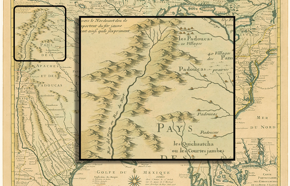
Copper-engraved map on two sheets of laid paper, 48.8 cm (19.2 in) by 65.2 cm (25.6 in). Public Domain.
Ultimately, Nicholas King’s 1803 map— the map created for what would later be called the Lewis and Clark Expedition—placed the “Rio Norte or Rio Bravo” as given by Delisle (also spelled de l’Isle). His history-changing map included a Spanish mission at “Cenis” named “Mission de los Tejas établie et 1716,” the first printed form of the geographic name Texas. The detail above shows Delisle’s original “Rio del Norte ou Riv. du Nort.”
The Mysterious Rio Norte
Monticello Mar. 20. 1803.
Dear Sir
. . . . .
I do not find in my library any thing which can throw light on the geography of the Rio Norte. certainly we find his [John Mitchill’s 1755] map much nearer the truth than could have been expected considering when it was made. hence I conclude that his delineation of the Rio Norte is more to be credited than any other, not excepting Danville & Delisle. Accept my best affections.
Th: Jefferson[1]Thomas Jefferson to Albert Gallatin, Founders Online, National Archives, founders.archives.gov/documents/Jefferson/01-40-02-0071 accessed 15 May 2022. [Original source: The Papers of Thomas … Continue reading
Notes
| ↑1 | Thomas Jefferson to Albert Gallatin, Founders Online, National Archives, founders.archives.gov/documents/Jefferson/01-40-02-0071 accessed 15 May 2022. [Original source: The Papers of Thomas Jefferson, vol. 40, 4 March–10 July 1803, ed. Barbara B. Oberg. Princeton: Princeton University Press, 2013, pp. 89–90.] |
|---|