Seventy-Six Conservation Area, MO Continuing up the Mississippi, the boats pass through a narrow channel avoiding a dangerous whirlpool near Tower Rock. Lewis describes the view from the top of a “sugarloaf point” as beautiful and commanding.
Grand Tower (cropped)
Karl Bodmer (1809–1893)
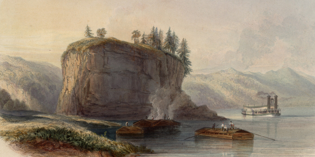
Rare Book and Special Collections Division, Library of Congress.
Tower Rock
On the W. side and about 25 feet up this rock [ is a small cavern— the rock is limestone & the same quality of the clifts heretofore discribed (i e) intermixed with a considerable portion of Flint stone. When the river is high the courent setts in with great violence on the W. side of this rock and being confined on that by a range of high hills is drven with much impetuosity through a narrow channel
—Meriwether Lewis
A Commanding View
There is a most beautifull and commanding view from the summit of the sugarloaf point; it commands the top of the grand Tower about 60 feet and overlooks the low surrounding country: the view of the river above is particularly beautifull; as well as the rang of hills which appear to the E. & stretching from the river below; from S. to N.—
—Meriwether Lewis
Lewis likely is referring to a hill behind the Tower Rock Natural Area. Backbone Ridge above the town of Grand Tower, Illinois also provides excellent views. Conic-shaped hills were commonly called “sugar loafs.” On 4 June 1804, Clark would climb Sugar Loaf Rock.
Advice for the Pilot
Cumings advice for passing down the Mississippi at Devil’s Bake Oven and Grand Tower:
When you are round Duncan’s bar, above, incline to the right, and pass pretty near the mouth of Obrazo river, and then incline to the left, to about the middle of the river, to avoid the eddy on the right, be]ow. About one and a half miles below Obrazo river, is a singular rock, near the right shore, called the Grand Tower. This rock is about one hundred feet in circumference, and one hundred and fifty feet in height. About half a mile above the Grand Tower, on the left, is a high rock, with a singular excavation, about one hundred feet from the surface of the water, called the Devil’s Bake-oven.[1]Samuel Cumings, The Western Pilot: Containing Charts of the Ohio River, and of the Mississippi . . . (Cincinnati: N. & G. Guilford & Co., 1834), 80.
Notes
| ↑1 | Samuel Cumings, The Western Pilot: Containing Charts of the Ohio River, and of the Mississippi . . . (Cincinnati: N. & G. Guilford & Co., 1834), 80. |
|---|