Stephensport, KY[1]No known record exists of expedition’s travel between Louisville and Fort Massac. Using information from travelers of the period and Cramer’s 1802 river guide, The Navigator, one … Continue reading The challenges of the Ohio River in low water make navigating between the Falls of the Ohio and Fort Massac difficult. Travelers reported hidden bars, whirlpools, and difficulty picking the correct channel.
Ohio River Navigation Plan and Profile (1979)
U. S. Army Engineering Division
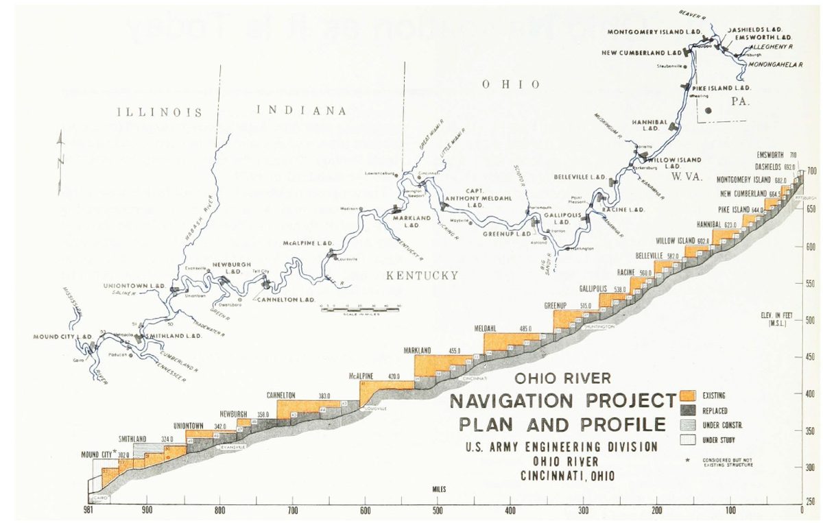
Ohio River Navigation, 1979.
Hidden Bar
[W]e passed the channel across at the lower end of the island before we saw it and kept on but touchd in passing the bar which spreads quite over the river below the island.
We have not before seen a bar spread more ginerally over the river of more difficult to discover, the way over there being several channels and none good
—Thomas Rodney[2]22 October 1803. Dwight L. Smith and Ray Swick, ed., A Journey Through the West: Thomas Rodney’s 1803 Journal from Delaware to the Mississippi Territory (Athens: Ohio University Press, 1997), … Continue reading
Most of the Ohio River hazards were mitigated early in the 20th-century through engineering. By 1929, the entire river was slackwater, an accomplishment noted in this celebration program:
The Dream of Half a Century has been realized. The Ohio River has been completely canalized and periodical interruptions to navigation because of low water are of the past.
In its natural state it was one of the great rivers of the world and the chief factor in the development of the Middle-West, playing also an important part in the migration of pioneers to lands beyond.[3]Official Program and Complete History, Ohio River Pageant and Dedication, October 19th–25th, 1929, in Ohio River Navigation: Past, Present, Future (U.S. Army Corps of Engineers, Ohio River … Continue reading
Indian-Settler Relations
Near the mouth of the Blue River in 1808, Fortescue Cuming recorded the following as told by a local resident:
He told us that a small tribe of Miami Indians were encamped on Oil creek about two miles distant. On asking if they were troublesome, he replied with much sang froid, still splitting his log, “We never permit them to be troublesome, for if any of them displease us, we take them out of doors and kick them a little, for they are like dogs, and so will love you the better for it.” He informed us, that they frequently get the Indians together, take their guns, knives and tomahawks from them, then treat them with whiskey until they are drunk, when they set them by the ears, to have the pleasure of seeing them fight . . . .
—Fortescue Cuming[4]Fortescue Cuming, Sketches of a Tour to the Western Country: Through the States of Ohio and Kentucky, a voyage down the Ohio and Mississippi rivers, and a trip through the Mississippi territory, and … Continue reading
Notes
| ↑1 | No known record exists of expedition’s travel between Louisville and Fort Massac. Using information from travelers of the period and Cramer’s 1802 river guide, The Navigator, one conjecture is that the captains were near Stephensport on this date. |
|---|---|
| ↑2 | 22 October 1803. Dwight L. Smith and Ray Swick, ed., A Journey Through the West: Thomas Rodney’s 1803 Journal from Delaware to the Mississippi Territory (Athens: Ohio University Press, 1997), 130. |
| ↑3 | Official Program and Complete History, Ohio River Pageant and Dedication, October 19th–25th, 1929, in Ohio River Navigation: Past, Present, Future (U.S. Army Corps of Engineers, Ohio River Division, 1979), 1. |
| ↑4 | Fortescue Cuming, Sketches of a Tour to the Western Country: Through the States of Ohio and Kentucky, a voyage down the Ohio and Mississippi rivers, and a trip through the Mississippi territory, and part of West Florida, commenced at Philadelphia in the winter of 1807 . . . (Pittsburgh: Cramer, Spear, & Eichbaum, 1810), 238-39. |