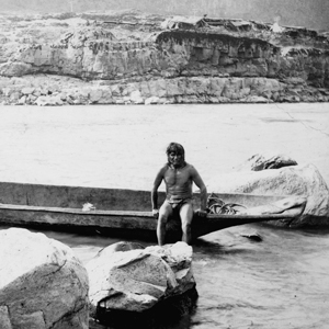
At the time of the Lewis and Clark Expedition, the Teninos lived on the north side of the Columbia River and controlled key fishing areas on the river’s south side. Tenino was a small village at Five Mile Rapids above The Dalles of the Columbia. In 1815, the people began locating on the south side, and the name became associated with four bands: The Teninos proper, the Tukspush (John Day River), the Wyams (Celilo Falls, Deschutes River), and the Tyighs. Hunn and French assert that Tenino has been incorrectly applied to all Sahaptin villagers between Umatilla, Oregon and The Dalles.[1]Robert H. Ruby, John A. Brown, and Cary C. Collins, A Guide to the Indian Tribes of the Pacific Northwest (Norman: University of Oklahoma Press, 2010), 343; Eugene S. Hunn and David H. French, … Continue reading To Lewis and Clark, they were the “E-nee-shur” Indians who charged too much for their horses.
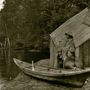
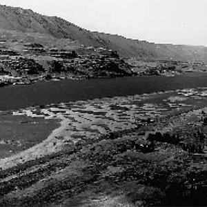
Fishing Huts at the Dalles
Joseph Drayton (1795–1856)
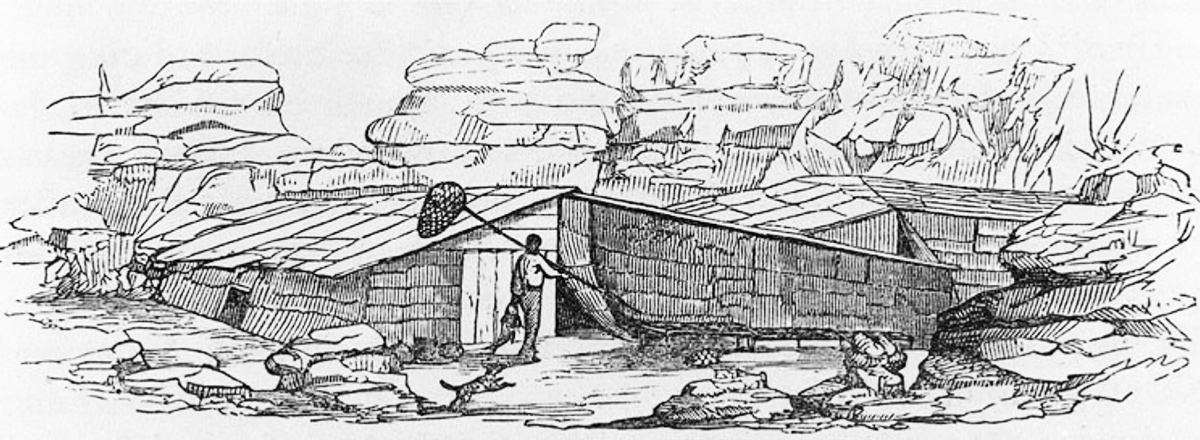
Photograph of a woodcut from Wilkes 4:383, with contrast and exposure adjusted. Courtesy of University of Washington Libraries. Special Collections Division, NA3996.
Although Tenino was above the entrance to The Dalles, the woodcut in the above figure accurately represents the temporary tule reed mat shelters often used to accommodate the influx of people during salmon runs. Shelters made from wood were used by longer-term residents.
Joseph Drayton was an official artist traveling with the Charles Wilkes Expedition. Wilkes, who was at the Lee Mission at The Dalles in early July 1841, gave this description of gigging and spearing salmon:
There are great conveniences at the Dalles for pursuing this fishery. They use the hooks and spears, attached to long poles: both the hook and the spear are made to unship readily, and are attached to the pole by a line four feet below its upper end. If the hook were made permanently fast to the end of the pole, it would be liable to break, and the large fish would be much more difficult to take. The Indians are seen standing along the walls of the canals in great numbers, fishing, and it is not uncommon for them to take twenty to twenty-five salmon in an hour.[2]Charles Wilkes, The Narrative of the United States Exploring Expedition During the Years [1838–1842] (Philadelphia: Lea and Blanchard, 1845), 4:383–84.
Selected Encounters
Here the Columbia was “an agitated gut Swelling, boiling & whirling in every direction.” Even so, Cruzatte and Clark agreed that they could run the canoes through.
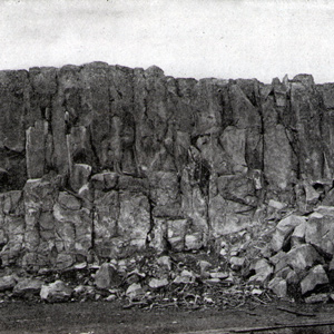
The party “Came too, under a high point of rocks on the Lard. Side below a creek”—Quenett (“salmon”), now Mill Creek—a “Situation well Calculated to defend our Selves,” and duly named their bivouac “Fort Rock Camp.”
October 27, 1805
Taking Indian vocabularies
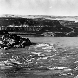
Fort Rock, The Dalles, OR Visiting Indians give the captains an opportunity to compare the languages and customs of the Sahaptian and Chinookan Peoples living above and below The Dalles of the Columbia.
January 13, 1806
Running out of candles
Fort Clatsop, Astoria, OR Elk tallow is rendered to make new candles, Lewis finds that the area’s elk do not have enough fat to make a sufficient supply, and President Jefferson writes to Lewis’s mother with news of the expedition’s progress.
Homeward bound in April 1806, the Lewis and Clark Expedition traveled through the Columbia Gorge and pitched camps on its north side. Their passage was tense and unpleasant, with Indians taking small goods regularly.
April 18, 1806
Tenino horse deal
At a Wishram village, Clark doctors a Tenino chief and his wife and then makes a successful horse deal. At Fort Rock, Lewis has the two large dugouts cut up for fuel, and moves across the river.
April 20, 1806
Six stolen tomahawks
Working at separate villages at Celilo Falls, the captains have difficulty buying more horses and even lose one. After six tomahawks are stolen, Lewis orders all Indians away from his camp.
April 21, 1806
Several severe blows
When items are stolen from his camp, Lewis gives an Indian “several severe blows” and then threatens to kill and burn the entire village. After portaging Celilo Falls, they proceed on by horse and canoe.
April 23, 1806
Friendly Tenino village
To continue up the Columbia, most of the members must walk over large sand dunes. At present Rock Creek, they reach a friendly Tenino village of Wah-how-pum. The day ends with smoking and dancing.
Notes
| ↑1 | Robert H. Ruby, John A. Brown, and Cary C. Collins, A Guide to the Indian Tribes of the Pacific Northwest (Norman: University of Oklahoma Press, 2010), 343; Eugene S. Hunn and David H. French, Handbook of North American Indians: Plateau Vol. 12, ed. Deward E. Walker, Jr. (Washington, D.C.: Smithsonian Institution, 1998), 379, 392–93. |
|---|---|
| ↑2 | Charles Wilkes, The Narrative of the United States Exploring Expedition During the Years [1838–1842] (Philadelphia: Lea and Blanchard, 1845), 4:383–84. |