In northeast Nebraska, the Missouri River exposed geologically diverse rock formations, white clay, interesting minerals, and steaming and smoking hot earth.
August 22–24, 1804 Route Map (Detail)

Base Map Data © 2009 Google;
Detailed route map of the August 22–24, 1804 expedition traverse up the Missouri River in northeastern Nebraska. By mapping the 1804 course of the river, the present-day location of the “Ionia Volcano,” and the position of the “Rugged Burning Bluffs” observation made by William Clark west-northwest of present-day Lime Creek, it is evident that Ionia Volcano locale has been incorrectly linked with the essential expedition observation that “Those Bluffs appear to have been laterly on fire, and at this time is too hot for a man to bear his hand in the earth.”
For every Lewis and Clark scholar, aficionado, or casual trail traveler, there are portions of the Lewis and Clark Trail that hold a special meaning, where connections can be made to the captains, the enlisted men, the native cultures, the flora and fauna, or the landscapes that were so vibrantly memorialized in the expedition journals. Those whose interest lies in the earth science aspects of the expedition can readily retrace certain sections of the Trail by tracking down the geological features that Lewis and Clark visited, experienced, and described.
Among the most compelling regions are the bluffs of northeastern Nebraska from southeast of present-day Ponca State Park leading northwestward up to the Calumet Bluffs. It was along this extraordinary stretch of river and terrain, which the expedition traversed between August 22 and September 1, 1804 (a distance of approximately 95 river miles according to Clark’s figures), that the most intensive mineral collecting took place.[2]Some 49% of the 47 minerals that have documented collection dates were obtained in this short time period, making it by far the most productive sampling phase of the expedition.
As a consequence of the Missouri River running close to the base of the bluffs in strategic areas, rock formations were revealed to the explorers that were geologically diverse, distinctly colored, rich in mineral content, and in some places, dramatically distinguished by steaming and smoking hot earth that beckoned to be investigated.
Aowa Creek Exposures
Greenhorn Limestone
Ponca State Park
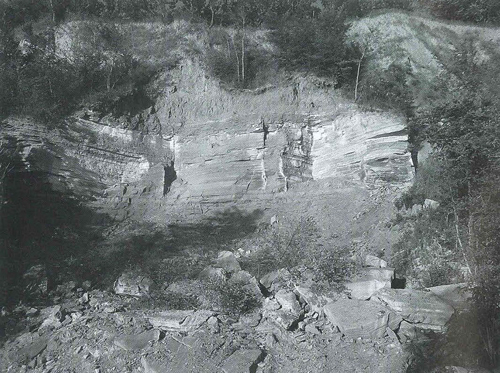
Photo by the author
The formation beneath the prominent cliff face of Greenhorn Limestone here in Ponca State Park is the gently sloping Graneros Shale, which contains layers of the mineral melanterite. Melanterite, formed after the decomposition of pyrite or marcasite, can have a striking bluish green color that the captains either mistook for cobalt or correctly identified as “copperas,” and it’s a strong candidate for one of the tested minerals that debilitated Meriwether Lewis on 22 August 1804.
In the early morning of 22 August 1804, with the memory of burying their “Decesed brother”[3]Gary E. Moulton, ed., The Journals of the Lewis and Clark Expedition, (Lincoln: University of Nebraska Press, 1986), 2:495. All Lewis’s or Clark’s journal quotations between August 22-24, … Continue reading Sergeant Charles Floyd still fresh in their minds, Meriwether Lewis, William Clark, and the Corps of Volunteers for North Western Discovery pushed off from their camp for another day’s struggle against the unrelenting current and stiff winds along the Missouri River. It already had the makings of an important day as the captains had decided the time had come for a vote to determine Sgt. Floyd’s replacement. But the focus of this day changed some two and a half miles out of camp.
While laying up at present-day Aowa Creek, Nebraska to meet two hunters who had brought in game, a distinctive feature of the landscape attracted the captains’ attention. Either from their own observations, or from a sample brought in by the inquisitive John Shields, the captains noted that the bluffs on the larboard side of the Missouri River possessed something more interesting than any of the rocks they had encountered since embarking from St. Louis.
And so it was that Meriwether Lewis probably retrieved a copy of Richard Kirwan’s Elements of Mineralogy from a keelboat locker to re-acquaint himself with the procedures of assaying and identifying mineral deposits. Here, at the mouth of Aowa Creek, were rock exposures that were worthy of experiment.
Lewis was already aware, by virtue of his scientific training in Philadelphia in the spring of 1803, that many of the diagnostic mineral tests in Elements of Mineralogy required smelling the fumes emitted from specimens. This was true whether the sample in question was arsenic (“this Calx is often found in Clays and blue Marles and may be distinguished by its smell when thrown on burning Coals”[4]Richard Kirwan, Elements of Mineralogy, Salts, Inflammables, and Metallic Substances (London: Printed for P. Elmsly, in the Strand, 1796), 2:259-260.) or other ores (“In the dry way, it is discovered by its evaporation, in the form of a white Smoke on burning Coals or red hot Iron, with its peculiar smell”).[5]Ibid., 438.
Calcerous Concretions in Carlile Shale
West of Vermillion Ferry
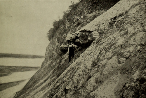
B. CALCAREOUS CONCRETIONS IN CARLILE FORMATION WEST OF VERMILION FERRY, NEBR. DESCRIPTION OF THE ROCKS.
While selenite crystals may be observed throughout the Graneros, Carlile, Niobrary, and Pierre, they are most abundant on slopes of the Carlile formation, especially at the Ionia Volcano or on other bluffs in that region, where they are commonly mistaken for mica. They vary in size from minute needles to 2 to 3 inches across. They originate near the surface from the weathering of the iron pyrites scattered through the clay, some of the products of which react with lime in solution in percolating waters, forming calcium sulphate which crystallizes as selenite. The usual belief that they were formed when the strata were deposited and that they occur in large numbers throughout the beds is therefore erroneous.
Source: George Evert Condra, Geology and Water Resources of a Portion of the Missouri River Valley in North-eastern Nebraska (Washington, D.C.: Government Printing Office, 1908), 12–13.
—Kristopher K. Townsend, ed.
Viewing what he and Clark thought might be cobalt, Lewis knew that “When Arsenical it [cobalt] gives out that smell on burning coals.”[6]Ibid., 273. So Lewis headed up to the bluffs to pursue his scientific duties, undoubtedly pleased that he could begin to fulfill President Thomas Jefferson‘s objective of ascertaining “the mineral productions of every kind” in this new terrain.[7]For an in-depth discussion of the mineralogical objectives of the expedition and the role of Thomas Jefferson in this enterprise, see John W. Jengo, ”Mineral Productions of Every Kind: … Continue reading
Clark vividly described the rock exposures at the mouth of present-day Aowa Creek,[8]Aowa Creek has been correlated with Clark’s dream-inspired name of “Roloje” Creek; Clark described this stream as coming “in from the L.S. passing under the Clifts for several … Continue reading just a few miles upriver from their encampment on August 21, 1804.
Commencement of a Bluff on the L.S . . . . This Bluff contain Pyrites alum, Copperass & a Kind Markesites. also a clear Soft Substance . . . . Capt lewis was near being Poisened by the Smell in pounding this Substance I belv to be arsenic or Cabalt.[9]Clark, August 22, 1804, Moulton, Journals, 2:500. Also referred to as Clark’s “River Journal,” these Field Noteswere first-draft notes presumably recorded under less favorable … Continue reading
examonation of this (1) Bluff Contained alum, Copperas, Cobalt, Pyrites; a alum rock Soft & Sand Stone. Capt. Lewis in proveing the quality of those minerals was near poisoning himself by the fumes & tast of the Cabalt which had the appearance of Soft Isoglass- Copperas & alum is verry pure.[10]Clark, August 22, 1804, Notebook Journal in Moulton, Journals, 2:501. These entries were recorded in the renowned small, stenographer-like notebooks that the captains intended to be the official … Continue reading
The bluffs at this location are primarily comprised of Cretaceous age Graneros Shale and Greenhorn Limestone.[11]Raymond R. Burchett, Vincent H. Dreeszen, Vernon L. Souders, and G.E. Prichard, Bedrock Geologic Map Showing Configuration of the Bedrock Surface in the Nebraska Part of the Sioux City 1° x 2° … Continue reading Clark did well here to mark the presence, probably in the Graneros Shale, of pyrite and marcasite, both iron sulfide minerals with an identical chemistry but different crystal forms.
Sgt. John Ordway provided helpful detail as well when he described one of the minerals as “brass,” which is the signature color of pyrite and marcasite, and recorded that the minerals had a “Sulpheras Smell,”‘ another positive indicator of iron sulfide minerals.[12]Moulton, Journals, 9:42.
An Experiment Goes Badly
Mineral specimens were collected here, probably by Lewis himself. For at least one specimen, Clark (in the Field Notes) described Lewis as “pounding this Substance”[13]Moulton, Journals, 2:500. and he recorded in his Notebook Journal that Lewis went further, inhaling the fumes and tasting the specimen(s). The way both the field notes and journal entries are presented (presumably chronologically), it could be surmised that Lewis performed the tests at the site of the collection, because Clark described Lewis’s physical condition right after his description of the mineral content of the locale, followed by the subsequent events of the day.[14]There appears to be an error on Martin Plamondon’s cartographic reconstruction of this day’s travel; see Martin Plamondon II, Lewis and Clark Trail Maps: A Cartographic Reconstruction, … Continue reading
The experiment went badly. While there is uncertainty regarding what minerals Lewis attempted to assay using this method, the fumes and ingestion of these substances made him ill, with an aftereffect that would linger for several days. It’s probable that Lewis hoped he could recover on his own, but Clark reported that his friend took “a Dost of Salts this evening to carry off the effects.”[15]Moulton, Journals, 2:500.
Was it Copperas?
Selenite Crystal
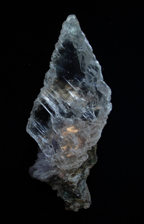
Photo by Eurico Zimbres. Permission under the Creative Commons Attribution-Share Alike 2.5 Generic license.
Selenite Crystals on Greenhorn Limestone
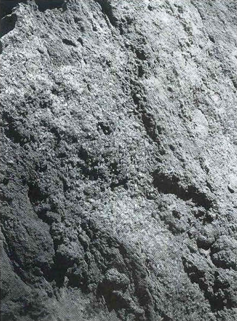
Photo by the author
Selenite crystals cover entire fracture surfaces of the Greenhorn Limestone in a locale passed by the expedition on August 22, 1804. Selenite, a transparent, colorless variety of gypsum, along with pyrite, marcasite, and melanterite, were among the minerals that William Clark observed in “great quantity” along this route that would comprise many of the collected specimens that Lewis shipped back East from Fort Mandan in April 1805.
Farther upriver in what is present-day Ponca State Park, one of the most complete and accessible outcrops in this region lies adjacent to the park’s boat ramp. This exposure is approximately 5.5 miles upriver from the bluff that Clark described earlier on August 22nd, so it probably is not the exact spot that Clark noted as being “Seven miles above.”[16]Ibid, 501. There’s an internal discrepancy associated with this distance call. Clark’s course and distance for this transect adds up to eight miles, not seven, and Clark appears to have … Continue reading Nevertheless, the river-facing bluffs along this route expose two of the same geological formations the captains encountered at the mouth of Aowa Creek:
Clift of Allom Stone of a Dark Brown Colr. Containing also in crusted in the Crevices & Shelves of the rock great qts. of Cabalt, Semented Shels & a red earth.[17]August 22, 1804, Moulton, Journals, 2:501.
The formation at ground level is the gently sloping Graneros Shale, a medium to dark gray, partly calcareous shale with interbeds of bentonite, siltstone and sandstone, which is overlain by a prominent outcrop of Greenhorn Limestone, a light gray, ledge-forming limestone with interbeds of marl and calcareous shale.[18]Burchett, et al., Bedrock Geologic Map, USGS Map I-1879.
To check on Clark’s journal description, it was critical to see if any incrustations could be found in the crevices of the rock or in association with ‘Semented Shels’. During one visit, I picked a route between fallen slump blocks to try to reach the sharply defined ledges near the top of the bluff. While passing upward through the Graneros Shale, I observed rock fragments covered with the iron sulfide mineral marcasite.
Although it was not evident to me on that day, melanterite,[19]Roger K. Pabian and Dennis R. Lawton, Geology of Ponca State Park, Nebraska, Educational Circular 6 (Lincoln: Institute of Agriculture and Natural Resources, 1984), 32. a hydrated iron sulfate (FeSO4) formed after the decomposition of pyrite or marcasite (iron sulfide or FeS2) is also present in the upper section of the Graneros Shale. Melanterite can have a striking bluish green color that the captains either mistook for cobalt or correctly identified using the antiquated term “copperas.”[20]The blue color is derived from impurities of copper that replace some of the iron in the crystals; the name “copperas” is from the Greek meaning “copper water.”
Copperas (which will be referred to as melanterite hereafter) is a strong candidate for the mineral that Lewis tested on August 22nd. When this mineral is formed from the oxidation of iron sulfide, the reaction also produces sulfuric acid (H2SO4), a highly corrosive substance that can seriously damage the skin upon contact or the lungs when inhaled. This suggests that Lewis may not have needed to “roast” this mineral because just “pounding” the specimen and coming into contact with the associated sulfuric acid would have deleterious effects.[21]Contact with sulfuric acid will burn the skin, and breathing sulfuric acid causes respiratory tract irritation. Melanterite is one of the few sulfates that are soluble in water, and that may have … Continue reading
There’s one piece of compelling internal evidence for this theory in addition to the fact that Clark specifically identified “copperas” as being present at the outcrops they were examining. Sometime after working through the potential chemistry of what Lewis and Clark were encountering at these outcrop exposures, I updated the antiquated descriptive terminology in the explanatory notes of the mineral specimens that Lewis sent back East from Fort Mandan.[22]The Fort Mandan mineralogical specimen numbers used in this article follow those that were recorded in the Donation Book of the APS, see Gary E. Moulton, ed., The journals of the Lewis and Clark … Continue reading Shortly after the Fort Mandan mineralogical specimens arrived in Philadelphia, Adam Seybert, physician, gentleman scientist, and leading mineralogy expert, added supplemental mineralogical identifications to augment Lewis’s original descriptions.[23]For details on the important role that Adam Seybert played in the subsequent fate of the entire mineral collection, see John W. Jengo, “‘Specimine of the Stone’: The Fate of Lewis … Continue reading
An extensive annotation Seybert added to Lewis’s description of Fort Mandan mineralogical specimen No. 4, collected on August 23, 1804, observed that it “consists principally of Sulphat of Iron derived from decomposed Sulphuret of Iron.”[24]Moulton, Journals, 3:473. The term “sulpheret” was in common use in this time period and was subsequently replaced by the term “sulfide.” This transition was occurring around … Continue reading Remarkably, Seybert described the same reaction of iron sulfide (Seybert’s “Sulphuret of Iron”) to form melanterite (iron sulfate or Seybert’s “Sulphat of Iron”) that occurs in nature within the bluffs of northeastern Nebraska, thus providing additional evidence that this mineral was present in these localities for Lewis and Clark to encounter.
On my investigation of the bluffs, I finally reached the basal unit of a superb exposure of the Greenhorn Limestone.[25]Robert F. Diffendal, Jr. and Anne P. Diffendal, Lewis and Clark and the Geology of the Great Plains, Education Circular No. 17 (Lincoln: Conservation and Survey Division/School of Natural Resources, … Continue reading It is deceptive in its initial appearance because it seems to be comprised of different colored rocks, grading from a light gray in some sections to a color resembling hazelnut coffee creamer in others. However, it is all the same formation. Like most limestones, including those Lewis and Clark examined at the Three Forks of the Missouri, this formation is a gray color in fresh exposures, but weathers to a light tan to cream color once it has been exposed for a period of time.
In examining some of the Greenhorn Limestone slump blocks downslope, I was soon rewarded with a spectacular view of selenite crystals (a transparent, colorless variety of gypsum) that had formed in the fractures in the limestone. These selenite crystals, a hydrated calcium sulfate (CaSO4-2H2O) are striking enough in appearance to justify the captains’ interest in them, and were second only to the number of iron sulfide minerals, and their reaction byproducts, that they observed and collected.[26]The nine samples collected on August 22, 1804 are Fort Mandan mineralogical specimens Nos. 10, 13, 18, 20, 38, 49, 51, 56, and 68; most of these appear to have been iron sulfide minerals (e.g., … Continue reading
Selenite covers broad surfaces of these rock fractures, forming when sulfuric acid reacts with the calcium carbonate (CaCO3) of the limestone.[27]The fascinating relationship between the iron sulfide minerals pyrite and marcasite oxidizing to form melanterite and sulfuric acid, with the sulfuric acid reacting with calcium carbonate to form … Continue reading Also present along bedding planes of the limestone are dense remnants of the extinct bivalve Mytiloides sp. or Inoceramus sp., the “Semented Shels” that Clark notes in his journal.[28]Moulton, Journals, 2:501. In the geological literature, these fossils are identified as Inoceramus, which used to be synonymous with genus Mytiloides, but recent paleontological research has … Continue reading
A Productive Day
Twinned Crystal Selenite
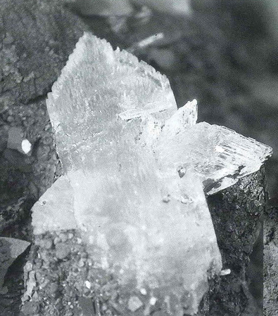
Photo by the author
Three documented mineral specimens from the expedition that have survived to the present-day have been identified as selenite, including a twinned crystal (Fort Mandan mineralogical specimen No. 8 collected on August 23, 1804) that is similar to this specimen observed in the Carlile Shale outcrop at the Ionia Volcano locale, suggesting that the Carlile Shale was the source of some of the selenite samples that the captains collected in this region.
To return to the sequence of events on August 22, 1804, Lewis and Clark examined the bluffs at the confluence of Aowa Creek when they landed to pick up two deer that their hunters had killed. Intrigued by what they saw there, Lewis decided to perform his ill-fated experiments, most probably on iron sulfide minerals (pyrite or marcasite) or on the secondary mineral melanterite. Not discouraged by the aftereffects his friend suffered, Clark kept an eye out for additional exposures upriver.
At certain loops of the river, bluffs were right along the shoreline and rock exposures would have been obvious no matter where the keelboat and pirogues were. If Lewis did, in fact, become ill from exposure to sulfuric acid after testing the minerals near Aowa Creek, it would be logical to assume that any further collecting or observation that occurred upriver was conducted instead by Clark. Regardless of who did the work, the result was the single most productive day of collection on the 1804 leg of the expedition. At least nine mineral specimens were collected. On the following day, at least six more samples were obtained, including one of the three documented surviving mineral specimens, Fort Mandan mineralogical specimen No. 8, which has now been identified as selenite.[29]Jengo, “Specimine of the Stone,” 23.
The list of mineral specimens collected on August 22nd doesn’t indicate at which locality the nine samples were collected, but it can be deduced that some were collected at Aowa Creek. That certainly includes Fort Mandan mineralogical specimen No. 68, recorded as having been “brought [to] us by one of our hunters, John Shields who found it at the Allum Bluff,”[30]Moulton, Journals, 3:478. the same location that Clark described as having “great quantities of those minerals.”[31]Moulton, Journals, 2:500.
‘Blue Clay’ and Bluffs ‘on Fire’
Ionia Volcano
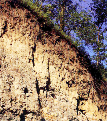
Photo © John Jengo
The formation beneath the prominent cliff face of Greenhorn Limestone here in Ponca State Park is the gently sloping Graneros Shale, which contains layers of the mineral melanterite. Melanterite, formed after the decomposition of pyrite or marcasite, can have a striking bluish green color that the captains either mistook for cobalt or correctly identified as “copperas,” and it’s a strong candidate for one of the tested minerals that debilitated Meriwether Lewis on August 22, 1804.
Among the most significant scientific remarks to be recorded on the entire expedition, and one that would generate great interest from the scientific community back in Washington upon the expedition’s return, was Clark’s observation from August 24th:
Commencement of a blue Clay Bluff of 180 or 190 feet high on the L.S. Those Bluffs appear to have been laterly on fire, and at this time is too hot for a man to bear his hand in the earth at any debth, gret appearance of Coal. An emence quantity of Cabalt or a Cristolised Substance . . . on the face of the Bluff.
Clark’s “Blue or Dark earth”[32]Moulton, Journals, 3:14. or “blue Clay Bluff’ notations typically refer to the Cretaceous age Carlile Shale.[33]Moulton, Journals, 3:15, n6. The Carlile Shale “blue earth” facies can be technically described as a “very dark bluish gray.” It does appear distinctly bluish in outcrop. This observation is supported by Ordway’s journal, which says that this deposit had great quantities of “mineral Substance,” and would undoubtedly have included selenite.[34]Moulton, Journals, 9:43.
On-site examiners should note that it is difficult to closely examine the “landlocked” bluffs of the Carlile Shale today. Only a few feet remain visible of the “blue clay” facies of the Carlile Shale at the Ionia Volcano location; colluvium has buried nearly 70% of the outcrop. By contrast, at the time the captains encountered the Carlile Shale along the river, any material that slumped from higher elevations was continually being swept away by the Missouri River. This allowed much fuller exposures of the Carlile Shale to be observed.
The fascinating chemical reaction Lewis and Clark saw in 1804 begins with iron sulfide minerals present in the Carlile Shale.[35]Joseph Nicolas Nicollet, a French scientist, mathematician, and topographer, deduced this relationship following his April 4-June 12, 1839 retracing of Lewis and Clark’s route up the Missouri … Continue reading Iron sulfide (FeS2), particularly in the form of the mineral marcasite,[36]Although chemically identical to pyrite, marcasite has been found to oxidize more readily than pyrite due to its crystal structure (orthorhombic rather than cubic or isometric). reacts readily with oxygen (O2) and water (H2O) to produce ferrous iron (Fe+2), and through a follow-up reaction with oxygen and hydrogen, ferric iron (Fe+3) is produced. Not only is this reaction “exothermic” (releasing energy in the form of heat), it also has a positive feedback loop component; when ferric iron is produced, it can also oxidize iron sulfide minerals. This process has a chain reaction component; the hydrogen (H+) that is thrown off also lowers the pH, which creates an environment for acid-loving microorganisms (or acidophiles) to participate in and accelerate the reaction (by “up to few orders of magnitude” under certain conditions).[37]B.E. Taylor and M.C. Wheeler, “Sulfur- and Oxygen-Isotope Geochemistry of Acid Mine Drainage in the Western United States: Field and Experimental Studies Revisited,” in Charles N. Alpers … Continue reading
Interestingly, museums constantly wrestle with the degradation of iron sulfide minerals in their collections because of this same phenomenon. It is likely the reason why mineralogist Adam Seybert was already noting decomposition of some of Lewis’s pyrite/marcasite specimens after their arrival in Philadelphia. For example, Seybert documented that the Fort Mandan mineralogical specimen No. 41, collected on August 23, 1804, had “Pyrites decomposed” and other iron sulfide samples in the collection were “in a state of efflorescence.”[38]Moulton,]ournals, 3:476-477. Seybert’s observation of efflorescence suggests he was seeing some kind of incrustation or powdery deposit on the surface of the specimens, which normally is … Continue reading
The unique feature here is the interaction between the iron sulfide and clay minerals that comprise the Carlile Shale. The clay minerals absorb and retain water, critically driving the reaction.[39]S.L. Borek, “Effect of Humidity on Pyrite Oxidation,” in Alpers and Blowes, eds., Environmental Geochemistry of Sulfide Oxidation, 31-44. If lignite (the lowest grade of coal) is present, it will ignite and generate its own heat as well.[40]Diffendal, Geology of the Great Plains, 30. These reactions are the source of the “burning bluffs” so famously described by Clark, and confirmed by the ever-diligent Sgt. Ordway, who remarked that the “burning bank or Bluff” had a “sulpheras Smell.”[41]Moulton, Journals, 9:43.
Was it the Ionia Volcano?
Mulberry Bend State Wildlife Management Area
Clark’s bluffs ‘on fire’

Photo by the author
Clark’s bluffs “on fire” observation on August 24, 1804 should actually be applied to the rock exposures west-northwest of the Route 15 bridge at Mulberry Bend SWMA, upriver of Missouri River’s former confluence with Lime Creek, which corresponds to an area where the Carlile Shale was broadly exposed to, and literally on the edge of, the 1804 position of the river.
The essential part of Clark’s journal entry, particularly variations on the phrase “Those Bluffs appear to have been laterly on fire, and at this time is too hot for a man to bear his hand in the earth,” has come to be extensively used in historical signage,[42]Such as the Nebraska Historical Marker “The Ionia Volcano” located on Route 12 in Pfister Park on the eastern approach to Newcastle at the intersection of Rt. 12 (Annie Street) and Martha … Continue reading various travel and geological guidebooks,[43]Such as Thomas Schmidt, National Geographic’s Guide to The Lewis and Clark Trail, (Washington, D.C.: The National Geographic Society, 1998), 36-37; and Diffendal, Geology of the Great Plains, … Continue reading and merits important footnotes in the definitive editions of the journals.[44]Moulton, Journals, 2:506, n1. Yet unfailingly, the description is ascribed to the so-called Ionia Volcano, a narrow exposed bluff located approximately 3.5 miles northeast of Newcastle, Nebraska. The Ionia Volcano, though, is not the only Carlile Shale bluff in this locale so it was worth questioning how this particular bluff came to be identified as “the” pseudo-volcano that Clark was describing. That this general area was the site of pseudo-volcanic activity seems indicated by its name, “Volcano Hill”. But in 1804, the river was at least one mile away according to Martin Plamondon’s cartographic reconstruction; thus, it can be confidently concluded that the Missouri River was not actively undercutting this bluff when the expedition passed by on August 22, 1804.[45]Plamondon, Lewis and Clark Trail Maps, 1:106. Close proximity to the river would trigger/facilitate the reaction and enable the captains to witness the phenomenon up close. These conditions do not … Continue reading
Expedition maps of the painstaking haul up the Missouri River during this time period clearly reveal that they passed the Ionia Volcano locale on August 22nd, and camped on the opposite side of the river.[46]Gary E. Moulton, ed., Atlas of the Lewis and Clark Expedition, (Lincoln: University of Nebraska Press, 1983), Map 17. Neither the captains nor the other extant journal keepers (Ordway, Whitehouse, and Gass) noted any volcanic occurrences, suggesting that the Ionia Volcano was not the subject of Clark’s subsequent observations.[47]Although not recorded in the field notes or notebook journals, the captain did collect a specimen of pyrite on the following day (August 23, 1804) that Lewis stated was “found at the Burning … Continue reading
If Clark was recording his August 24, 1804 Field Notes observations in the present tense (and the geological details on expedition maps[48]Moulton, Atlas, Map 17. verify that he was), then the Ionia Volcano locale has been incorrectly linked with this essential expedition observation. If the expedition route mapped by Martin Plamondon[49]Plamondon, Lewis and Clark Trail Maps, 1:107-108. is accurate, Clark’s bluffs “on fire” observation on August 24, 1804 should actually be applied to the rock exposures west-northwest of the Route 15 bridge at Mulberry Bend SWMA, upstream from the river’s former confluence with Lime Creek (see map).
Clark was quite specific that the “Blue Clay Bluffs” that “have been latterly on fire” commenced 2.5 miles upriver from the expedition’s August 23rd encampment and that they traveled along these “verry hot” bluffs for 1.75 miles.[50]Moulton, Journals, 2:506. According to geological maps,[51]Burchett, et al., Bedrock Geologic Map, USGS Map 1-1879. the burning bluffs location correlates precisely with an area where the Carlile Shale was broadly exposed to, and literally on the edge of, the 1804 position of the river, thus providing William Clark with an opportunity to examine firsthand that these bluffs were “too hot for a man to bear his hand in the earth.”[52]Candidates for the true “burning bluffs” include the exposures that can be readily seen along 891 Road west-northwest of the Missouri River’s former confluence with Lime Creek and … Continue reading
White Clay ‘Marl’
Niobrara Formation
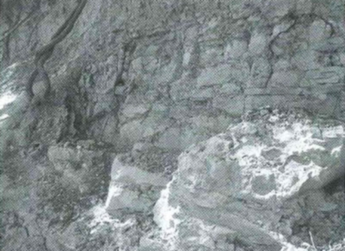
Photo by the author
The captains correctly identified extensive exposures of the Niobrara Formation, a relatively soft and pure form of limestone, in their numerous descriptions of “white earth,” “white hard clay,” “white clay marl,” and “chalk” between August 26 and September 1, 1804.
One of the most distinct changes in the geological terrain along the expedition route was immediately recognized by William Clark. He was accurate in describing the Cretaceous age Niobrara Formation as a chalk deposit:[53]Moulton, Journals, 3:18, n2.
[August 26, 1804:] a Clift of White earth on the L. S of 2 ms. in length.
[August 27, 1804:] passed a white Clay marl or Chalk Bluff under this Bluff is extensive
I discovered large Stone much like lime incrusted with a Clear Substance which I believe to be Cabalt, also ore is imbeded in the Dark earth, resembling Slate much Softer.
[August 28, 1804:] passed a Short White Bluff of about 70 or 80 feet high.
Chalk is a relatively soft and pure form of limestone and is composed primarily of calcium carbonate (CaCO3), in the form of spherical skeletons called cocospheres from a group of chalk forming plankton (single-celled algae).[54]Robert L. Bates and Julia A. Jackson, eds., Glossary of Geology, (Falls Church, Virginia: American Geological Institute, 1980), 104.
Certain strata of chalk are white for a very different reason than the bleaching of the sandstones the captains encountered at the White Cliffs of the Missouri.[55]Jengo, “Mineral Productions of Every Kind,” 207, n50. White chalk is essentially free from other sediments or minerals that would discolor it. It is thought that for this to occur, the sedimentary paleo-environment of chalk deposits had to be in clear marine seas far from adjacent landmasses, keeping them isolated from eroded sediments that would affect their composition and color.
Because the Niobrara Formation is a bluff-forming horizon, its most accessible modern exposures are along road cuts that descend onto the flood plain of the Missouri, such as 563 Avenue northwest of St. Helena, Nebraska. Here, the formation is comprised of both massive exposures of chalk and intervals of chalky shale that appeared to have been “chinked” (like old-fashioned mortar) with fragments of medium gray to white chalk. These outcrops remind the viewer of Clark’s appropriate use of the word “marl,” defined as a loose, well-blended combination of clay and calcium carbonate.[56]Containing 35-65% clay and 65-35% carbonate according to Francis J. Pettijohn, Sedimentary Rocks, (New York: Harper & Brothers, 1957), 410.
As far as Clark’s “large stone” is concerned, flint nodules can easily be found in the Niobrara Formation; it has been surmised that these nodules developed, probably after multiple rounds of dissolution and re-crystallization, from the siliceous skeletons of organisms such as sponges.
Calumet Bluffs
Calumet Bluffs
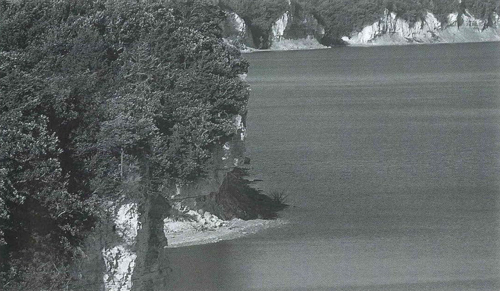
Photo by the author
The Calumet Bluffs, comprised of yellowish orange exposures of the Niobrara Formation upriver of the Gavins Point Dam, were the concluding geological highlight along an extraordinary stretch of terrain that the expedition traversed between August 22 and September 1, 1804, where nearly half of all the date-documented mineral specimens from the 1804 leg of the expedition were collected.
One of the primary geological highlights in this region is Calumet Bluffs, the site of an important council with the Yankton Sioux on August 30-31, 1804. Upon embarking on the following morning, Clark noted:
[Sept. 1, 1804:] pass Calumet Bluff of a yellowish read [red] & brownish white Hard clay, this Bluff is about 170 or 180 foot high here.
proceeded on pass the Bluffs Compsd,of a yellowish red, & brownish White Clay which is a hard as Chalk this Bluff is 170 or 180 feet high.
Construction of the Gavins Point Dam in 1952-1957 significantly disturbed the chalk cliffs located immediately downstream. A few exposures remain on the Nebraska side, including a narrow bluff immediately east of the spillway and a low-lying cliff hidden in a birch tree woodland between the boat ramp parking area and Route 12. At this latter outcrop, the Niobrara Formation is comprised of medium gray to white chalk that was fractured extensively into tabular sheets and blocks. It has the appearance of a well-worn white masonry wall.
The Niobrara Formation is spectacularly exposed above the waterline on the upstream side of the dam all the way past the Bon Homme-Yankton County line. These upriver exposures are, as Clark noted, not pure white but yellowish orange, suggesting either depositional impurities or post-depositional staining.
‘A Hard as Chalk’
The Niobrara Formation is one of the most extensive rock units in the Great Plains, and was deposited between 87 and 82 million years ago during the Late Cretaceous Period.[57]Michael J. Everhart, “Revisions to the Biostratigraphy of the Mosasauridae (Squamata) in the Smoky Hill Chalk Member of the Niobrara Chalk (Late Cretaceous) of Kansas,” Transactions of … Continue reading Most chalk deposits worldwide were formed during the Cretaceous Period, the most famous being the White Cliffs of Dover. They record a time when global sea levels were at one of their greatest heights in the last 570 million years, due to several factors including the break-up of the supercontinent of Pangaea. Chalks are so representative of this time period that the word Cretaceous was derived from the Latin word for chalk—creta.
Lewis and Clark knew how to recognize chalk, even though they opted to initially identify these chalk exposures cautiously as “Clay which is a hard as Chalk.”[58]Moulton, Journals, 3:38. I wonder if the absence of the technical rock description of chalk in Clark’s Field Notes and Notebook Journal on August 26th (and Ordway’s and Whitehouse’s … Continue reading When the captains had the opportunity to closely examine the formation, it’s easy to imagine them chipping off a piece and perhaps running it across one of their writing slates to find it produces a distinctive streak as strong and dense as schoolhouse chalk. Whether or not they did so, they subsequently labeled a specimen as Fort Mandan mineralogical specimen No. 52. It became one of the key mineralogical samples sent back East.


Ionia Volcano is a High Potential Historic Site along the Lewis and Clark National Historic Trail managed by the U.S. National Park Service. “The Ponca Tribe consider the bluff to be a sacred site. Located north of Newcastle, Nebraska, the Ionia Cemetery is across the road from a small overlook and the top of the Ionia Volcano remnants.”—ed.
Notes
| ↑1 | John W. Jengo, “‘Blue Earth,’ ‘Clift of White’ and ‘Burning Bluffs’,” We Proceeded On, Volume 37, No. 1 (February 2011), the quarterly journal of the Lewis and Clark Trail Heritage Foundation. Editorial additions include page titles, side headings, and graphics to assist the web-based reader. The original full-length article is provided at lewisandclark.org/wpo/pdf/vol37no1.pdf#page=8. |
|---|---|
| ↑2 | Some 49% of the 47 minerals that have documented collection dates were obtained in this short time period, making it by far the most productive sampling phase of the expedition. |
| ↑3 | Gary E. Moulton, ed., The Journals of the Lewis and Clark Expedition, (Lincoln: University of Nebraska Press, 1986), 2:495. All Lewis’s or Clark’s journal quotations between August 22-24, 1804 in the ensuing text are from Moulton, Journals, Vol. 2, by date. |
| ↑4 | Richard Kirwan, Elements of Mineralogy, Salts, Inflammables, and Metallic Substances (London: Printed for P. Elmsly, in the Strand, 1796), 2:259-260. |
| ↑5 | Ibid., 438. |
| ↑6 | Ibid., 273. |
| ↑7 | For an in-depth discussion of the mineralogical objectives of the expedition and the role of Thomas Jefferson in this enterprise, see John W. Jengo, ”Mineral Productions of Every Kind: Geological Observations in the Lewis and Clark Journals and the Role of Thomas Jefferson and the American Philosophical Society in the Geological Mentoring of Meriwether Lewis,” in Robert S. Cox, ed., “The Shortest and Most Convenient Route: Lewis and Clark in Context,” Transactions of the American Philosophical Society, Vol. 94 (2004), Part 5, 136-214. |
| ↑8 | Aowa Creek has been correlated with Clark’s dream-inspired name of “Roloje” Creek; Clark described this stream as coming “in from the L.S. passing under the Clifts for several Miles,” meaning the creek was passing under bluffs that bordered the Aowa Creek drainage, and not those cliffs that face the Missouri River. Perhaps Clark got this information from Shields or the other unnamed hunter they were meeting at this confluence, or he explored this creek himself while Lewis was collecting and testing minerals. |
| ↑9 | Clark, August 22, 1804, Moulton, Journals, 2:500. Also referred to as Clark’s “River Journal,” these Field Noteswere first-draft notes presumably recorded under less favorable weather conditions that were later copied into the Notebook Journals. |
| ↑10 | Clark, August 22, 1804, Notebook Journal in Moulton, Journals, 2:501. These entries were recorded in the renowned small, stenographer-like notebooks that the captains intended to be the official journals of the expedition. |
| ↑11 | Raymond R. Burchett, Vincent H. Dreeszen, Vernon L. Souders, and G.E. Prichard, Bedrock Geologic Map Showing Configuration of the Bedrock Surface in the Nebraska Part of the Sioux City 1° x 2° Quadrangle, (U.S. Geological Survey Miscellaneous Investigations Map I-1879, 1988), one sheet, scale 1:250,000. The Cretaceous Period covers the time period from approximately 145.5 to 65.5 million years ago. |
| ↑12 | Moulton, Journals, 9:42. |
| ↑13 | Moulton, Journals, 2:500. |
| ↑14 | There appears to be an error on Martin Plamondon’s cartographic reconstruction of this day’s travel; see Martin Plamondon II, Lewis and Clark Trail Maps: A Cartographic Reconstruction, (Pullman: Washington State University Press, 2000), 1:105. I have taken Clark’s initial S47°W and subsequent due West course and distance call from the previous day’s encampment, and ended up on the south side of Aowa Creek whereas Plamondon took these bearings and ended up over a mile away on the north side of the creek. By my reckoning, it appears that Plamondon mistakenly used a S70°W bearing instead of S47°W. This is very important because it determines the location of the mineral bluffs that Lewis sampled and Clark described. The reason I may be correct is that Clark had Aowa Creek coming in “above this Bluff,” which would place the mineral bluffs south of the creek’s confluence with the Missouri River. In ground-truthing this supposition, I found numerous exposed bluffs along 594 Avenue on the south side of present-day Aowa Creek that are promising candidates for the bluffs Lewis initially sampled, but there are also fine bluff exposures north of the creek that the captains may also have examined. |
| ↑15 | Moulton, Journals, 2:500. |
| ↑16 | Ibid, 501. There’s an internal discrepancy associated with this distance call. Clark’s course and distance for this transect adds up to eight miles, not seven, and Clark appears to have replaced “eight” miles with “seven” miles in his notebook journal entry for some reason. Another issue about where this distance call ends up (which determines which outcrop the captains observed later in the day) relates to where the distance call starts (north or south of Aowa Creek), which is affected by the bearing error described above. |
| ↑17 | August 22, 1804, Moulton, Journals, 2:501. |
| ↑18 | Burchett, et al., Bedrock Geologic Map, USGS Map I-1879. |
| ↑19 | Roger K. Pabian and Dennis R. Lawton, Geology of Ponca State Park, Nebraska, Educational Circular 6 (Lincoln: Institute of Agriculture and Natural Resources, 1984), 32. |
| ↑20 | The blue color is derived from impurities of copper that replace some of the iron in the crystals; the name “copperas” is from the Greek meaning “copper water.” |
| ↑21 | Contact with sulfuric acid will burn the skin, and breathing sulfuric acid causes respiratory tract irritation. Melanterite is one of the few sulfates that are soluble in water, and that may have been the manner in which Lewis ingested it; if so, in combination with sulfuric acid, Lewis could have experienced burns to his mouth, throat, and stomach, triggering gastrointestinal distress. |
| ↑22 | The Fort Mandan mineralogical specimen numbers used in this article follow those that were recorded in the Donation Book of the APS, see Gary E. Moulton, ed., The journals of the Lewis and Clark Expedition, August 25, 1804-April 6, 1805 (Lincoln: University of Nebraska Press, 1987), 3:473-478. Any reference to a mineral specimen in the narrative prefaced by “Fort Mandan mineralogical specimen” refers to those minerals primarily collected in 1804 and sent back East from Fort Mandan in April 1805. All Lewis or Clark journal quotations between August 25-September 1, 1804 in the ensuing text are from Moulton, Journals, Vol. 3, by date. |
| ↑23 | For details on the important role that Adam Seybert played in the subsequent fate of the entire mineral collection, see John W. Jengo, “‘Specimine of the Stone’: The Fate of Lewis and Clark’s Mineralogical Specimens,” We Proceeded On, Vol. 31, No. 3 (August 2005), 17-26 [also on this site as The Mineralogical Specimens]. |
| ↑24 | Moulton, Journals, 3:473. The term “sulpheret” was in common use in this time period and was subsequently replaced by the term “sulfide.” This transition was occurring around the time of the publication of William Barstow, Sulphurets: What They Are (New York: A. Roman and Company, 1867), 114. |
| ↑25 | Robert F. Diffendal, Jr. and Anne P. Diffendal, Lewis and Clark and the Geology of the Great Plains, Education Circular No. 17 (Lincoln: Conservation and Survey Division/School of Natural Resources, December, 2003), 27. |
| ↑26 | The nine samples collected on August 22, 1804 are Fort Mandan mineralogical specimens Nos. 10, 13, 18, 20, 38, 49, 51, 56, and 68; most of these appear to have been iron sulfide minerals (e.g., pyrites) and so-called crystallized “Sulphat of Lime,” or selenite. Lewis was apparently collecting different selenite crystal configurations not knowing they were chemically the same mineral. Appreciative thanks to Sandy Schenck of the Delaware Geological Survey and Dr. Peter Leavens of the University of Delaware for confirming the mineralogy of the Greenhorn Limestone selenite samples collected by the author. |
| ↑27 | The fascinating relationship between the iron sulfide minerals pyrite and marcasite oxidizing to form melanterite and sulfuric acid, with the sulfuric acid reacting with calcium carbonate to form selenite and reacting with aluminous and potassic-containing rocks to form a potassium aluminum sulfate (alum), intimately links all their parent geological units into one enormous chemical laboratory. |
| ↑28 | Moulton, Journals, 2:501. In the geological literature, these fossils are identified as Inoceramus, which used to be synonymous with genus Mytiloides, but recent paleontological research has suggested that these extinct bivalves should be distinguished from one another. Given the regulation prohibiting collection of fossils within the park, I was unable to acquire samples for further study to determine which genus identification (Inoceramus or Mytiloides) is correct. The differences are very subtle and require detailed morphological analyses. |
| ↑29 | Jengo, “Specimine of the Stone,” 23. |
| ↑30 | Moulton, Journals, 3:478. |
| ↑31 | Moulton, Journals, 2:500. |
| ↑32 | Moulton, Journals, 3:14. |
| ↑33 | Moulton, Journals, 3:15, n6. The Carlile Shale “blue earth” facies can be technically described as a “very dark bluish gray.” It does appear distinctly bluish in outcrop. |
| ↑34 | Moulton, Journals, 9:43. |
| ↑35 | Joseph Nicolas Nicollet, a French scientist, mathematician, and topographer, deduced this relationship following his April 4-June 12, 1839 retracing of Lewis and Clark’s route up the Missouri River. Nicollet stated that “many have erroneously supposed that volcanoes existed on the Upper Missouri. This, however, is a mistake. The smoke and pseudo-pumice . . . proceed from the same source, the ignition of the iron pyrites and lignite, which are found in great abundance in the plastic clay”. The American Journal of Science and Arts (October 1843), 45:154-155. |
| ↑36 | Although chemically identical to pyrite, marcasite has been found to oxidize more readily than pyrite due to its crystal structure (orthorhombic rather than cubic or isometric). |
| ↑37 | B.E. Taylor and M.C. Wheeler, “Sulfur- and Oxygen-Isotope Geochemistry of Acid Mine Drainage in the Western United States: Field and Experimental Studies Revisited,” in Charles N. Alpers and David W. Blowes, eds., Environmental Geochemistry of Sulfide Oxidation: Developed from a Symposium sponsored by the Division of Geochemistry, Inc., at the 204th National Meeting of the American Chemical Society, Washington, D. C., August 23-28, 1992, ACS Symposium Series 550, (Washington, DC: American Chemical Society, 1994), 481-514. |
| ↑38 | Moulton,]ournals, 3:476-477. Seybert’s observation of efflorescence suggests he was seeing some kind of incrustation or powdery deposit on the surface of the specimens, which normally is comprised of an aggregate of halotrichite and melanterite; see Charles B. Sclar, “Decomposition of Pyritized Carbonaceous Shale to Halotrichite and Melanterite,” The American Mineralogist, Vol. 46, May-June 1961, 754-756. |
| ↑39 | S.L. Borek, “Effect of Humidity on Pyrite Oxidation,” in Alpers and Blowes, eds., Environmental Geochemistry of Sulfide Oxidation, 31-44. |
| ↑40 | Diffendal, Geology of the Great Plains, 30. |
| ↑41 | Moulton, Journals, 9:43. |
| ↑42 | Such as the Nebraska Historical Marker “The Ionia Volcano” located on Route 12 in Pfister Park on the eastern approach to Newcastle at the intersection of Rt. 12 (Annie Street) and Martha Street. |
| ↑43 | Such as Thomas Schmidt, National Geographic’s Guide to The Lewis and Clark Trail, (Washington, D.C.: The National Geographic Society, 1998), 36-37; and Diffendal, Geology of the Great Plains, 30. |
| ↑44 | Moulton, Journals, 2:506, n1. |
| ↑45 | Plamondon, Lewis and Clark Trail Maps, 1:106. Close proximity to the river would trigger/facilitate the reaction and enable the captains to witness the phenomenon up close. These conditions do not appear to have occurred on August 22, 1804. |
| ↑46 | Gary E. Moulton, ed., Atlas of the Lewis and Clark Expedition, (Lincoln: University of Nebraska Press, 1983), Map 17. |
| ↑47 | Although not recorded in the field notes or notebook journals, the captain did collect a specimen of pyrite on the following day (August 23, 1804) that Lewis stated was “found at the Burning Cliffs,” but even here, it’s likely that this specimen was collected near present-day Turkey Creek at the closest approach of 1804 Missouri River to the Carlile Shale on the August 23rd traverse, and some four miles west-northwest from the Ionia Volcano; see Fort Mandan mineralogical specimen No. 46 in Moulton, Journals, 3:476. |
| ↑48 | Moulton, Atlas, Map 17. |
| ↑49 | Plamondon, Lewis and Clark Trail Maps, 1:107-108. |
| ↑50 | Moulton, Journals, 2:506. |
| ↑51 | Burchett, et al., Bedrock Geologic Map, USGS Map 1-1879. |
| ↑52 | Candidates for the true “burning bluffs” include the exposures that can be readily seen along 891 Road west-northwest of the Missouri River’s former confluence with Lime Creek and approximately 8,500-11,150 feet east-southeast of where Ames Creek emerges from the uplands. |
| ↑53 | Moulton, Journals, 3:18, n2. |
| ↑54 | Robert L. Bates and Julia A. Jackson, eds., Glossary of Geology, (Falls Church, Virginia: American Geological Institute, 1980), 104. |
| ↑55 | Jengo, “Mineral Productions of Every Kind,” 207, n50. |
| ↑56 | Containing 35-65% clay and 65-35% carbonate according to Francis J. Pettijohn, Sedimentary Rocks, (New York: Harper & Brothers, 1957), 410. |
| ↑57 | Michael J. Everhart, “Revisions to the Biostratigraphy of the Mosasauridae (Squamata) in the Smoky Hill Chalk Member of the Niobrara Chalk (Late Cretaceous) of Kansas,” Transactions of the Kansas Academy of Sciences, 2001, Vol. 104, 56-75. |
| ↑58 | Moulton, Journals, 3:38. I wonder if the absence of the technical rock description of chalk in Clark’s Field Notes and Notebook Journal on August 26th (and Ordway’s and Whitehouse’s journals also) indicates that they observed a clay facies of the Niobrara Formation on August 26th or simply observed a chalk bluff from afar but did not get close enough to ascertain its true lithology until the next day. |
Experience the Lewis and Clark Trail
The Lewis and Clark Trail Experience—our sister site at lewisandclark.travel—connects the world to people and places on the Lewis and Clark Trail.
![]()
Discover More
- The Lewis and Clark Expedition: Day by Day by Gary E. Moulton (University of Nebraska Press, 2018). The story in prose, 14 May 1804–23 September 1806.
- The Lewis and Clark Journals: An American Epic of Discovery (abridged) by Gary E. Moulton (University of Nebraska Press, 2003). Selected journal excerpts, 14 May 1804–23 September 1806.
- The Lewis and Clark Journals. by Gary E. Moulton (University of Nebraska Press, 1983–2001). The complete story in 13 volumes.
This site is provided as a public service by the
![]()
Lewis and Clark Trail Alliance
with additional funding from the following:

