Fort Mandan, ND Clark estimates that half the Mandan population has formed a large hunting party and are heading down the river. Charbonneau tells Clark why Hidatsa Chief Le Borgne has kept his distance.
Indians Arms and Utensils (detail)
Karl Bodmer (1809–1893)
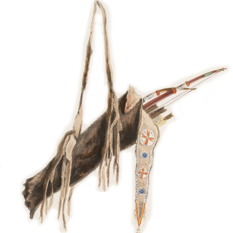
Rare Book Division, The New York Public Library. “Indianische geräthschaften und waffen. Ustensiles et armes indiens. Indian utensils and arms.”[1]New Yorka Public Library Digital Collections. Accessed February 22, 2019. http://digitalcollections.nypl.org/items/510d47da-c46b-a3d9-e040-e00a18064a99.
A Major Buffalo Hunt[2]Originally aired weekdays by Yellowstone Public Radio during the Bicentennial observance of 2003-2006. Narrated by Hal Hansen. Scripts by Whit Hansen and Ed Jacobson. Produced by Leni Holliman. … Continue reading
Massive Hunting Party
(great number of Indians move Down the River to hunt) . . . . about ½ the Mandan nation passed this to day to hunt on the river below, they will Stay out Some Days
—William Clark
Mandan Hunting and Farming
those people Kill a number of Buffalow near their Villages and Save a great perpotion of the meat, their Custom of makeing this article of life General leaves them more than half of their time without meat Their Corn & Beans &c they Keep for the Summer, and as a reserve in Case of an attack from the Soues [Sioux], which they are always in dread, and Sildom go far to hunt except in large parties
—William Clark
Sour Hidatsa Relations
Chaboneu [Charbonneau] informs that the Clerk of the Hudsons Bay Co. with the Me ne tar res [Hidatsas] has been Speaking Some fiew expressns. unfavourable towards us, and that it is Said the N W Co. intends building a fort at the Mene tar re’s— he Saw the Grand Chief of the Big bellies who Spoke Slightly of the Americans, Saying if we would give our great flag to him he would Come to See us.
—William Clark
Celestial Observations
Observed Meridian altitude of
U. L. with Sextant and glass artifical Horizon. 43° 18′ 30″
Latitude deduced from this observation. N. 47° 20′ 52.6″.
—Meriwether Lewis
Weather Diary
Ther. at Weather Wind at Thert. at 4 P.M. Weather Wind at 4 P.M. River 34 [below 0] fair N W 20 below [0] fair N W raise 2 in. —Meriwether Lewis[3]To assist the reader, the editor of this web page has omitted the date column, merged the “River” columns, and spelled out some abbreviations.


Fort Mandan is a High Potential Historic Site along the Lewis and Clark National Historic Trail managed by the U.S. National Park Service. The North Dakota Department of Parks and Recreation manages a modern reconstruction and the Lewis and Clark Interpretive Center located at US Hwy 83 and ND Hwy 200A.
Knife River Indian Villages National Historic Site is a High Potential Historic Site along the Lewis and Clark National Historic Trail managed by the U.S. National Park Service. A unit of the National Park System, the site is located at 564 County Road 37, one-half mile north of Stanton, North Dakota. It has exhibits, trails, and a visitor center.
Notes
| ↑1 | New Yorka Public Library Digital Collections. Accessed February 22, 2019. http://digitalcollections.nypl.org/items/510d47da-c46b-a3d9-e040-e00a18064a99. |
|---|---|
| ↑2 | Originally aired weekdays by Yellowstone Public Radio during the Bicentennial observance of 2003-2006. Narrated by Hal Hansen. Scripts by Whit Hansen and Ed Jacobson. Produced by Leni Holliman. © 2003 by Yellowstone Public Radio. |
| ↑3 | To assist the reader, the editor of this web page has omitted the date column, merged the “River” columns, and spelled out some abbreviations. |