Fort Mandan, ND The weather warms, and the men are able to work outside in one-hour shifts. They continue erecting the fort’s picket fence while Clark updates his maps.
Fort Mandan Pickets (replica)
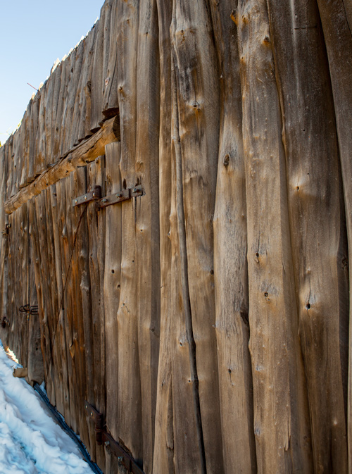
Taken with cooperation from the Fort Mandan Visitors’ Center. Photo © 2013 by Kristopher K. Townsend. Permission to use granted under the Creative Commons Attribution-Share Alike 4.0 International license.
Clark’s Fort Mandan Maps
I engage my self in Connecting the Countrey from information. river rise a little
—William Clark
Raising Pickets
the weather has moderated Some Since yesterday morning. So that we went about Setting up our pickets. half the men out at a time & relieved every hour, it being too cold to be out all the time.
—John Ordway
Weather Diary
Ther. at rise
Weather Wind at Thert. at 4 P.M. Weather Wind at 4 P.M. River 2 below cloudy S W 16 fair S. rise 1 in. began to Piquet the Fort on the river side—
—Meriwether Lewis[1]To assist the reader, the editor of this web page has omitted the date column, merged the “River” columns, and spelled out some abbreviations.


Fort Mandan is a High Potential Historic Site along the Lewis and Clark National Historic Trail managed by the U.S. National Park Service. The North Dakota Department of Parks and Recreation manages a modern reconstruction and the Lewis and Clark Interpretive Center located at US Hwy 83 and ND Hwy 200A.
Knife River Indian Villages National Historic Site is a High Potential Historic Site along the Lewis and Clark National Historic Trail managed by the U.S. National Park Service. A unit of the National Park System, the site is located at 564 County Road 37, one-half mile north of Stanton, North Dakota. It has exhibits, trails, and a visitor center.
Notes
| ↑1 | To assist the reader, the editor of this web page has omitted the date column, merged the “River” columns, and spelled out some abbreviations. |
|---|