The expedition passes the Umatilla River and then climbs to the high plain above the Wallula Gap. Late in the day, they are met by Chief Yelleppit and guided to his village opposite the mouth of the Walla Walla.
To the Walla Walla Village
by Yellowstone Public Radio[1]Originally aired weekdays by Yellowstone Public Radio during the Bicentennial observance of 2003-2006. Narrated by Hal Hansen. Scripts by Whit Hansen and Ed Jacobson. Produced by Leni Holliman. © … Continue reading
High Hills Resume
at the distance of fifteen miles passed through a country similar to that of yesterday; the hills at the extremity of this distance again approach the river and are rocky abrupt and 300 feet high. we ascended the hill and marched through a high plain for 9 miles when we again returned to the river
—Meriwether Lewis
Wallula Gap
View upstream
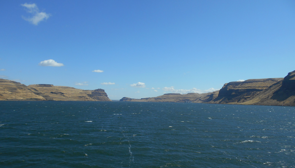
© 2019 by Robert Heacock. Used by permission.
Yelleppit’s Village
[W]e were met by the principal Chief of the Wal lah wal lah Nation and Several of his nation . . . . he appeared much gratified at Seeing us return. he envited us to remain at his village 3 or 4 days and assured us that we Should be furnished with a plenty of Such food as they had themselves, and Some horses to assist us on our journey. after our Scanty repast we Continued our March accompanied by Yelleppit and his party to the Village which we found at the distance of Six miles, Situated on the North Side of the river.
—Meriwether Lewis
Wallula Gap Ascent
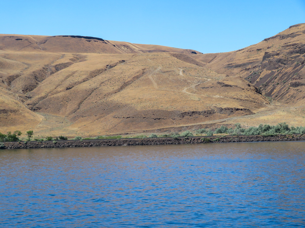
© 2021 by Robert Heacock. Used by permission.
Above: It is likely the expedition descended down a horse trail at this spot intending encamp. After the Walla Walla met them here, they would have to climb back up to reach Chief Yelleppit’s village further upstream.
Food and Firewood
Yelleppet haranged his village in our favor intreated them to furnish us with fuel & provisions and Set the example himself by bringing us an armfull of wood, and a platter with 3 rosted mullets. Soon followed his example with respect to fuel and we Soon found ourselves in possession of an ample Stock
—Meriwether Lewis
Road to the Nez Perce
the Indians informed us that there was a good road Which passed from the Columbia opposit to this Village to the enterance of Kooskooske [Clearwater River] on the S. Side of Lewis’s river, they also informed us, there were a plenty of Deer and Antilopes [pronghorns] on the road with good water and grass. we knew that a road in that direction if the Country would permit it would Shorten the rout at least 80 miles. the Indians also inform us that the County was leavel and the road good, under those circumstances we did not hesitate in pursueing the rout recommended by our guide and Corroberated by Yetleppit and others.
—Meriwether Lewis
Weather Diary
State of weather at rise
Wind at State of the weather at 4 P.M. Wind at 4 P.M. River fair after rain S E fair N W 1 ½ in. had a shower of rain last night
—Meriwether Lewis[3]To assist the reader of this web page, the date column is omitted, the “State of the Columbia River” columns have been merged, and some abbreviations have been spelled out.


Walla Walla River Confluence is a High Potential Historic Site along the Lewis and Clark National Historic Trail managed by the U.S. National Park Service. The confluence is best visited by boat, Madame Dorian memorial Park, and McNary National Wildlife Refuge.
Notes
| ↑1 | Originally aired weekdays by Yellowstone Public Radio during the Bicentennial observance of 2003-2006. Narrated by Hal Hansen. Scripts by Whit Hansen and Ed Jacobson. Produced by Leni Holliman. © 2003 by Yellowstone Public Radio. |
|---|---|
| ↑2 | Moulton, Journals, 5:307n1. |
| ↑3 | To assist the reader of this web page, the date column is omitted, the “State of the Columbia River” columns have been merged, and some abbreviations have been spelled out. |