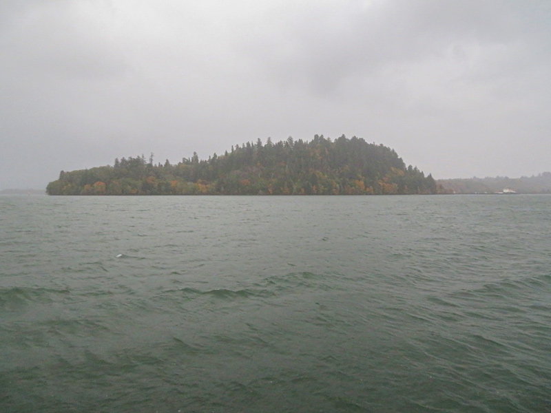
Tongue Point, Astoria, OR After receiving Indian visitors, they paddle to present-day Tongue Point. There, they are forced to take shelter from high wind and waves. Everyone is wet and disagreeable.
Lewis and Clark National Wildlife Refuge
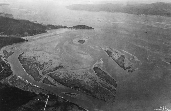
Brubaker Aerial Survey, 6 May 1929 NARA Pacific Alaska Region (Seattle), RG77, Portland District.
Above: In the distance, Tongue Point juts out into river where the expedition encamped near the low spot in the middle. During high water, early travelers could portage their canoes across this low area.
Rounding Tongue Point
© 2019 by Robert Heacock. Used by permission.
Morning Visitors
at day light 3 Canoes and 11 Indians Came from the [Kathlamet] Village with roots mats, Skins &c. to Sell, they asked Such high prices that we were unable to purchase any thing of them, as we were about to Set out missed one of our axes which was found under an Indians roab I smamed [Nicholas Biddle: Shamed] this fellow verry much and told them they should not proceed with us—
—William Clark
Rounding Tongue Point
we proceded on between maney Small Islands passing a Small river of [blank] yds wide which the Indians Call—[Nicholas Biddle: Kekemar〈qu〉ke] and around a verry remarkable point which projects about 1½ Miles directly towards the Shallow bay the isthmus which joins it to the main land is not exceding 50 yards and about 4 Miles around. we call this Point William.
—William Clark
Sheltering at Tongue Point
below this point the waves became So high we were Compelled to land unload and traw up the Canoes, here we formed a Camp on the neck of Land which joins Point William to the main at an old indian hut.
—William Clark
Disagreeable Weather
Continued hard all day we are all Wet and disagreeable. one Canoe Split before we Got her out of the Water 2 feet— The water at our Camp Salt that above the isthmus fresh and fine—
—William Clark
Weather Diary
Day of the month Wind State of the Weather 27th S W rain violent wind and hard rain all day. Campd. at Pt. William
—Meriwether Lewis[1]Some abbreviations have been spelled out.


Tongue Point is a High Potential Historic Site along the Lewis and Clark National Historic Trail managed by the U.S. National Park Service. The site can be viewed from the east at the Lewis and Clark National Wildlife Refuge and to the west along the Astoria Riverwalk.
Notes
| ↑1 | Some abbreviations have been spelled out. |
|---|