Fort Clatsop, Astoria, OR The morning is fair, and the expedition travels from Tongue Point to the Netul River, a ‘most eligible situation’ for winter quarters. The hunters return without York, so Clark must wait for him to catch up.
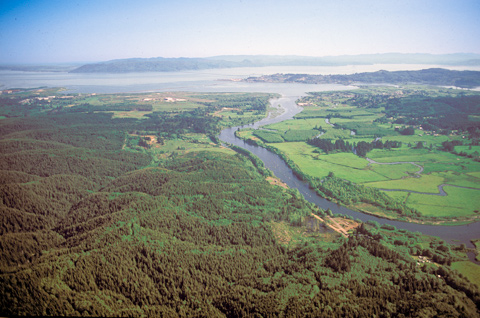
Among the trees opposite the river’s sharp bend at left center, they would build Fort Clatsop. The Lewis and Clark River flows into Youngs Bay forming the southern shore of the Columbia River.
Moving On[1]Originally aired weekdays by Yellowstone Public Radio during the Bicentennial observance of 2003-2006. Narrated by Hal Hansen. Scripts by Whit Hansen and Ed Jacobson. Produced by Leni Holliman. © … Continue reading
Leaving Tongue Point
Set out to the place Capt Lewis had viewed and thought well Situated for winter quarters— we proceeded on against the tide to a point about [blank] miles here we met Sergt Pryor and his party returning to the Camp we had left without any meat, the waves verry verry high, as much as our Canoes Could bear
—William Clark
Waiting for York
I delayed about half an hour before York Came up, and then proceeded around this Bay which I have taken the liberty of calling Meriwethers Bay the Cristian name of Capt. Lewis who no doubt was the 1st white man who ever Surveyed this Bay
—William Clark
Netul River Landing
We then unloaded our Canoes & carried all our baggage, about 200 yards to piece a rising ground in a thicket of tall pine Trees
—Joseph Whitehouse
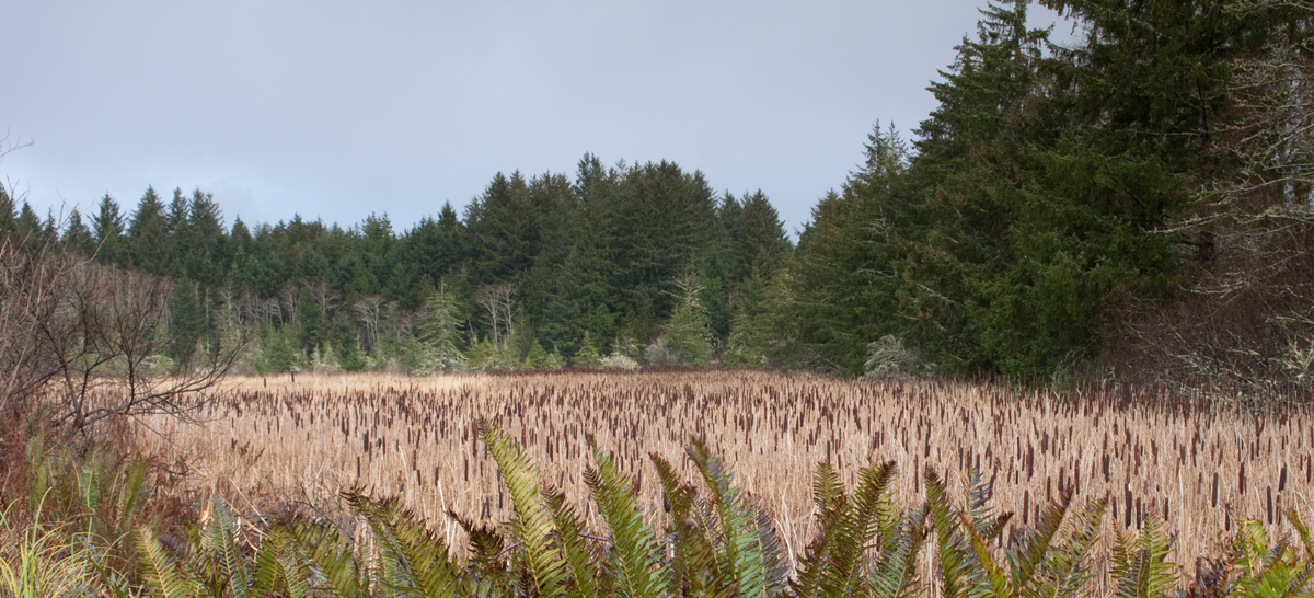
Netul Landing Marsh (view north)
© 18 December 2010 by Kristopher K. Townsend. Permission to use granted under the Creative Commons Attribution-Share Alike 4.0 International license.
Above: Fort Clatsop was located on the high point on the far side of the cattail marsh.
A Most Eligible Situation
extencive marshes at this place of Encampment We propose to build & pass the winter . . . . this is certainly the most eligable Situation for our purposes of any in its neighbourhood.
—William Clark
Weather Diary
Day of the Month Winds State of the Weather 7th S E fair after rain rained from 10 to 12 and at 2 P M. leave Pt. William
—Meriwether Lewis[2]To assist the reader, the editor of this web page has spelled out some abbreviations.


Tongue Point is a High Potential Historic Site along the Lewis and Clark National Historic Trail managed by the U.S. National Park Service. The site can be viewed from the east at the Lewis and Clark National Wildlife Refuge and to the west along the Astoria Riverwalk.
Fort Clatsop is a High Potential Historic Site along the Lewis and Clark National Historic Trail managed by the U.S. National Park Service. The site is managed by the Lewis and Clark National and State Historic Parks.
Notes
| ↑1 | Originally aired weekdays by Yellowstone Public Radio during the Bicentennial observance of 2003-2006. Narrated by Hal Hansen. Scripts by Whit Hansen and Ed Jacobson. Produced by Leni Holliman. © 2003 by Yellowstone Public Radio. |
|---|---|
| ↑2 | To assist the reader, the editor of this web page has spelled out some abbreviations. |